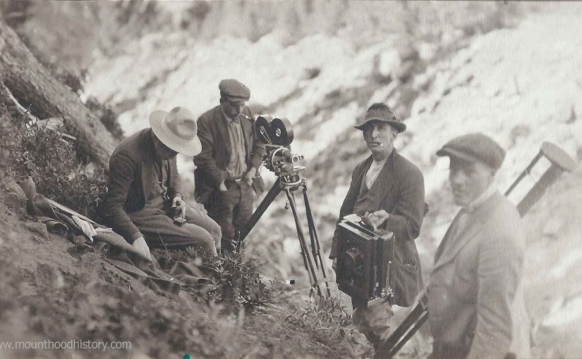
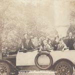
The filming of an Oregon Silent Movie on Mount Hood
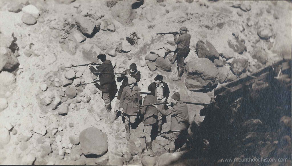
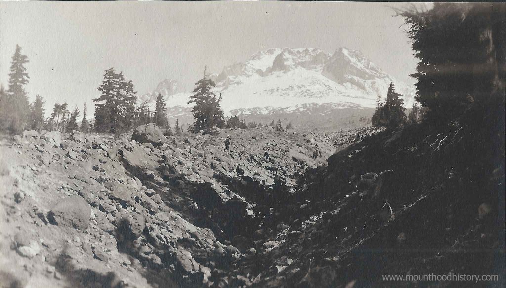
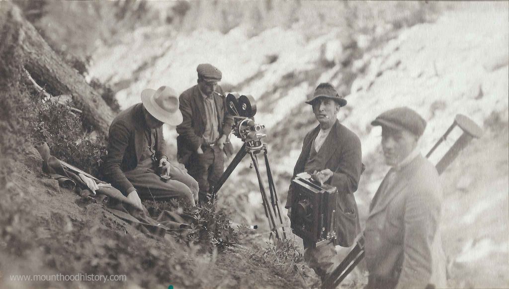
I have come across an interesting series of photographs recently that document the filming of an early Oregon Silent Movie filmed on Mount Hood. The photos show a crew of photographers and actors that appear to be reenacting a mining scene. There appears to be a wooden sluice set up, men with shovels as well as a scene with men with rifles who appear to be defending their claim.
The scene that shows Government Camp gives some indication of the age of the photos. Dr Kelly’s cabin is clearly seen as well as the old Timberline Climbers Cabin which was located very near the future location of Timberline Lodge. This would place the event near what I found to be the best possible chance to be a documented filming of a movie around Mount Hood. A silent movie filmed in 1917 called “A Nugget in The Rough”.
The subject of this movie seems to be about gold miners. There seems to be a scene with gold panners with a sluice filmed on the slopes of Mount Hood. There’s also a scene where it appears that the miners are protecting their claim with rifles. After I acquired the photos I found out there were other scenes to this set that appear to have been filmed in Portland at a constructed set with a primitive town, log buildings etc. The town scenes appear to depict the activities of miners when they’re in town to spending their earnings, including saloon scenes and a group of “painted ladies”.
I thought that these photos would be great to own, but now that I have acquired them I’m a bit saddened that the group was broken up and separated. These are historically significant images depicting very early movie making in Oregon. Perhaps one of the first Oregon Silent Movie films made in Oregon.
This list of films shot in the U.S. state of Oregon are listed first by region, and then
… The first documented film made in Oregon was a short silent film titled The …
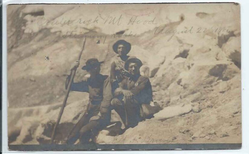
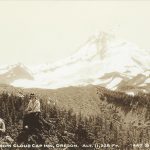
This is an old privately made Real Photo Postcard of a crew of three friends taking a break from hiking or climbing on Mount Hood.
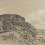
The writing on the front reads: “Crater Rock Mt Hood – Steaming Rocks – August 22nd, 1906”. Climbing Mount Hood has always been a popular sport with tourists over the last 100 years. Although Crater Rock is not the summit of the mountain it’s a healthy hike above Timberline to get to that location.
This photo was taken in the summertime when climbing Mount Hood is the most dangerous so it’s most likely that this group didn’t make it to the top.
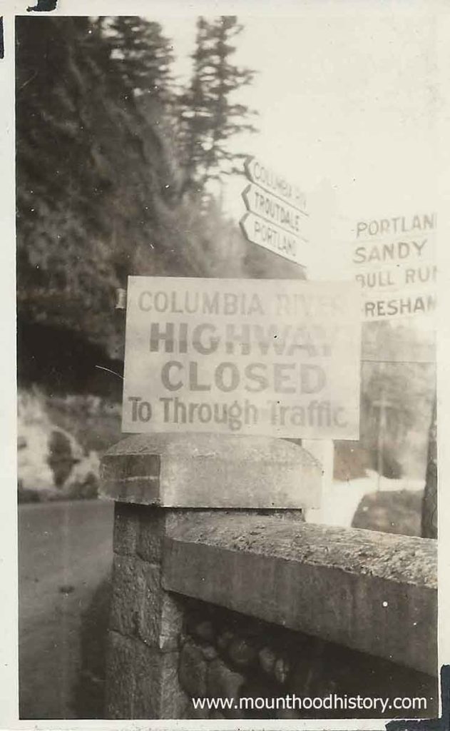
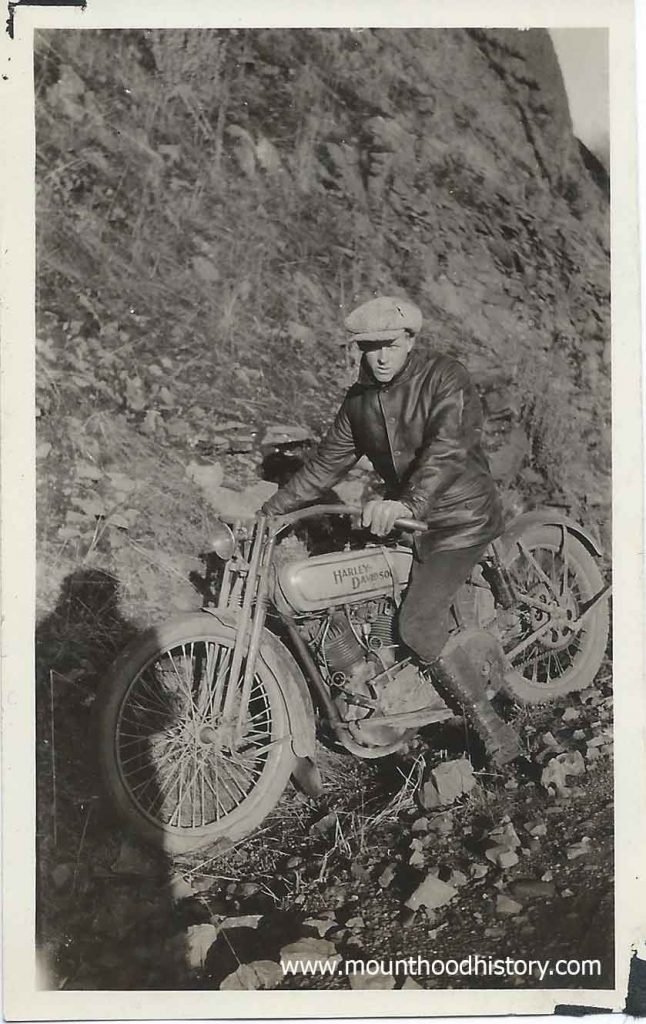
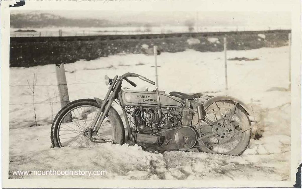
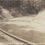
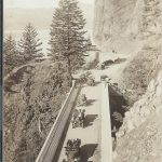
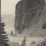
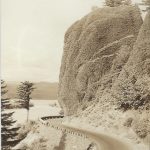
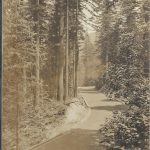
Here’s a series of photos from 1927, ten years after the opening of the Historic Highway, showing a young man and his Harley Davidson motorcycle. It must have been in the Winter as there seems to be snow and rock fall in the photos.
One of the photos clearly shows road signs with familiar destinations – Portland, Sandy, Bull Run, Gresham, Troutdale and the Columbia River Highway. The best part of the photo is the additional temporary sign that reads “Columbia River Highway Closed To Through Traffic” placed in on top of one of the road’s stone and concrete guard rails. The second one shows some stone rubble along a roadway which looks much like a winter day at unstable spots along the old road today.
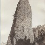
The Summit of Mt. Hood circa 1915 – This is a “Magic Lantern” slide from my collection. It shows a climber standing on the top of Mount Hood with the old Summit House fire lookout station built by the legendary mountain man Lige Coalman.
All of the lumber was carried up the mountain by hand, with Lige doing most of the carrying. Lige found it difficult to find men who would work as hard as him. Most of those whom he hired lasted only a day or two before quitting. Once the building was built Lige routinely carried barrels of heating oil and other supplies to the lookout.
This structure was built in the Summer of 1915. By 1941 it had deteriorated to bad that it was pushed over the edge.
Standing on the summit of Mt. Hood, the highest point in Oregon at 11,250 feet, is
a lifelong dream for many aspiring mountaineers. The Mazamas have been …
A Day on Historic Columbia River Highway when it was new.
It was 1915 and a lot was going on just east of Troutdale Oregon in the beautiful Columbia River Gorge. Planning was taking place for the construction of the now Historic Columbia River Highway.
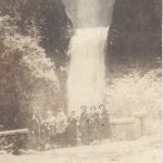
The Columbia River Gorge back then had only limited ways of accessing it. Traditionally excursions from Portland on steam powered sternwheeler paddle boats were the way that most transportation took place. In time the railroads were built, primarily for trade but in time passenger trains started taking people there on day trips. Tourist excursions to the waterfalls on the south side of the river were common. Locations such as Multnomah Falls were the main attractions.
Of course many people rode horses or travelled in horse drawn wagons back then but with the advent of automobiles the old primitive roads were improved and new roads were made but they were still dirt wagon roads. Not long after the idea to create one of the first paved scenic automobile roads in America was imagined by several prominent Portland businessmen. Thus was created the Scenic Columbia River Highway.
Although a cultural treasure today, not all who lived in the area back then supported this idea. Many people still used horses and automobiles were owned by the wealthy. Many people back then never thought that they would ever own a car let alone use one to tour the Columbia River Gorge. Public support for financing the highway was tenuous at best.
As we all know, the highway was built and within a couple of decades was being used heavily for transporting cars from central Oregon to the Willamette Valley. Heavy trucks had been developed to carry commodities and products and most everyone had a car in their garage. It didn’t take long to see how those who imagined the highway were visionaries. The highway was quickly becoming overused and plans for a riverside highway, which would become Highway 84, was in the works.
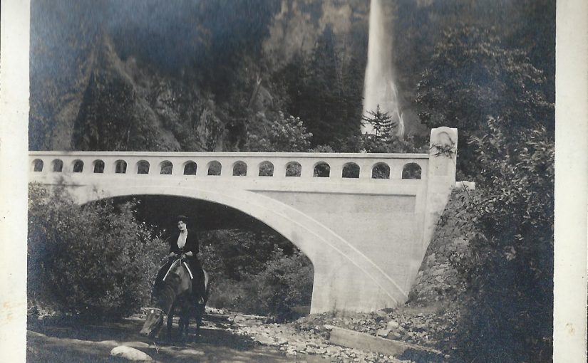
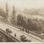
And so back in 1915 the Historic Columbia River Highway was in construction. It would be dedicated a couple years later in 1917, but that didn’t keep people from going out to explore the modern engineering marvel. Of course traffic was minimal back then. Today we can only imagine a peaceful horseback ride along it’s path to familiar waterfalls along the way, but that’s just what this couple did.
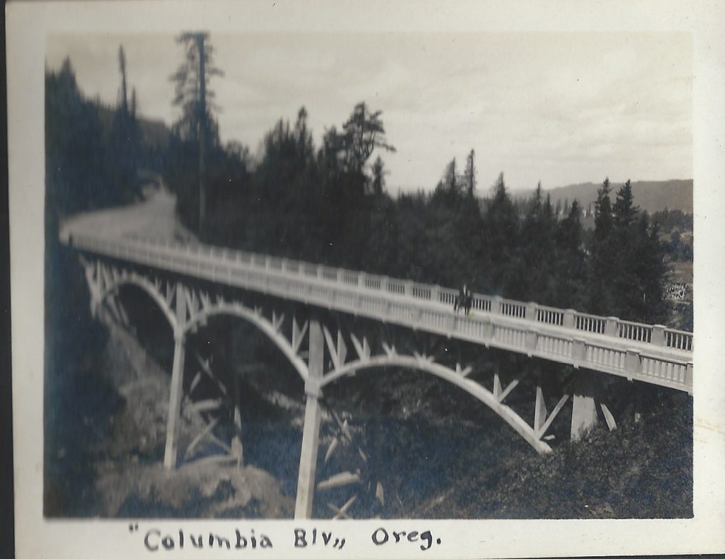
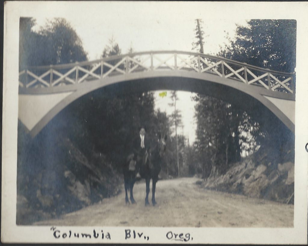
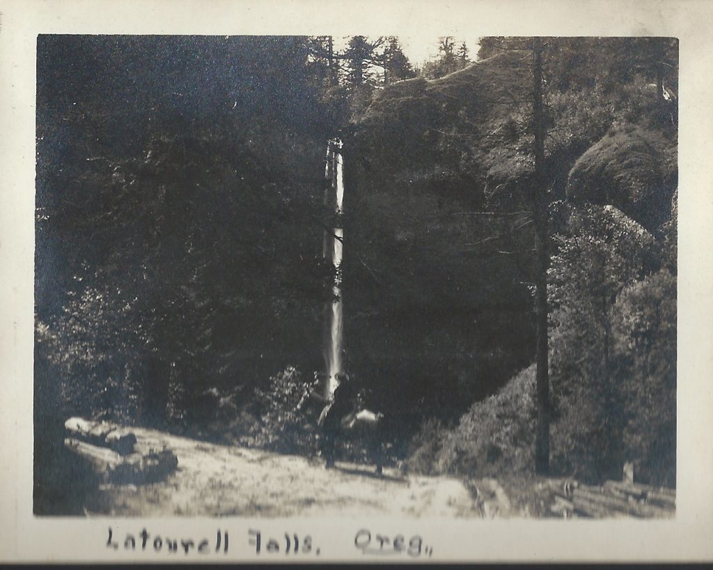
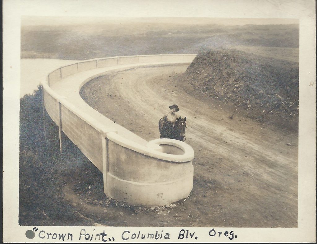
Harry and Alvida Calvert decided to take a trip out to survey the progress on the new highway via horseback. Harry Calvert was a photographer from Oregon City, Oregon.
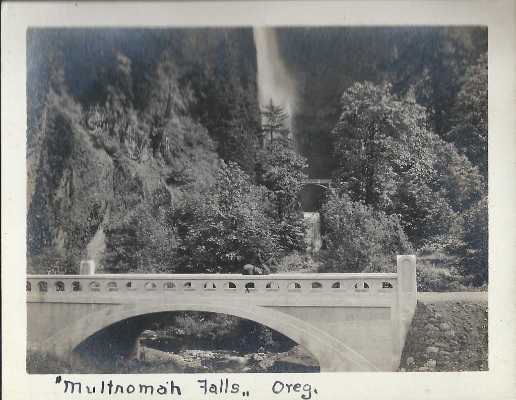
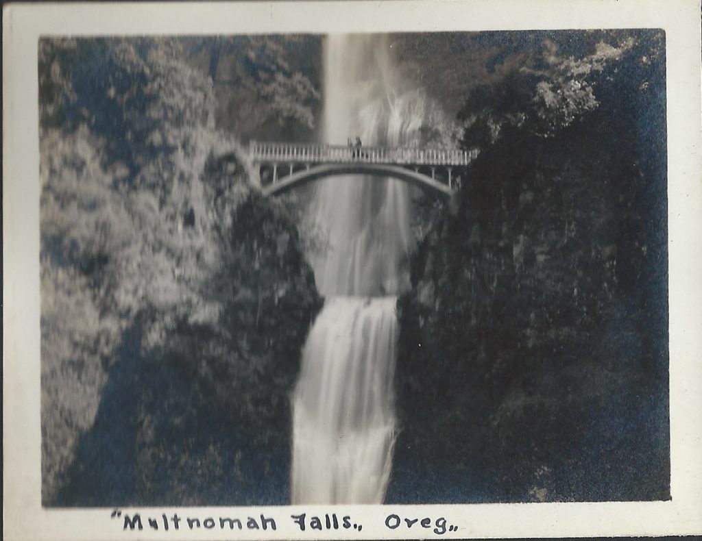
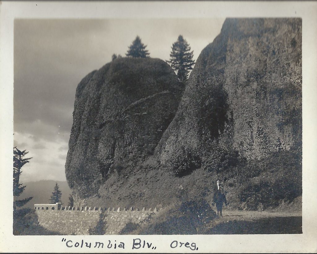
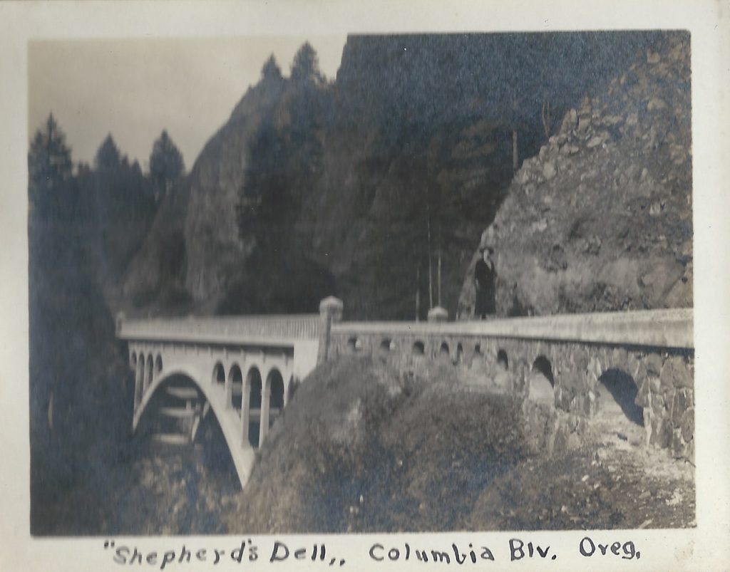
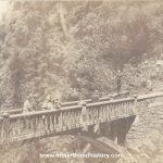
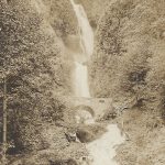
These photos are some of his personal photos. Snapshots into his and his wife Alvida’s life. In these photos you can see familiar places along the Historic Columbia River Highway such as Crown Point, Latourell including the falls and the old arched footbridge that was removed due to obstruction of trucks that needed to pass as well as the recently constructed highway bridge. Other locations include Bishops Cap and the Sheppards Dell Bridge, as well as Multnomah Falls. Alvida and Harry take turns posing in the photos with their horse Pat, including one where one of them made their way to the Simon Benson bridge between the upper and lower tier of Multnomah Falls.
Needless to say a horse ride on the old Historic Columbia River Highway is totally impractical today, but there once was a time. I’m certainly glad that Harry and Alvida took the time to document their day in the Scenic Columbia River Gorge.
Horse Ride in The Columbia River Gorge – Multnomah Falls
Horse Ride in The Columbia River Gorge – Multnomah Falls
Horse Ride in The Columbia River Gorge – Multnomah Falls
Horse Ride in The Columbia River Gorge – Bishop’s Cap at Shepperds Dell
Horse Ride in The Columbia River Gorge – Shepperds Dell Bridge
Horse Ride in The Columbia River Gorge – Latourell Falls Bridge
Horse Ride in The Columbia River Gorge – Latourell Walking Bridge
Horse Ride in The Columbia River Gorge – Latourell Falls
Horse Ride in The Columbia River Gorge – Crown Point
Sep 21, 2011 … About 14000 years ago, cataclysmic floods scoured out the Columbia River
Gorge. Early visionaries engineered an inspired drive along its …
“Dear Flo – Just a postal of us on a Trip Up The Columbia River Highway, Portland, Ore. Love to all.”
Addressed to: Miss Flo. McGuiness. 38 Gardner Avenue, Jersey City, New Jersey.
This is a unique set of postal cards that were made by the family using the photos that they made that day. It was quite common back in the early part of the 20th Century to have your photos printed on postcard stock. You could then send the cards off to friends and relatives across the country. In the group photo a camera is clearly seen in the left hand of the gentleman on the right. Most likely an early Kodak.
Although we don’t know how the folks in the photos area, I’m sure that their “Trip up The Columbia Highway” was very similar to a day on the Historic Columbia River Highway in today’s Columbia River Gorge.
27 Jul 2016 … A parade of antique cars traveled from Troutdale to the Gorge Discovery Center,
to experience the Historic Columbia River Highway in the …
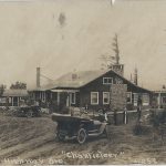
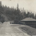
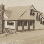
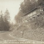
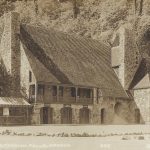
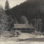
Roadhouses on The Mt Hood Loop – The Wistaria Farm Inn
The Wistaria Farm Inn, near Cherryville Oregon east of Sandy on the old Mount Hood Loop Highway (Highway 26 today), was only one of the many roadhouses located on the Mount Hood Loop Highway popular during the motor age. Continue reading The Wistaria Farm Inn
Cross and Dimmit Postcards of The Columbia River Gorge and Historic Columbia River Highway.
Cross and Dimit were two of the most successful photographers in Portland back in the first part of the 20th Century.
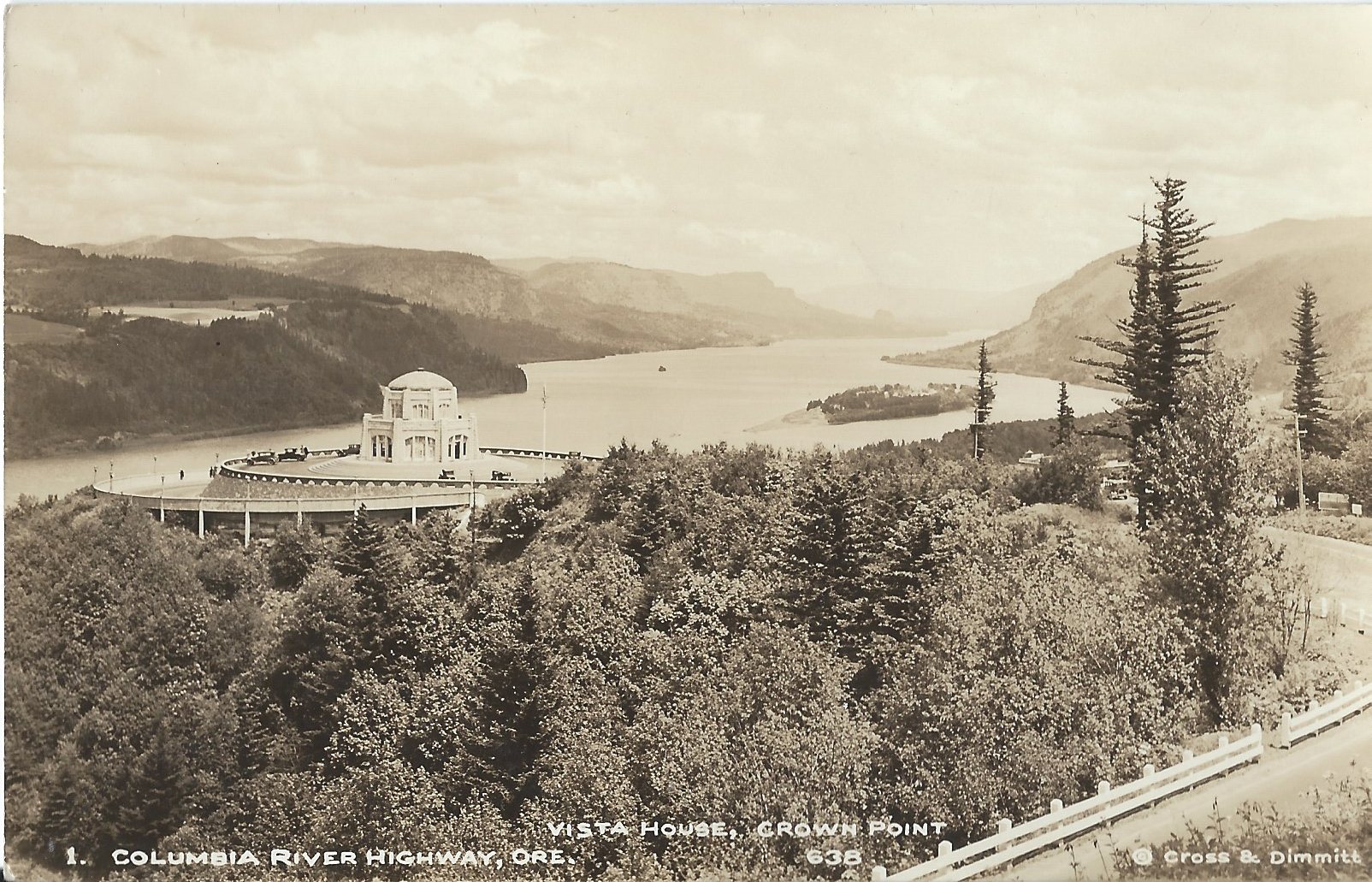
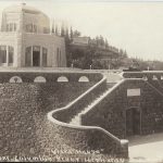
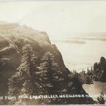
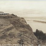
Crown Point and Vista House
Arthur B. Cross opened his photography studio in Portland Oregon in 1909. Five years later Edward L. Dimmit began working at Cross’s at his studio and two years later became partners with Cross, naming it “Cross and Dimmit”.
The Historic Columbia River Highway was dedicated in 1917 and quickly became a huge tourist draw. All along the new road built through the pristine and deeply beautiful Columbia River Gorge, roadhouses, restaurants and gift shops sprung up to supply the needs of the tourist traffic.
And around that very same time postcards became extremely popular due to the fact that one could buy a package of cards and forego lugging their own camera long, or to allow those without ne to have photos of the views, streams and waterfalls along the road. All of these factors came together to provide the new Cross and Dimmit venture with a steady stream of potential customers via the souvenirs shops as well as from the running boards of their Model T Ford. In time they had their own gift shop located at Crown Point near Vista House.
Cross and Dimmit created real photo postcards in large quantities and sold them individually as well as packs of a variety of scenes. Most everyone who toured the gorge back then bought some. Cross and Dimmit sold scenes from other areas, but the photos of the gorge are their most iconic photos. Today they’re some of the best photos of the Columbia River Gorge and the historic Columbia River Highway from that era, and because of the quantities that they made, are still easy to find.
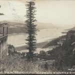
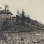
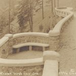
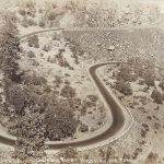
This is a series of their most common cards of the Columbia Gorge. They start from Chanticleer Point, today referred to as The Women’s Forum near the town of Corbett. They then go along the highway from Crown Point and Vista House to the Rowena Loops near The Dalles Oregon.
Arthur Cross died in 1940 and Dimmit lived until 1963.
View From Chanticleer Inn
Chanticleer Inn at Chanticleer Point
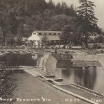
Mrs M E Henderson’s Crown Point Chalet
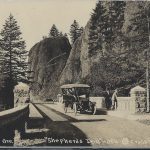
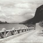
View of Crown Point
View of Crown Point
View of Crown Point
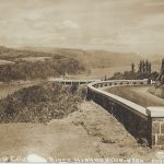
Columbia River Highway at Crown Point Prior to Warrenite
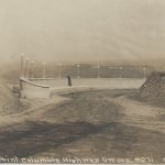
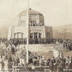
Columbia River Highway Dedication
Vista House New
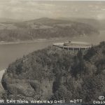
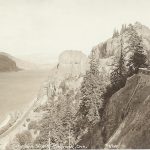
The View from Crown Point
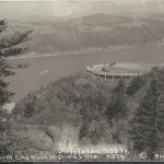
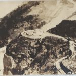
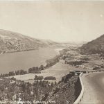
Aerial View of Crown Point and Vista House
Crown Point and Vista House
Crown Point and Vista House
Crown Point and Vista House
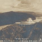
Vista House
Vista House
The View from Vista House
Crown Point
Cross and Dimmit Columbia River Highway Postcard Crown Point
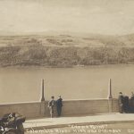
View East from Crown Point
View East from Crown Point
View west from Crown Point
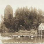
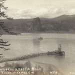
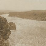
Fish Cannery at Rooster Rock
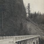
Historic Columbia River Highway Before Warrenite
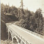
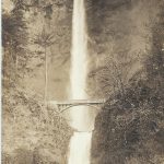
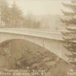
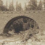
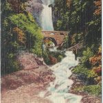
Latourell Bridge
Cross and Dimmit Columbia River Highway Scene at Latourell Postcard
Falls Villa at Latourell
Latourell Falls
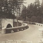
Bridge at Latourell
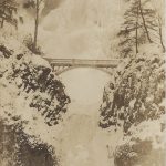
Shepperds Dell Bridge
Shepperds Dell Bridge
Shepperds Dell Bridge
Shepperds Dell Bridge
Bishops Cap near Shepperds Dell
Bishops Cap near Shepperds Dell
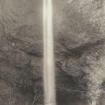
Bridal Veil Falls
Pillars of Hercules
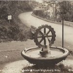
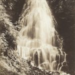
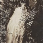
Wahkeena Falls
Rotary Wheel at Waukeena Falls
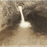
Fairy Falls
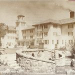
Multnomah Lodge at Mist Falls
Multnomah Falls Lodge
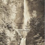
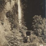
Multnomah Falls
Multnomah Falls
Multnomah Falls
Multnomah Falls
Multnomah Falls in Winter
Columbia River Highway Viaduct near Multnomah Falls
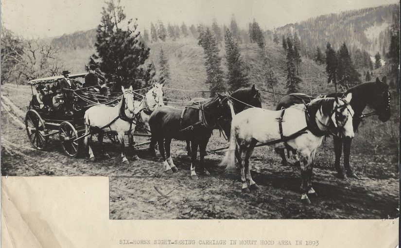
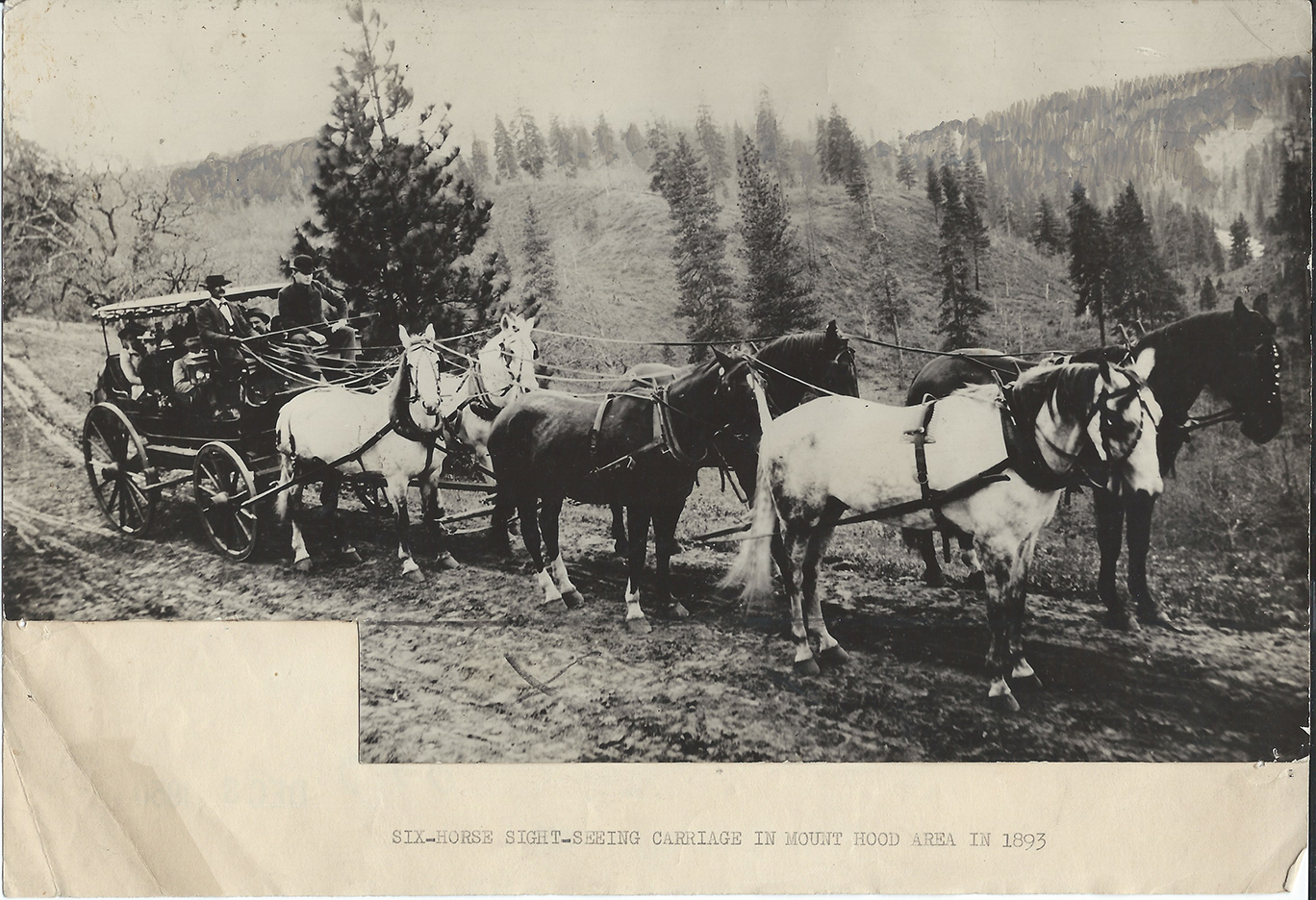
Mt Hood Area Sightseeing Carriage – Early Oregon Tourism
Six Horse Mt Hood Area Sightseeing Carriage – SIX-HORSE TEAM AND SIGHT-SEEING CARRIAGE IN MOUNT HOOD AREA IN 1893 –
Before the days of automobiles sight-seers were taken over roads at the base of Mount Hood in equipages such as this. The late E. S. Olinger, known as one of Oregon’s most noted drivers is holding the reins.
This six-horse team pulling its crowded carriage of a summer-Sunday sightseers was photographed in 1893 in the Mt. Hood area. E.S. Olinger, one of top drivers, handled the reins.
Six-horse sight-seeing carriage in Mount Hood area in 1893
The Oregon Trail is a 2,170-mile (3,490 km) historic East–West, large-wheeled
wagon route … on the California Trail (from 1843), Mormon Trail (from 1847), and
Bozeman Trail (from 1863), before turning off to their separate destinations.
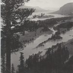
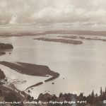
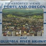
Views of Portland Oregon and the Columbia River Gorge – Antique Postcard Set
20 Assorted Views of Portland Oregon.
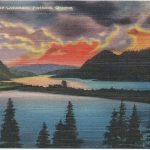
Here’s a great assortment of views of Portland Oregon and the Columbia River Gorge circa 1950. They’re printed using an offset printing process on canvas textured paper. Printed by the Angelus Commercial Studio in Portland, Oregon. The cards are the same as the postcards that the company printed but are half the size.
The set, labeled 20 Views of Portland Oregon and the Columbia River Gorge, takes one on a tour from Portland Oregon east through the Columbia River Gorge on the Historic Columbia River Highway to the Hood River Valley and then south on what is now Highway 35 to the south side of Mount Hood and the iconic historic Timberline Lodge.
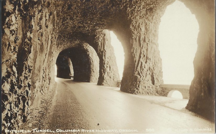
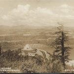
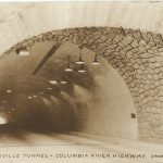
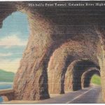
This very same tour can be taken today via modern cars and improved highways in a day; A very full and satisfying day. The only things that have changed since the era that these cards were made are that the Columbia River Highway, Historic Highway 30 has been replaced with the more modern Highway 84 through the gorge. Also the old Mitchell Point Tunnel was demolished in 1966 during construction of Hwy 84, but there are efforts through the restoration of the old highway to consider restoring the tunnel by boring a new tunnel through Mitchell Point.
All of these Views of Portland Oregon and the Columbia River Gorge are available for your enjoyment today, but these old photos bring back a more bucolic era in the Portland and the Mount Hood countryside. One where tourism was more slow and laid back. One where the trip was about the ride and not the destination. One that allowed us to stop along the way and send a postcard or two.
20 Assorted Views of Portland, Oregon
Portland, Oregon, “The Rose City”, Mt. Hood (Altitude 11,225) in background. Population 500,000.
Portland, the largest city in Oregon, has varied industry and is one of the nation’s foremost fresh-water ports and ports of entry.
Four transcontinental railway lines use this terminal for trains operating in and out of Portland, and a traveler going through Oregon passes some of the finest scenery in America.
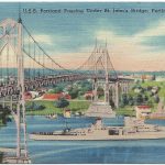
The St. John’s Bridge was completed in June, 1931, at a cost of $4,250,000, and its span of 205 feet above the Willamette River is sufficient to allow any type of vessel to pass under it. The Bridge is 3,833 feet in length.
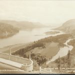
Crown Point 25.5 miles from Portland, Oregon. A view of 35 miles both East and West can be seen from Vista House.
Probably no scenic Highway in America, except the 1600 mile long Oregon Coast Highway, offers such magnificent scenery in concentrated variety as that which borders the Columbia River Highway in Oregon.
Probably no scenic Highway in America, except the 1600 mile long Oregon Coast Highway, offers such magnificent scenery in concentrated variety as that which borders the Columbia River Highway in Oregon.
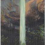
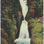
Beautiful Latourell Falls on Columbia River Highway has a sheer drop of 225 feet.
Bridal Veil Falls, Columbia River Highway, Oregon are considered by many a masterpiece of beauty.
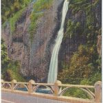
Wah-Kee-Na Falls is considered by many the most beautiful and picturesque of all falls along the Columbia River Highway.
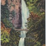
Multnomah Falls height 620 feet. The highest falls in the U.S. that runs water year ’round.
Lovely waterfalls leap from the Columbia River Highway gorge’s towering crags into the river below. Horsetail Falls hurtle through the air from a height of 205 feet.
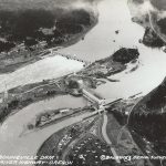
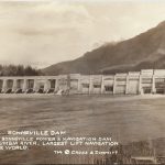
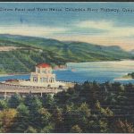
Forty-two miles east of Portland on the Columbia River is the famed Bonneville Dam, rected at a cost of $65,000,000 sand completed in 1940.
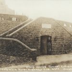
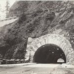
Mitchell Tunnel has five openings or windows out of which a beautiful view of the mighty Columbia River may be obtained.
Portland, the largest city in Oregon, has varied industries and is one of the nation’s foremost fresh-water ports and ports of entry.
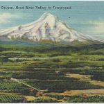
Mt. Hood and Hood River Valley where the best apples in the world are grown.
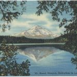
Mt Hood, Oregon, altitude 11,225 ft, “The Most Beautiful Mountain in America,” from the new “Loop” Highway. Mt. Hood is the only major peak in America that can be completely encircled by an automobile.
Mt Hood, Oregon, altitude 11,225 ft, “The Most Beautiful Mountain in America,” from the new “Loop” Highway. Mt. Hood is the only major peak in America that can be completely encircled by an automobile.
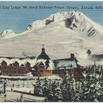
Timber Line Lodge, Mount Hood National forest, Oregon. Erected by the Federal Government at a cost of $1,000,000. Elevation 6,000 feet.
Mt Hood, Oregon, altitude 11,225 ft, “The Most Beautiful Mountain in America,” from the new “Loop” Highway. Mt. Hood is the only major peak in America that can be completely encircled by an automobile.