The Welch’s Ranch in Welches Oregon

And how it became a town and a tourist destination

In 1882, before Welches Oregon became a destination, it was a family homestead ranch. Samuel Welch, an emigrant from Virginia, homesteaded in the valley in 1882. His son William, as well as Edward Kopper, Billy’s first wife’s father, homesteaded in the valley in 1889.  

Welch's Ranch
Welch’s Ranch Welches Oregon

Samuel “Uncle Sam” Welch and his son William “Billy” Welch homesteaded adjoining 160-acre sections of the Salmon River Valley on the southwestern foothills of Mount Hood. Samuel Welch’s deed was signed by Benjamin Harrison on April 19, 1889, and was recorded in the Clackamas County Courthouse on April 27, 1893. The deed to Billy Welch’s place was signed by President William McKinley, June 11, 1897, and was recorded August 23, 1898.  

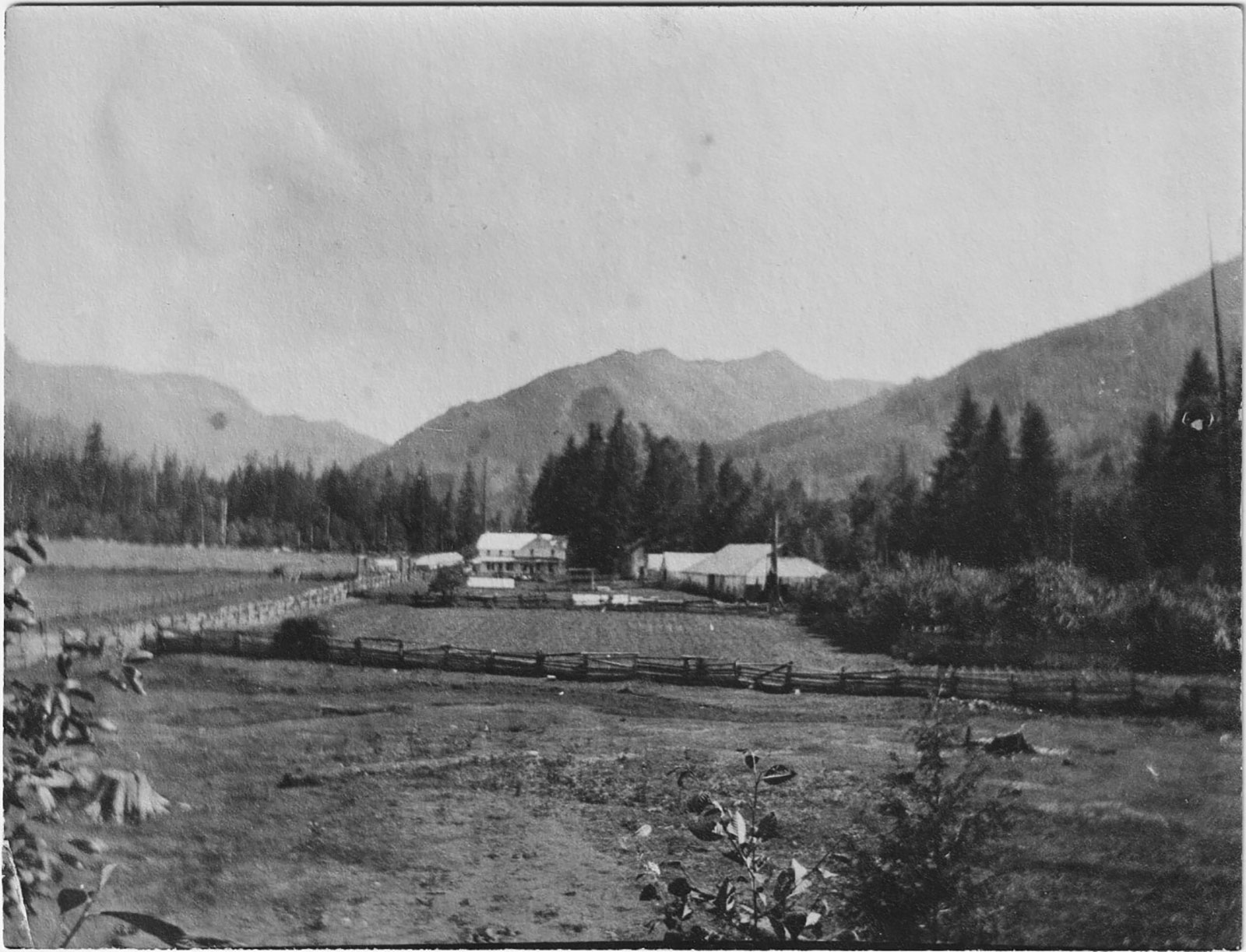
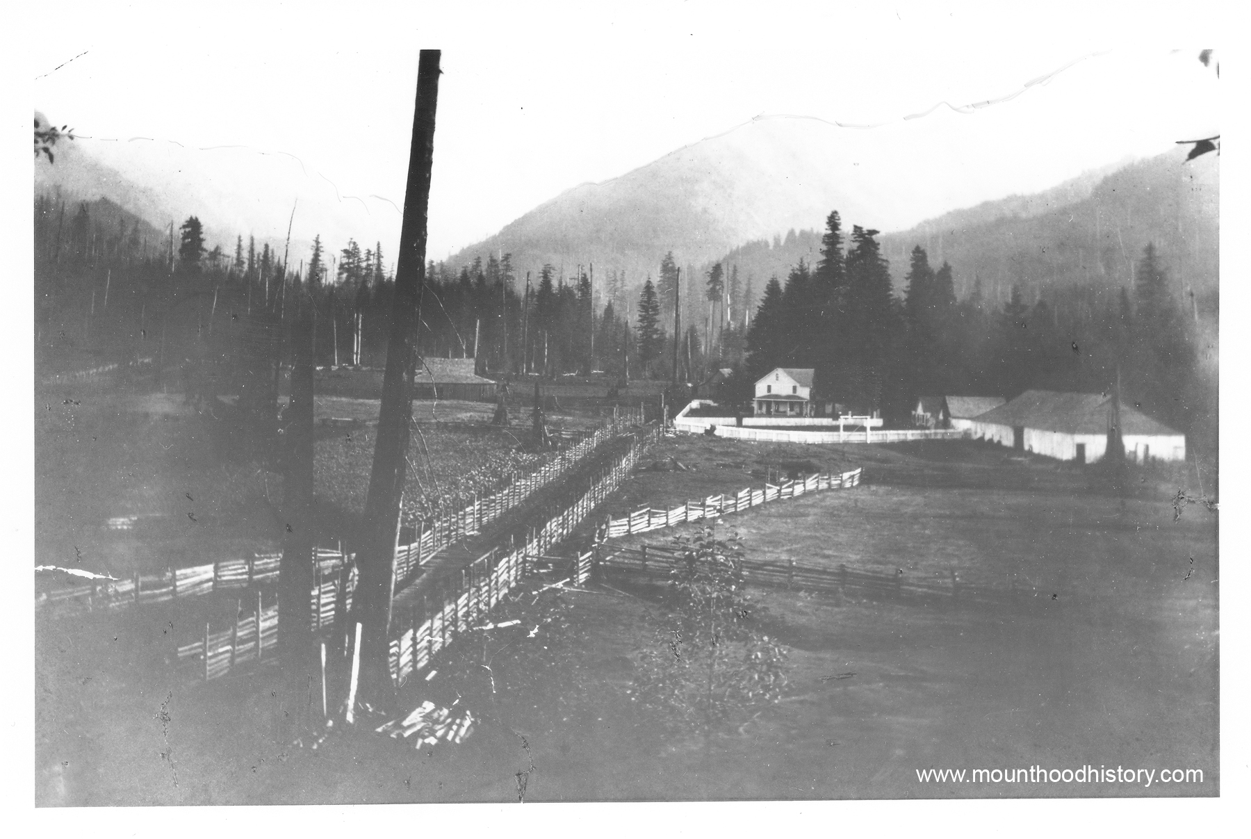
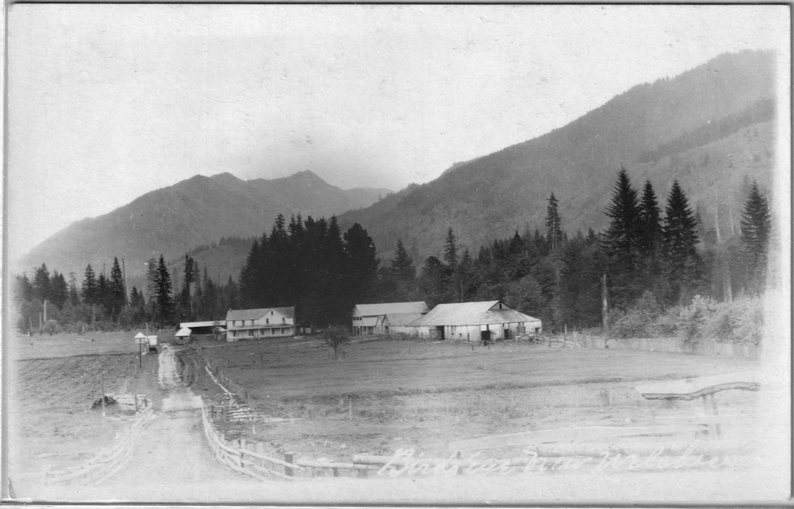
Samuel and Billy bought up other homesteads in the valley until they owned approximately 1000 acres covering the whole valley floor from Walkley’s homestead on the south to “Dutch Fred’s” Homestead to the north (Near present Fairway Av) and extending up the slopes of Hunchback Mountain to the east and Huckleberry Mountain to the west.  

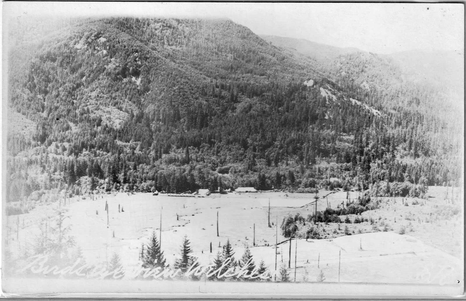
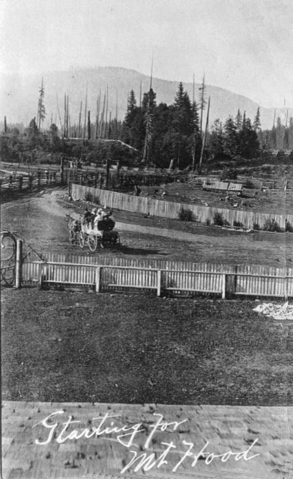
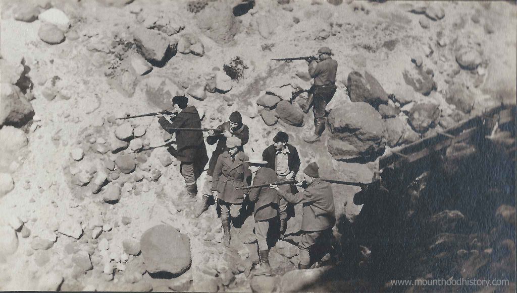
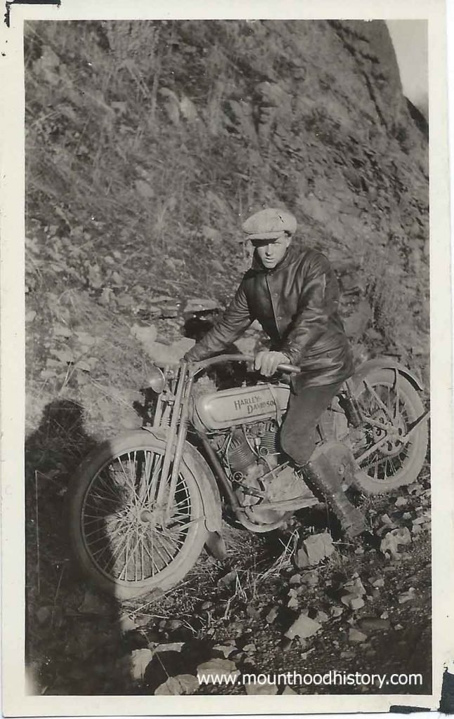
The ranch had pastures, corrals, and barns for livestock, including a herd of dairy cows, a few head of beef cattle, some sheep, and several pigs. It had an apple orchard and a large vegetable garden. Also available were an abundance of fish in the river and creeks and hills covered with deer and elk. There were stables and a blacksmith shop. As time passed it became a stop for stages and then motorized coaches that carried passengers along the old road to Mount Hood.  

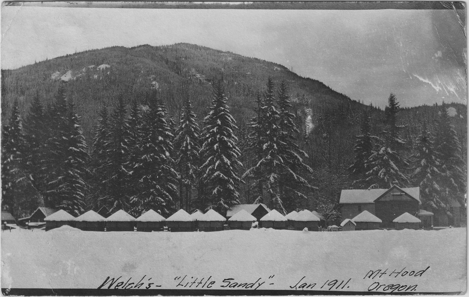
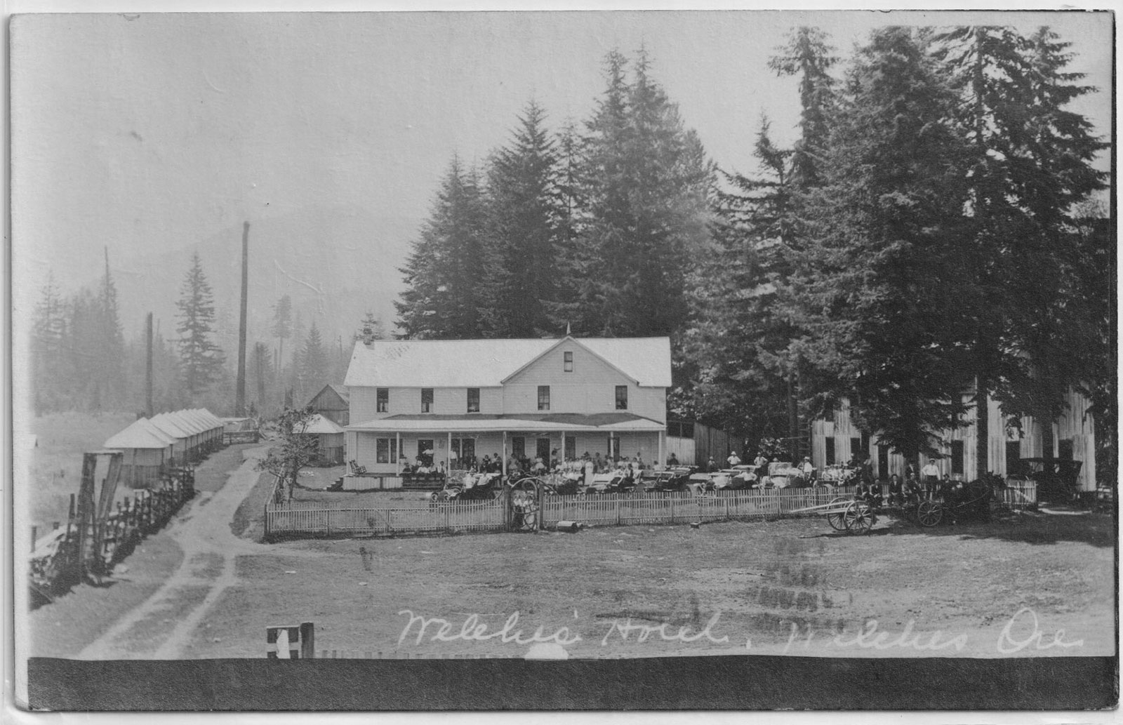
In 1889 Samuel died and deeded his property to Billy. Billy’s first wife, Mamie Kopper Welch, died in 1902. Tourists used to come to the valley in the summer to camp. In 1905 Clinton Kern and a Mr. Wren leased the property and opened it as a hotel resort, which they operated until 1909. The old dance hall was razed, and a large dining hall was erected behind the hotel near the banks of the Salmon River.  

To compensate for the loss of the dance hall Billy enlarged his store, which he maintained control of, and added a room in back with a pool table and a second story that was used as a dance hall. It had an east facing balcony where perspiring dancers could get fresh air and, especially on a moonlit night, a view across the pasture toward Hunchback Mountain.  

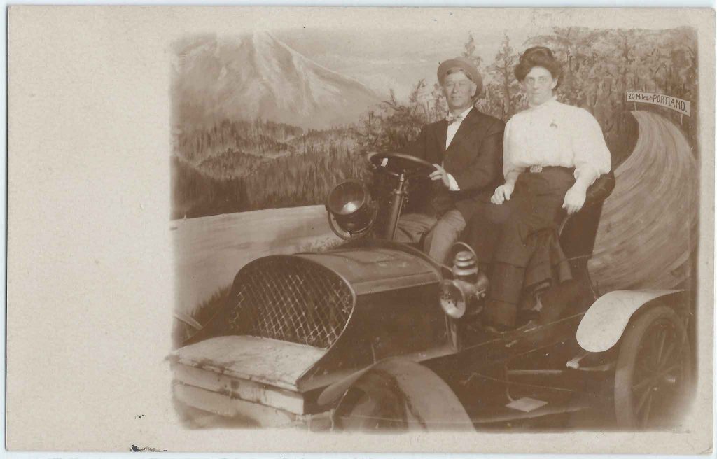
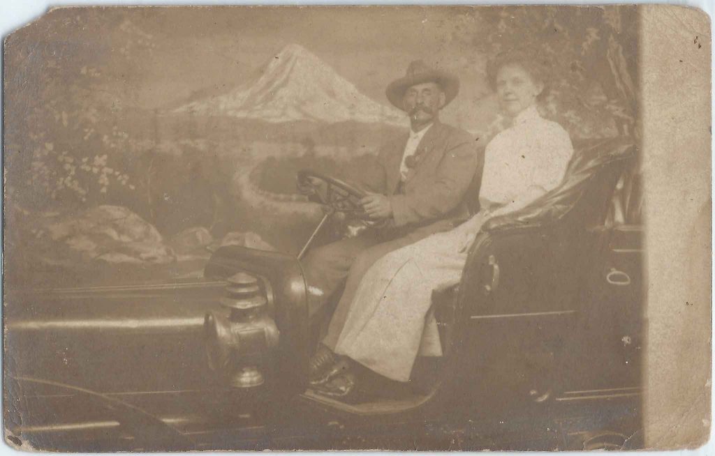
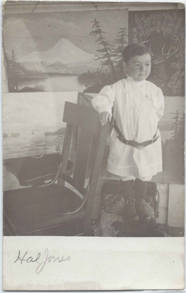
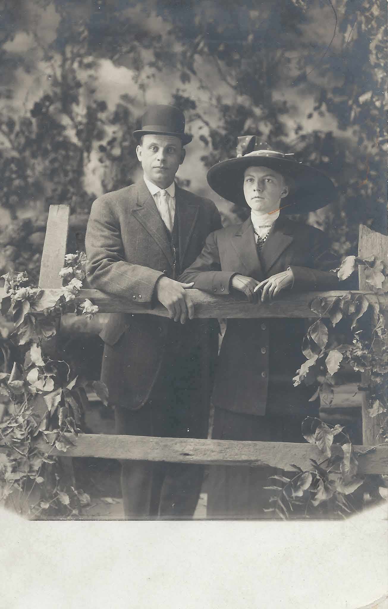
In April 1911 Billy Welch and Jennie Faubion were married. Jennie’s family homesteaded the little settlement of Faubion, just a couplie of miles east of Welches. Together they ran the resort, the store, post office and the dance hall above the store. 

In 1905 the Welches post office was established. It was named Welches because the postal service didn’t allow apostrophes in a town name. Billy Welch served as the postmaster from 1905 until 1940. After Billy’s death in 1942 Jennie Welch carried on the responsibilities of postmaster until 1960 when she retired. After Jennie retired the Welches post office was closed and moved to Wemme where it served the community for 17 years when a new post office was built in Welches.

Back then community bonfires, taffy pulls and roasting marshmallows on long sticks were popular. The children were sent out to drag back wood for the fire, which the adults would pile, wigwam style, in piles over 10 feet tall. Campers would sit around the fire and sing songs. Sometimes the festivities were helped along with a little “fortified cider”. The children enjoyed singing “old standards” such as the folk song “Ninety-Nine Blue Bottles,” which was first published in 1910. (Similar to 99 Bottles of Beer). There were several good story tellers that would entrance the folks around the fire with fascinating stories. They would usually end the evening.  

And then there were the dances. There were dances in the dance hall every Saturday night. Back then most everyone would come to the dances. Parents of small children would bring blankets and tuck the little ones in the corners of the hall. Billy Welch and one or more other local fiddlers would provide the music. Billy, with his eyes half closed, would pump out “old tunes with a lively beat” while dancers shook the building as they whirled and danced two-steps, schottisches, and the Paul Jones, interspersed with an occasion square dance and a waltz to allow the dancers to catch their breaths. 

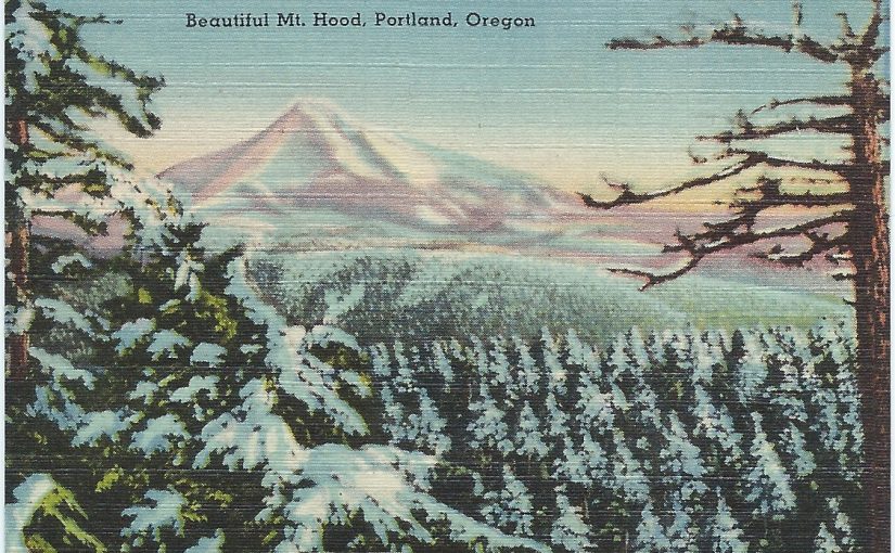
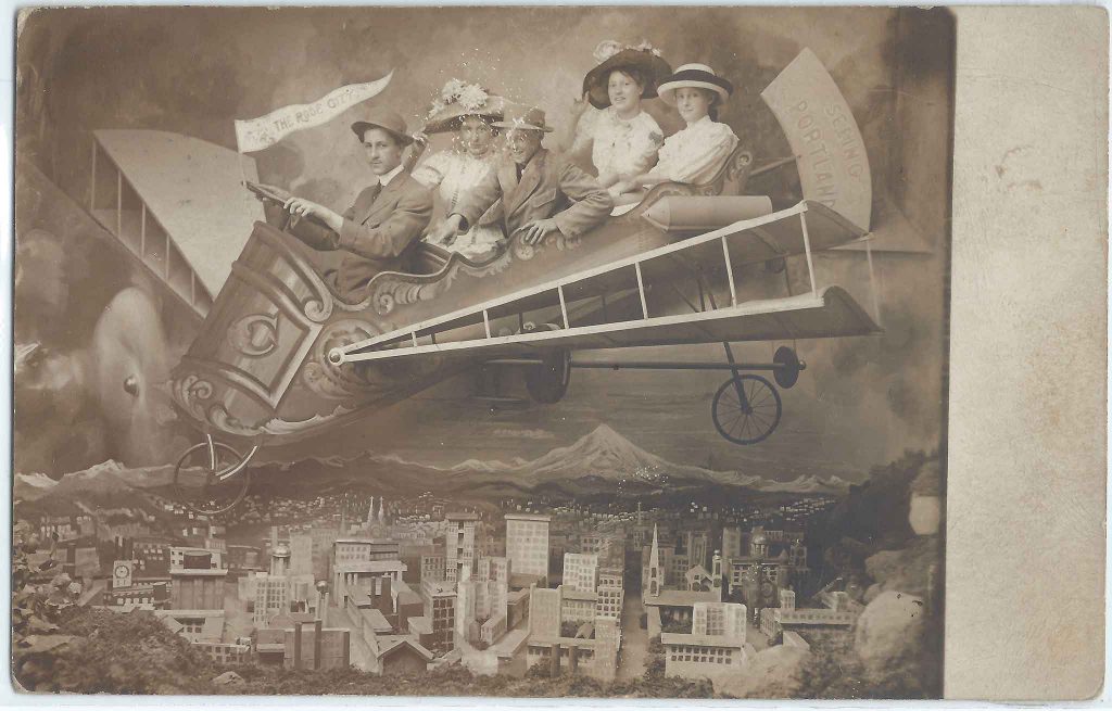
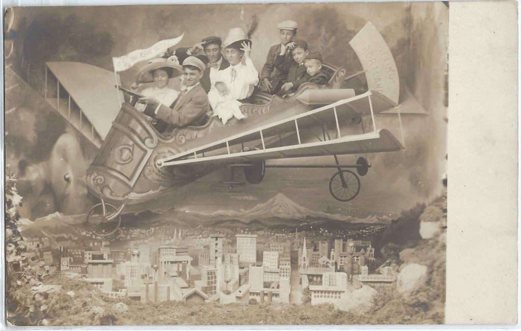
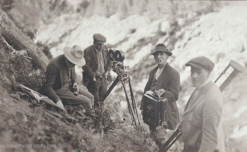
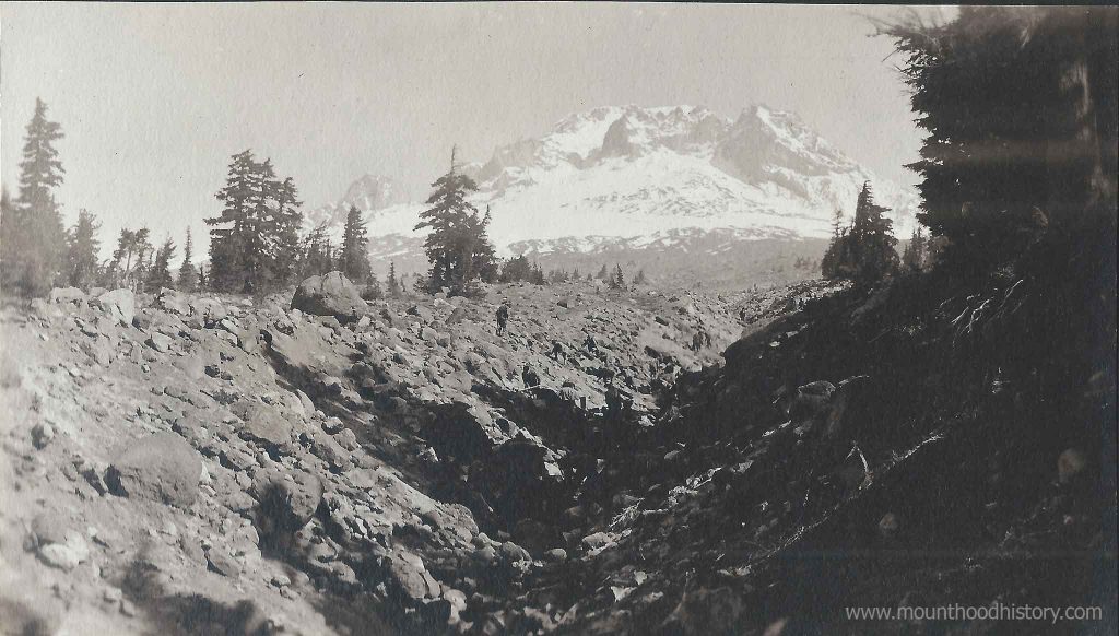
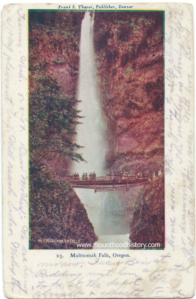
The valley was becoming a popular spot for summer vacations. In 1910 Tawney’s Hotel, about a mile south of the Welches Ranch at the end of the road, was entertaining guests. Other lodges were being built including the Arrah Wanna Lodge, about a mile down the Salmon River and the Rhododendron Inn in Rhododendron.  

Billy slowly converted the ranch to an outdoor vacation resort with a hotel and facilities for campers, hikers, hunters, anglers, and their families. Tent cabins were added when there were no longer enough rooms to meet the demand for lodging. Campers were arranged throughout the area around the hotel and along the Salmon River.   

Billy allowed people to camp along the Salmon River, with many of the people returning each year to the same camp spots. After a while Billy subdivided a portion of his property to allow those people to purchase their plot of land. Most of the people built small family cabins and the era of vacation cabins began.  

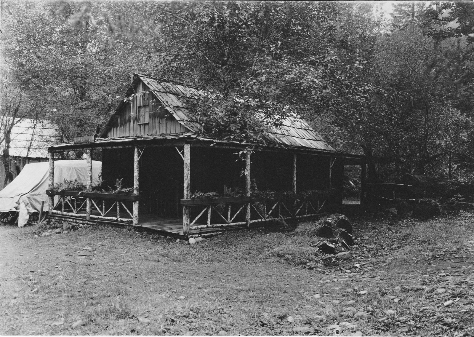
The first vacation cabin south of the Welches Hotel was put there by the Kaderly family. Mr. Kaderly arranged with Billy to move Uncle Sam’s original homestead cabin to a location about 300 feet south of Billy’s home. Except for the hand-hewn foundation and stringers, the whole cabin was constructed of all hand split cedar. In time more cabins were constructed by other families to the south of the hotel facing the meadow along the road toward the Walkley place.  

The stage to Mount Hood leaving Welches.

In about 1885 Sam sold 5 acres to Mr. and Mrs. John Roberts of Gresham. They built a cabin on the property. Their son Ed helped Billy in the Welches Store for several years. In 1903 Ed married Dora Owens and in 1910 they built their home on the original Roberts property. In 1913 Ed opened a small photo and candy shop that developed into Roberts Country Store. It was located not far south of the Welches Hotel. Ed died March 29, 1963, at the age of 84.  

In 1928, Mr. Ralph Waale leased the Welch pasture with an option to buy. They constructed a nine-hole golf course and operated it until 1939, when they relinquished it to the Welch’s. Billy and Jennie continued operation until 1942, when Billy Welch died. It went through several owners before it was sold to Mr. Eugene Bowman. 

CLICK HERE to read more about the development of the Mt Hood Golf Course, Rippling River and the Resort on The Mountain.

Mrs Pierce of Welches Killed a Bear With a Hoe
Mrs Pierce of Welches Killed a Bear With a Hoe – I have spent a lot of time talking with old timers and family

Mount Hood FAQ’s

  • Mt. Hood rises 11,240’ above sea level; its base spreads over 92 miles.
  • Mt. Hood dates from the late Pleistocene Era.
  • Mt. Hood is the highest mountain in Oregon; 4th highest in the string of Cascade Mountain Range volcanoes that stretch from Mt. Garibaldi in the British Columbia south to Mt. Lassen in Northern California.
  • “Wy’East is the American Indian name for Mt. Hood. (Mt. Adams was Klickitat and Mt. St. Helens was Loowit, and the Great Spirit was called Tyee Sahalie.)
  • Mt. Hood is a dormant or “sleeping” volcano, with steam constantly spewing from fumarole areas.
  • Recent eruptions (all minor); 1804, 1853, 1854, 1865, 1907. Scientists believe Mt. Hood could have a significant eruption within the next 75 years.
  • Eleven glaciers grace Mt. Hood’s peak.
  • Mt. Hood is 22 miles south of the Columbia River.
  • The first white men “discovered” the mountain on October 29, 1792, when British Navy Lt. William E. Broughton and his crew (representing King George III) saw it from the Columbia River near the mouth of the Willamette River. Broughton named the peak for famed British naval officer (and later, Admiral) Alexander Arthur Hood (who never saw the mountain).
  • In 1805, Lewis and Clark became the first Americans to see the mountain, first calling it “the Falls Mountain, or Timm Mountain”. Until learning or the prior naming by the British. Timm was the Indian name given to the falls area in the Columbia River just above the site of The Dalles.
  • In 1845, Oregon Trail pioneers Samuel K. Barlow, Joel Palmer and their parties opened the first wagon trail over the Cascades on the south side of Mt. Hood. While still a very difficult trail, the Barlow Trail Road became much preferred over the treacherous Columbia River rafting route to Oregon City.
  • First ascent: August 14, 1845 by 3 members of the Barlow Party, Sam Barlow, Joel Palmer and Philip Locke.
  • Oregon’s first golf course was built in 1928 in Welches, at the base of Mt. Hood.
  • Mt. Hood is the second most climbed mountain in the world, second only to Japan’s holy Mt. Fujiyama.
  • The largest party to ever climb Mt. Hood: 411 people, August 9, 1936.
  • The famed climbing dog, Ranger, born in 1925, climbed an alleged 500 times during his life, with his owners and friends. Ranger made his last climb in 1938, died in 1939, and was buried on the summit of Mt. Hood in a grave suitable for this canine mountaineer. Other animals sighted on the summit of Mt. Hood over the years include a badger, chipmunks, mice, and a couple of bears, an elk, red foxes, a wolf, and three domestic sheep.
  • The first wedding held on Mt. Hood’s summit was in July 1915, united Blanche Pechette and Frank Pearce.
  • Mt. Hood boasts 5 ski areas: Timberline Lodge Ski Area, Mt. Hood Meadows, Mt. Hood Ski Bowl, Cooper Spur Ski Area, and Summit Ski Area.
  • National Historic Landmark, Timberline Lodge, was built at the 6000’ elevation by the WPA (Works Projects Administration) and the CCC (Civilian Conservation Corps) and dedicated by President Roosevelt, September 28, 1937.
  • Timberline Lodge Ski Area has the only year-round ski season in North America, closed only for 2 weeks in late September. A record 318” base of snow was on the ground at Timberline during the winter of 1998-99.
  • Timberline Lodge Ski Area hosts the longest continually run ski race in America, the Golden Rose Ski Classic every June.
  • With 3590 vertical feet, Timberline Lodge Ski Area’s 1000 skiable acres boasts the most vertical feet of ski terrain in the Pacific Northwest.
  • Timberline’s Magic Mile chairlift, built in 1939, was the first chairlift in Oregon.
  • Mt. Hood Ski Bowl is the largest night skiing area in North America.
  • The Mt. Hood National Forest encompasses 1.2 million acres, has 4 designated Wilderness Areas, and over 1200 miles of hiking trails.

-Compiled by the Mt. Hood Information Center staff (Jan. 2000)

Mrs M.E. Henderson’s Crown Point Chalet

Mrs M.E. Henderson’s Crown Point Chalet

The Crown Point Chalet was one of the premier roadhouses along the Historic Columbia River Highway back in the day. And the indefatigable Mrs M. E. Henderson was a key player in the early days of hospitality along the old road.

In 1912 a Mr. & Mrs. A.R. Morgan built the Chanticleer Inn on a promontory just east of Corbett, with an incredible view to the east of the scenic Columbia River Gorge, the Chanticleer Inn became a popular destination for Portland’s affluent on their forays into the scenic Columbia River Gorge. Managed by Mrs. M. E. (Margaret) “Bidy” Henderson the inn became known for its hospitality and its delicious meals. By the following year the new Columbia River Highway was being pushed through the Gorge. Mrs. Henderson left the Chanticleer Inn to start her own venture at Latourell Falls. She named it The Falls Chalet. She enjoyed great success at this beautiful road house with a spectacular view of the falls, but within a year it was destroyed by a fire.

Leaving Latourell and returning to the vicinity of the Chanticleer Inn she acquired a site on a promontory of land that would soon be the site of the Vista House, and a very popular stopping point for automobile tourists. It was here she decided to build The Crown Point Chalet.
The Inn had a commanding view situated above and to the south of Crown Point.

The Crown Point Chalet opened for business in May of 1915. For over ten years Margaret enjoyed great success. But with the Depression looming and Mrs. Henderson’s health fading she sold the Chalet in 1927. Moving to Portland she started a very small dining room on Alder St. The Depression was the final blow and she went bankrupt. Her health worsened and in April of 1930 she passed away at the age of 58. Mrs. Henderson contributed greatly in the promotion and the successful completion of the Columbia River Highway.

The old lodge fell into disrepair and was demolished sometime in the early 1950’s.

Crown Point, Oregon – The Columbia River
“Cape Eternity” … Vista House … “Crown Point Falls” … Campsite of November 2, 1805 … Views from Crown Point … “Crown Point Chalet” … “Gardner’s Cafe” .

Cal Calvert and His Airplane

Cal Calvert and His Airplane

During the early days of photography, before it was common for the average person to own a camera, a studio photography session with a group of friends or the family was a popular indulgence, and in many cases a once in a lifetime luxury. In 1910 the consumer camera had only been available for about ten years.

At the time being a photographer could be quite lucrative but there was some stiff competition for business. Photographers had to be creative to come up with ways to make money. Rarely did one sit in his studio and wait for people to line up for portraits. Many photographers would travel to scenic locations to photograph local scenery to apply to postcards made available to tourists. Some would knock on doors of farms and homes in rural areas asking if the family would like to have their photo taken as a means to supplement their incomes. Many folks took advantage of these offers and would order several copies of the photos and would request postcards to be sent to friends and family far away.

At the time postcards were a very popular way to communicate. Phones weren’t in every home so a quick phone call was out of the question in many cases. Automobiles were primitive and typically owned by the more affluent and roads were still more primitive so hopping in the car for a quick trip wasn’t practical. Letters were saved for more lengthy and formal communication, but postcards were cheap, quick and easy way to send a quick greeting via mail. Having a photo of yourself with family or friends, the homestead or even the family horse on front of a postcard was a bonus.

There was one photographer from Portland Oregon who was especially creative in how he would entice customers to pose for their portraits at his studio. His name was Charles “Cal” Calvert and he specialized in fast postcard photos. He advertised himself as “Cal Calvert the 10 Minute Post Card Man”. While it was common for photographers to have a decorated backdrop for their clients to pose in front of, in Portland most all had one with a view of the city with Mount Hood in the distance, Cal Calvert went the extra mile with his fanciful, if not airworthy rendition of a aeroplane with cockpits for his clients to sit inside of while being portrayed as flying effortlessly over the city of Portland… complete with Mount hood on the skyline.

Cal Calvert had several backdrops that folks could choose from, probably the most popular was a conservative wood and ivy arbor but by far the most whimsical was the aeroplane in which you hardly saw a serious face, which was more typical of the era on more formal photos.

I’ve included an assortment of photo postcards that I’ve acquired through time. The best part to me are the faces of the people in the photos. I’ve also included several other photos that have backdrops from other unidentified Portland photographers from that era that include Mount Hood, just because I love Mount Hood. Most include either an airplane or a car, both symbols of status and owned only by a few.

Horseback Riding on The Historic Columbia River Highway
A Day on Historic Columbia River Highway when it was new. It was 1915 and a lot was going on just east of

Mt Hood Indian Pageant

A lot has come and gone along the old Mt Hood Loop Highway, the name given for the route that started in Portland and followed old Highway 30 along the Historic Columbia River Highway to Hood River then along the present Highway 35 south from Hood River to Government Camp and the back to Portland via Highway 26, the route of the original Barlow Trail and the Mt Hood Highway. Of course it could be travelled in either direction, but either way the route would take one completely around Mount Hood. It’s still a very popular “Sunday drive” for those wanting to get away and see some scenery.

Things have changed through the years – Cars are faster and roads are better. Today one can take the drive and only stop for a quick lunch before they arrive back at home again all within a day, but there once was a time when folks would take the trip on the old Mt hood Loop and take a week long vacation to do it. During those times there were many more stops to be had along the way that were tourist draws such as restaurants, lodges, roadhouses and recreational activities. There were even more camping options back then.

Much of this activity took place prior to World War II but the boom happened soon after the end of the war. Post World War II saw more people able to afford cars and free time and the roads and automobiles were improved. At that time a lot of soldiers were back home from the war and were looking to start a future for them and their families. Some built attractions along the old Loop Highway to try to pull these tourists in and extract some of their money in exchange for entertainment, lodging or meals. One such short lived attraction that sprung up was the Mt Hood Indian Pageant in Brightwood about 15 miles east of Sandy Oregon.

In 1947 one such soldier named Max Gilroy and his wife Virginia had the idea to set up a fort and to recruit Indians from Umatilla to come and setup an encampment and show tourists the ways of the Native American. Max and Virginia were very much interested in Native American history and tradition.

He and his wife Virginia, with help from friends, including Umatilla Indians that they knew, put all that they had into building the Mt Hood Indian Pageant that included a post constructed Fort Barlow. They advertised “Pageant Performances Daily” and to “Bring your camera”. The fort touted the sale of Indian curios a pioneer restaurant, saddle horse rides and playground and picnic grounds.

There was a grand performance daily where one could observe the Umatilla Indians as they presented “a view of their aboriginal life prior to the coming of the white man”. During the performance an “indian brave” would come back to camp, wounded by an enemy tribe spurring the encampment to prepare for war. In time the victorious warrior would “return to camp with prisoner” and a “scalp dance” ensued.

Once peace was restored to the encampment the Indian girls would would dance, a young couple would marry in a ceremony and the chiefs would smoke a peace pipe. Then “with the coming of the white man, the Indians move west in their tragic quest for the freedom they loved so well”. Tourists would watch as if attending a play.

I can’t find evidence that the Mt Hood Indian Pageant lasted more than a season, maybe two. No evidence of the old fort exists today. The location is nothing more than a level piece of land that now contains more modern homes along what is now Brightwood Loop Road, just west of the town of Welches.

If not for a few photographs and postcards, and an advertising flyer or two, this place would be forgotten.

Multnomah Falls History – The Bridge Over the Falls

Multnomah Falls History – The Bridge Over the Falls – Multnomah Falls is a two tiered waterfall located in the scenic Columbia River Gorge just east of the city of Portland. It was formed about 15,000 years ago as a result of the cataclysmic Missoula Floods, a series of massive floods that scoured out the Columbia River Gorge. It has a total height of 620 feet, with the upper falls being 542 feet and the lower segment being 69 feet. It’s the tallest waterfall in Oregon and the second tallest year-round waterfall in the United States, fourth largest if seasonal falls are included.

Multnomah Falls was named according to a legend of the local native Multnomah people that tells the story of how a beautiful maiden sacrificed herself to save the tribe from a plague by throwing herself from the top of a cliff. The tribe was saved and a creek formed at the top of the cliff creating Multnomah Falls.

From 1884 until World War II the ORNCo Oregon Railroad and Navigation Company operated a train stop at Multnomah Falls. It was around this time that the “bow string truss” bridge across Multnomah Creek, at the same location as the present Benson Bridge, was built. Somewhere around 1891 the bridge was reinforced but by 1899 the bridge was gone, most likely decayed and washed into the creek.

In 1915 a lot was happening in the gorge. Tourism was increasing on the steam powered sternwheelers and train excursions but would soon be replaced by automobile traffic on the soon to be completed, and now historic, Columbia River Highway. With this tourism comes the need for hiking trails. Many of the established trails were being improved and new ones were being made. One in particular was recommended by Samuel Lancaster to the Progressive Business Men’s Club of Portland to build a trail from the base of Multnomah Falls to the top of Larch Mountain to the south and the source of Multnomah Creek.

The club raised money and with donations from Portland businessman Simon Benson and his son Amos worked with the US Forest Service to establish the trail and a fire lookout on Larch Mountain. Simon Benson then hired Italian stonemasons to construct a bridge to allow access to the trail for visitors to the falls. The bridge is named Simon Benson Bridge in his honor.

That same year Benson donated 1,400 acres of land, including the land where Multnomah Falls is located to the city of Portland. Subsequently the ORNCo donated the land at the base of the falls, where their train station was located, to the city in agreement that a lodge would be built there the same year.  The stone Multnomah Falls Lodge’s construction was commissioned that year and the lodge was completed in 1925.

The historic Columbia River Highway was completed and dedicated in 1917 allowing Portlanders to easily take a bus or drive an automobile through the gorge while stopping at it’s amazing waterfalls, especially Multnomah Falls. The Benson Bridge is still used today and provides breathtaking views of the falls up close and personal. It has become a part of Multnomah Fall’s history.

The Legend of Multnomah Falls – Native American Antiquity
31 Jan 2013 Multnomah Falls is located on the Oregon side of the Columbia River … I AM mixed Native and Rainbow Child and have heard this story many …

Photos of An Early Oregon Silent Movie

The filming of an Oregon Silent Movie on Mount Hood

I have come across an interesting series of photographs recently that document the filming of an early Oregon Silent Movie filmed on Mount Hood. The photos show a crew of photographers and actors that appear to be reenacting a mining scene. There appears to be a wooden sluice set up, men with shovels as well as a scene with men with rifles who appear to be defending their claim.

The scene that shows Government Camp gives some indication of the age of the photos. Dr Kelly’s cabin is clearly seen as well as the old Timberline Climbers Cabin which was located very near the future location of Timberline Lodge. This would place the event near what I found to be the best possible chance to be a documented filming of a movie around Mount Hood. A silent movie filmed in 1917 called “A Nugget in The Rough”.

The subject of this movie seems to be about gold miners. There seems to be a scene with gold panners with a sluice filmed on the slopes of Mount Hood. There’s also a scene where it appears that the miners are protecting their claim with rifles. After I acquired the photos I found out there were other scenes to this set that appear to have been filmed in Portland at a constructed set with a primitive town, log buildings etc. The town scenes appear to depict the activities of miners when they’re in town to spending their earnings, including saloon scenes and a group of “painted ladies”.

I thought that these photos would be great to own, but now that I have acquired them I’m a bit saddened that the group was broken up and separated. These are historically significant images depicting very early movie making in Oregon. Perhaps one of the first Oregon Silent Movie films made in Oregon.

List of films shot in Oregon – Wikipedia
This list of films shot in the U.S. state of Oregon are listed first by region, and then … The first documented film made in Oregon was a short silent film titled The …

Oliver C. Yocum – Mount Hood Photographer

Oliver C. Yocum, Mount Hood Photographer – I love Mount Hood, history and photography, and when I can bring all three together in one place I’m happy. Loyal readers of my blog may remember the article that I wrote about Jennie Welch and her photography and its importance to the history of Welches and the Mount Hood area. Before Jennie Welch took her first photo another Mount Hood icon, Oliver C. Yocum, was bringing cutting edge photography technology that would eventually allow consumers, such as Jennie, an easier method to create their own photos to the Pacific Northwest.

Oliver C. Yocum, known to everyone as “OC”, came to Oregon in a wagon on the old Oregon Trail as a five year old child with his parents in 1847 and by the time that his life ended became a legend indelibly etched into the history of Mount Hood. His family settled in Yamhill County where he spent his childhood working on the family farm and odd jobs in between. By the time he was 17 he had worked as a clerk in the family hotel in Lafayette, was an apprentice saddlemaker, a builder and in his spare time studied law. In time he struck out on his own. He loved Shakespearean novels and travelled mining camps with a troupe reenacting the plays on a portable stage for the miners.

He eventually made it back to Lafayette where he met Ann Robertson, herself an Oregon Trail immigrant who travelled to Oregon as a two year old, and they were married. OC did some building, cabinet making and grain buying before the couple moved to Portland in 1881 where OC became a photograph printer and eventually a professional photographer.

Photography, back in the old days, was a messy and complicated procedure. It required a glass photo plate to be prepared with chemicals, exposed and developed all within a 15 minute period of time and required a portable darkroom in the form of a tent if you were taking photos in the outdoors. This form of photography was called wet plate photography. But in 1871 a process called dry plate was invented and by 1879 factories were being made to manufacture glass dry plates. Oliver Yocum was the first person in Oregon and, perhaps, the Pacific Northwest to manufacture dry plates. Dry plates were portable and able to expose the photo quicker allowing for hand held photos and were able to be stored for a time after the photo was made before it needed to be developed. This allowed more people to be able to enjoy photography and even though the cameras were still rather bulky, they allowed folks to carry their cameras into the outdoors.

In 1883 Oliver C. Yocum climbed Mount Hood for the first time. During the trip he carried a large 8” x 10” wooden camera and all of it’s accessories weighing close to 50 pounds. It was on this trip that the first photos taken on the summit of Mount Hood were made. It was also on this trip that Yocum fell in love with the countryside on the south side of Mount Hood.

For several seasons Yocum did photography in Portland during the Winter and came to Government Camp in the Summer. He took every opportunity to climb the mountain. In 1887 he was a member of the party that illuminated the summit and was one of the founding members of the Portland climbing club, the Mazamas, in 1894. He guided people to the top of Mount Hood until he turned 67 years old.

In his quest to spend time outdoors in clean air, due to “pulmonary problems” caused by smoky air in Portland, and no doubt the chemicals from the photography process, he changed his occupation to surveyor and in 1890 Yocum moved to Mount Hood, homesteaded, operated a sawmill and started guiding people to the top of Mount Hood. In 1900 he built the first hotel in the town that was named Government Camp.

Oliver lived on Mount Hood until 1911 when he sold most of his holdings in Government Camp and moved back to Portland where he decided to study dentistry and accepted a position at the North Pacific Dental College. He was 69 years old at that point and had sold most of the business to the soon to become legendary Lige Coalman, including the hotel.

OC lived a long and varied life and will forever be associated with the history of Mount Hood, but will also be a part of Mount Hood’s photographic history. OC died in 1928 and was followed into eternity by his wife Ann two years later.  Although his legacy rarely mentions his contributions to photography, his name will be preserved in some of the geographic locations on and around Mount Hood. Yocum Ridge, a very challenging ridge on the southeastern side of the mountain was named for him as well as the picturesque waterfall on Camp Creek, Yocum Falls.

Yocum Falls (Clackamas County, Oregon) – Wikipedia
Yocum Falls, is a waterfall located in the heart of the Mount Hood National Forest, … the west slope of Mount Hood, comes from businessman Oliver C. Yocum.

A Harley on the Columbia River Highway

Photos of a Harley on the Columbia River Highway

Here’s a series of photos from 1927, ten years after the opening of the Historic Highway, showing a young man and his Harley Davidson motorcycle. It must have been in the Winter as there seems to be snow and rock fall in the photos.

One of the photos clearly shows road signs with familiar destinations – Portland, Sandy, Bull Run, Gresham, Troutdale and the Columbia River Highway. The best part of the photo is the additional temporary sign that reads “Columbia River Highway Closed To Through Traffic” placed in on top of one of the road’s stone and concrete guard rails. The second one shows some stone rubble along a roadway which looks much like a winter day at unstable spots along the old road today.

Views of Portland Oregon and the Columbia River Gorge
20 Assorted Views of Portland Oregon. Here’s a great assortment of views of Portland Oregon and the

On The Summit of Mt. Hood in 1915

A Glass Slide of The Summit of Mt. Hood

The Summit of Mt. Hood circa 1915 – This is a “Magic Lantern” slide from my collection. It shows a climber standing on the top of Mount Hood with the old Summit House fire lookout station built by the legendary mountain man Lige Coalman.

All of the lumber was carried up the mountain by hand, with Lige doing most of the carrying. Lige found it difficult to find men who would work as hard as him. Most of those whom he hired lasted only a day or two before quitting. Once the building was built Lige routinely carried barrels of heating oil and other supplies to the lookout.

This structure was built in the Summer of 1915. By 1941 it had deteriorated to bad that it was pushed over the edge.

Climbing Mt. Hood FAQ | Mazamas
Standing on the summit of Mt. Hood, the highest point in Oregon at 11,250 feet, is a lifelong dream for many aspiring mountaineers. The Mazamas have been …