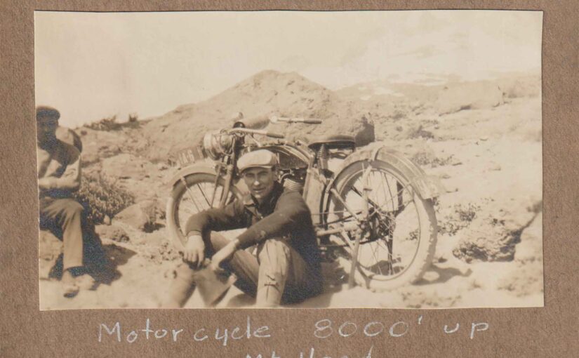
Motorcyclist Makes An Altitude Record – September 13, 1914
Axel Kildahl Drives Machine Over Snow and Ice 7600 Feet Above Government Camp
All altitude records for Mount Hood with motor driven vehicles were smashed last Sunday by Axel Kildahl of Lents, Oregon, when riding his Dayton motorcycle, he drove the machine over snow and ice from Government Camp to an elevation of 7600 feet. Great has been the competition during the last season among the local motorcycle dealers to place their two wheeled machines farther up the mountain side than their competitor.
Several parties have succeeded in climbing as high as 7000 feet above sea level, but the last 600 feet accomplished by Kildahl stands as an endurance test that the experts claim will not be broken in many years to come.
There were 12 cyclists who left Portland Saturday, September 5, and stopped at Rhododendron tavern over night. Sunday morning bright and early the ascent of the mountain was begun. After battling most of the day Kildahl finally placed his machine at a distance up the side of the mountain never traversed by a wheeled vehicle of any kind. During the last 500 feet of the climb Kildahl was forced to stop every 100 feet to allow his engine to cool. While the cylinders cooled the men amused themselves snowballing.
Adolph Aschoff’s Humor – Jokes from another century
The following account of the sense of humor of the legendary Adolph Aschoff, from Marmot Oregon, is from an entry to The Mountain Magazine in the early 1970’s. The Mountain Magazine published historical articles and sold advertising to local businesses from the Hoodland area. This article was written by Wilbur Sulzbach.
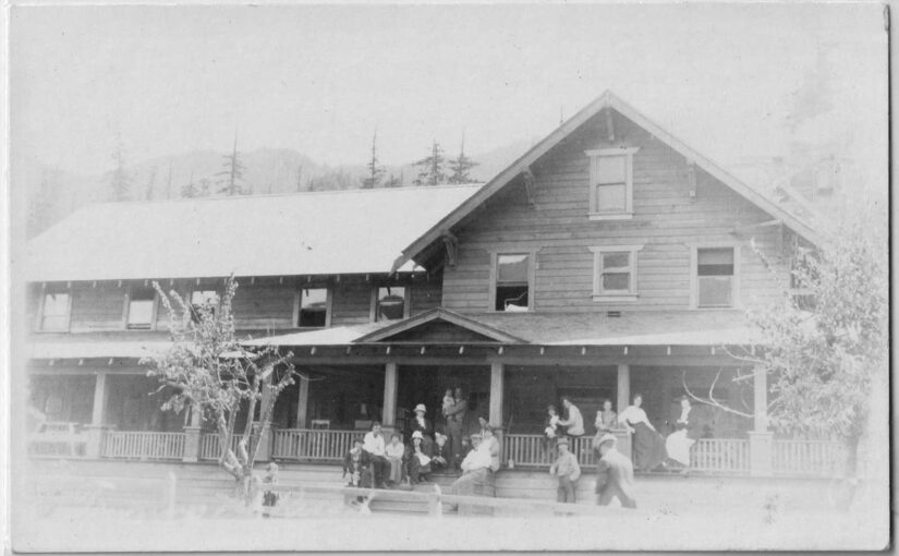
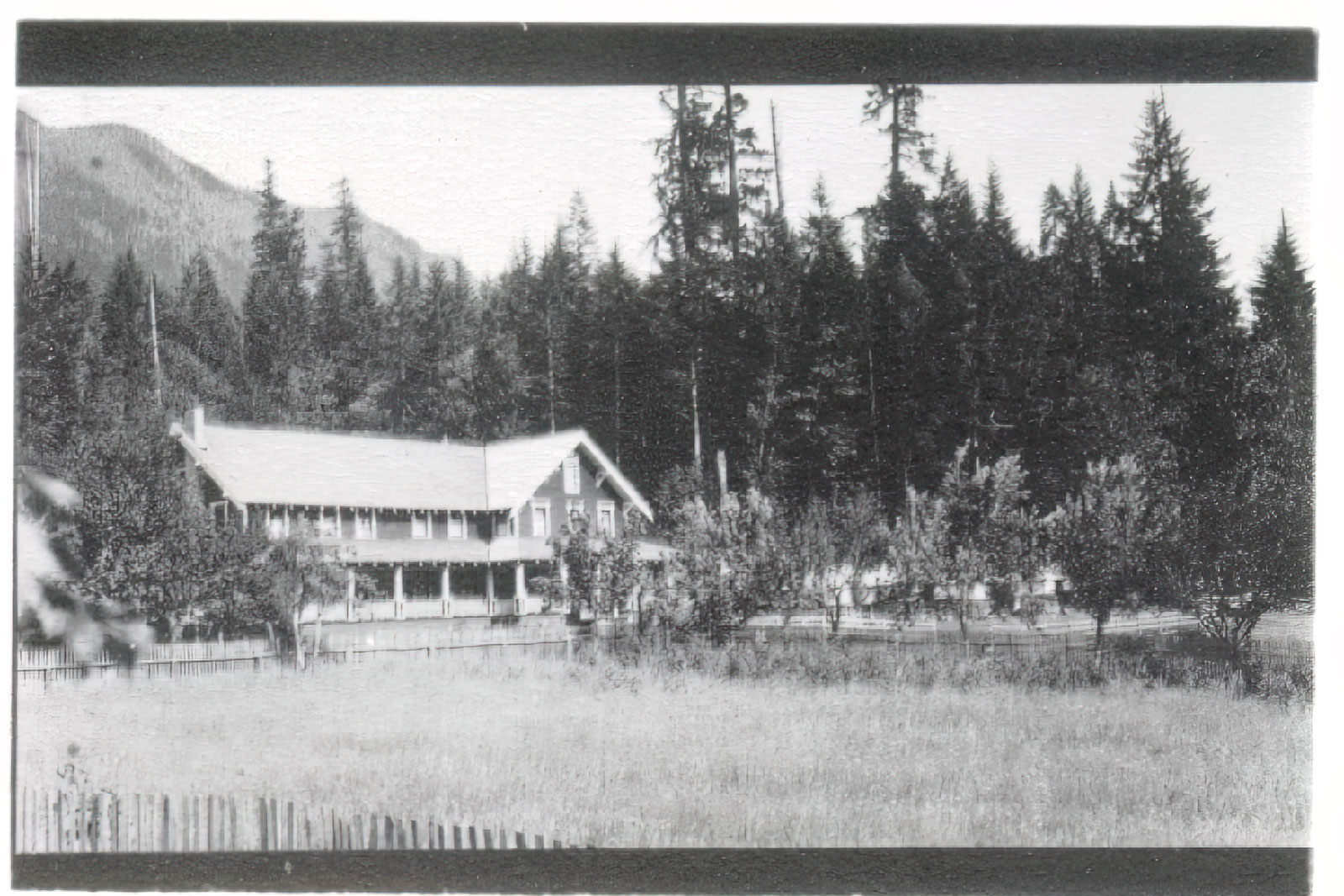
For some background, Adolph Aschoff was a pioneer homesteader who settled at Marmot, which he named, along the old Oregon Trail. He built a hotel called Aschoff’s Mountain Home and entertained guests and travelers along the Barlow Road between 1883 and 1930. It was a destination for many people that came to experience the great outdoors and to launch their adventures on Mt Hood.
Adolph was a jovial character who loved to entertain his guests. He played music told jokes and stories of high adventure. Back then story telling was an art and Adolph was adept at telling stories. The following is an account of two of the stories Adolph would share. This gives you an idea of the 19th century sense of humor and how people entertained themselves before radio and television. Today we’d probably consider Adolph Aschoff’s Humor as Dad Jokes.
You can read more about Adolph Achoff and Marmot Oregon HERE.
Many People remember Adolph Achoff as a man who brought life and laughter to any gathering. His jokes were told and told again with variations. Melvin Haneberg remembers these two.
Adolph told a gathering about a recent trip to Gresham with his wife. They were driving along standing in their high box wagon when a grouse flew up and suddenly in front of the horses. The team reared and jumped into the ditch alongside the road and overturned the wagon. Adolph and his wife crouched down as the wagon overturned and escaped injury but were trapped under the wagon.
“There we were,” said Adolph, “the wagon on top of us and we couldn’t get out.”
“You wouldn’t believe this but I had to walk almost a half a mile to find a fence rail to pry the wagon up and get us out.”
At another time some Marmot friends were complaining about sudden changes in the weather. Adolph said, “Gentlemen, let me tell you about Kansas. I was driving along in a light one-horse wagon on a lovely spring day. The sky suddenly grew black as night, the rain fell so hard I could not breathe, the water filled the wagonbox and ran over the top of my shoes. then the cold wind started to blow. In two minutes my hands were so numb I dropped the reins and had to call to the horse to take me home. When the horse stopped at the barn door I yelled for my wife to bring the axe and shop my feet loose from the wagonbox. Just then the sun came out and melted the ice before my wife could find the axe. Marmot weather is not so bad.”
-Wilbur (“Pete”) Sulzbach
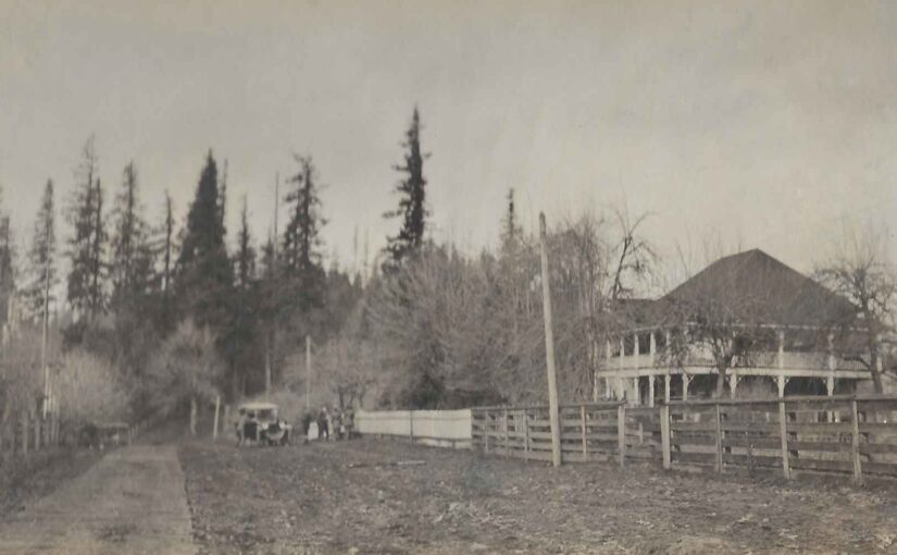
The Mazamas at Marmot experience Adolph Aschoff’s Humor.
Below is an article that I wrote for the Villages of Mt Hood about my friend Bill White. I’ve known Bill for quite some time now and have gotten to know him quite well. He and I both have many common interests, mostly the love of local Mount Hood history. This is the second article the I’ve written for this
Lolo Pass, on the west side of Mount Hood takes a route that goes from Zigzag, on the southwest side of the mountain, to the Hood River Valley on the north side. It travels between the west face of the mountain and the Bull Run watershed, the source of the city of Portland’s water.
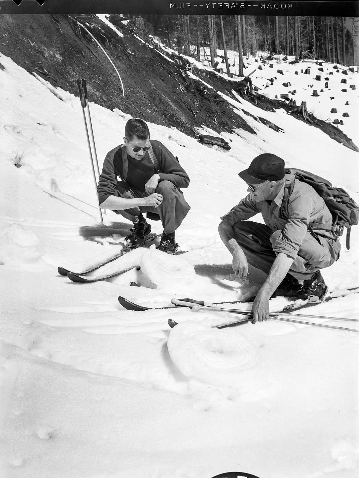
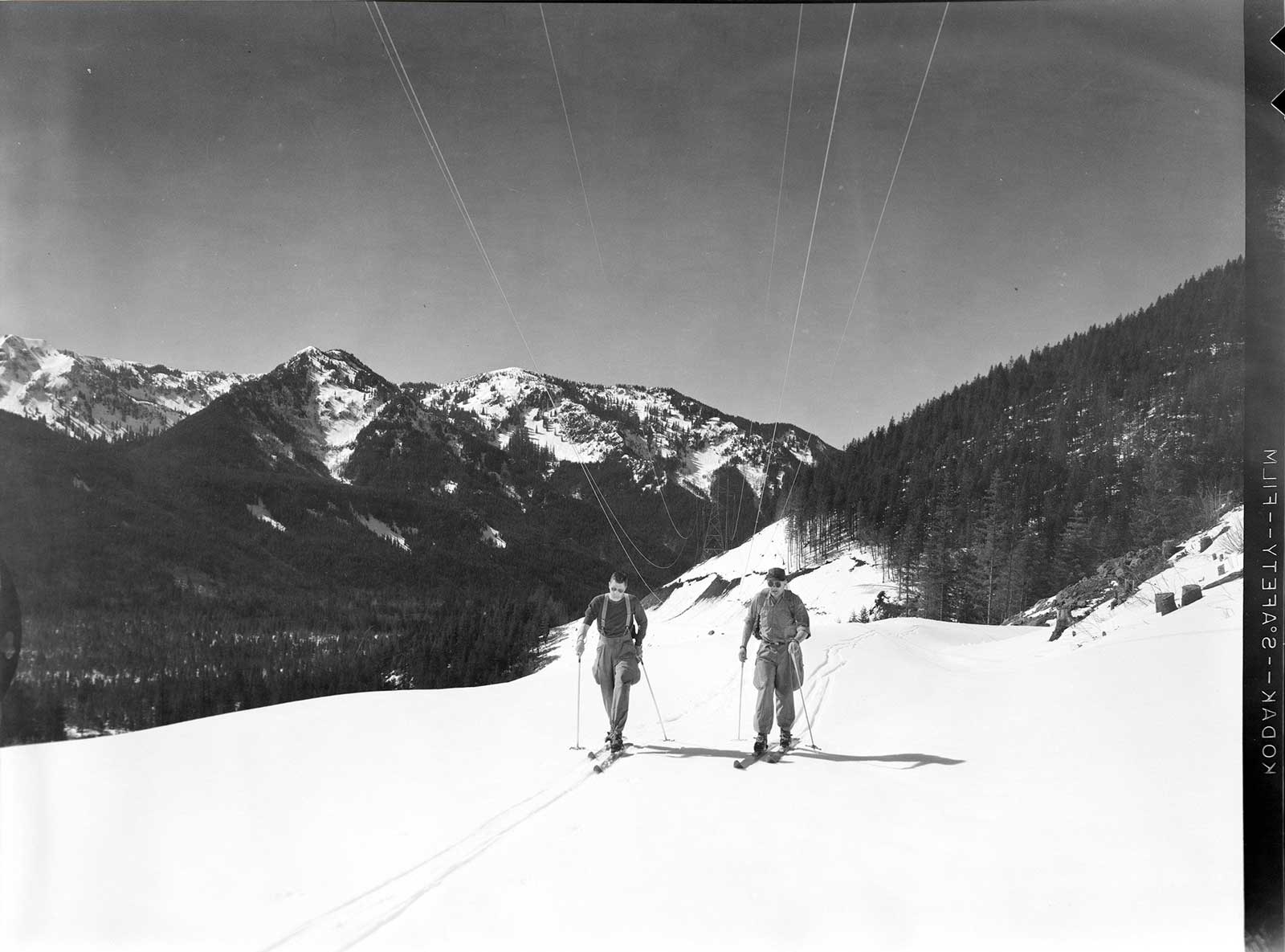
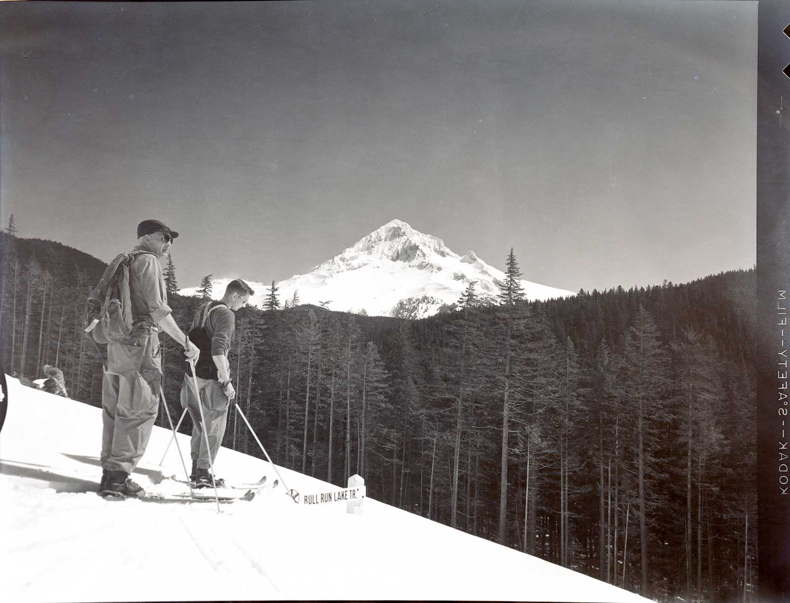
I collect old photos of Mount Hood and I thought that I’d share these old photos of a Lolo Pass Ski Trip. They’re a series of medium format negatives that I have digitized. They are dated April 5, 1955. They show a group of skiers enjoying a beautiful day, with a clear of Mount Hood in the distance. They seem to have a key to the gate that allows then access to the road. In one photo you can see a sign that shows a sign to the Bull Run Lake Trail.
Today, since the Patriot Act, everything west of Lolo Pass Road to Bull Run Lake is off limits. This group seems to be following the main road. The views in the photos can be seen clearly from some of the same viewpoints today.
The gateSnow FormationsOn the wayUnder the power linesA view through the electrical towersThe power linesEnjoying the tripA view of Mount HoodThe Bull Run Lake Trail signWooden skisWooden skisTaking a breakA classic Lolo Pass Ski Trip from 1955
Springs Indian Reservation (10) Timberline Lodge Mount Hood Wilderness LoloPass Columbia River Gorge National Scenic Area (8) Mark O. Hatfield Wilderness
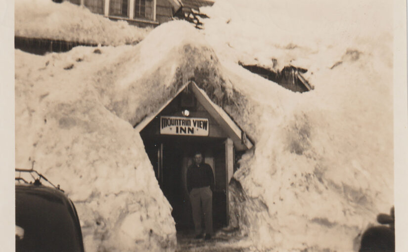
This is the old Mountain View Inn under heavy snow in the 1940’s. The Mountain View Inn was a hotel in the littleMt Hood town of Government Camp, Oregon.
The Mountain View Inn was originally the home of Lena Little, wife of pioneer homesteader Francis C. Little. The building was relocated from its original place to the north side of the main road through Government Camp.
Not long after it was relocated Jack Rafferty leased it to be converted into a hotel called Rafferty’s or Rafferty’s Hut. He later bought the property. Later the place was called the Tyrolian Lodge. It was closed through World War II.
After the War Harry Albright re-opened the inn and changed the name to the Mountain View Inn.
The old Inn burned in 1955. It was located across the street from Daar’s ski shop which is Charlie’s Mountain View today.
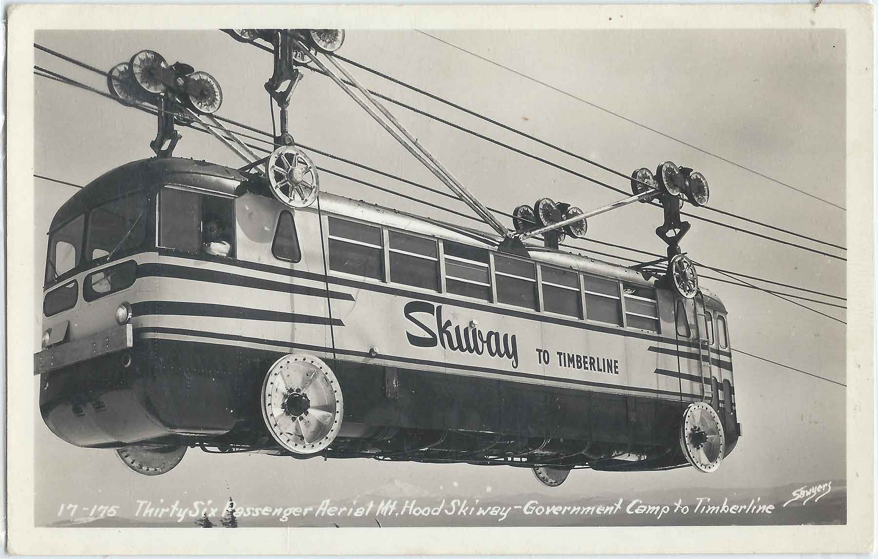
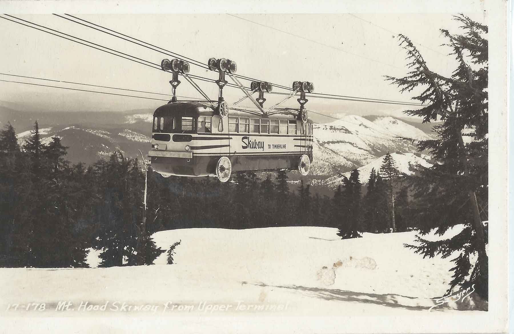
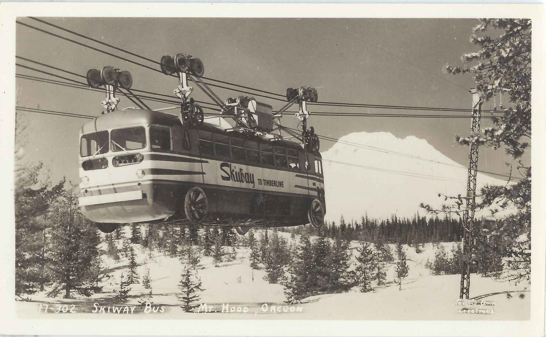
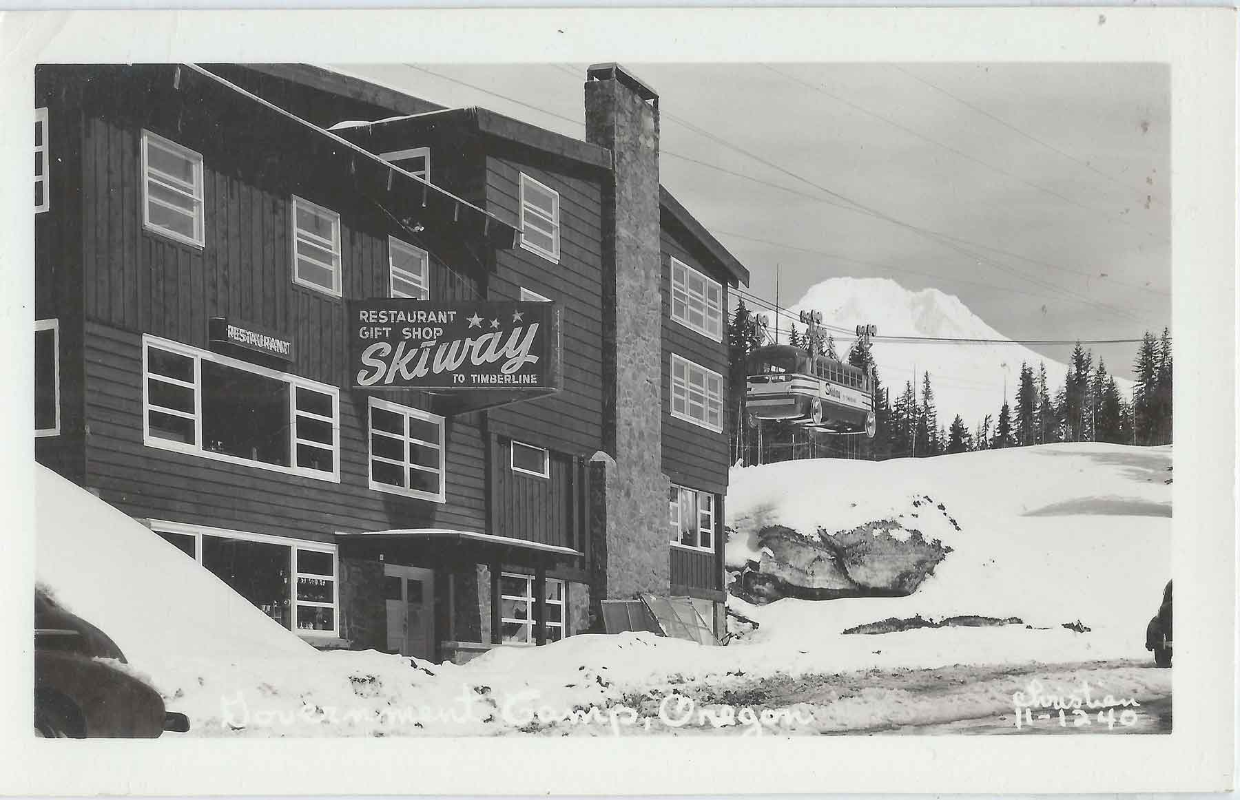
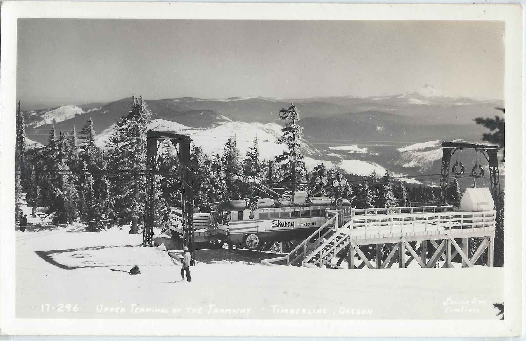
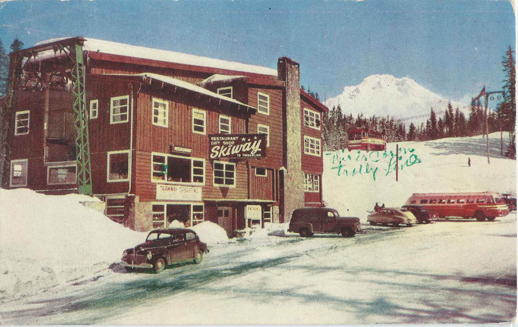
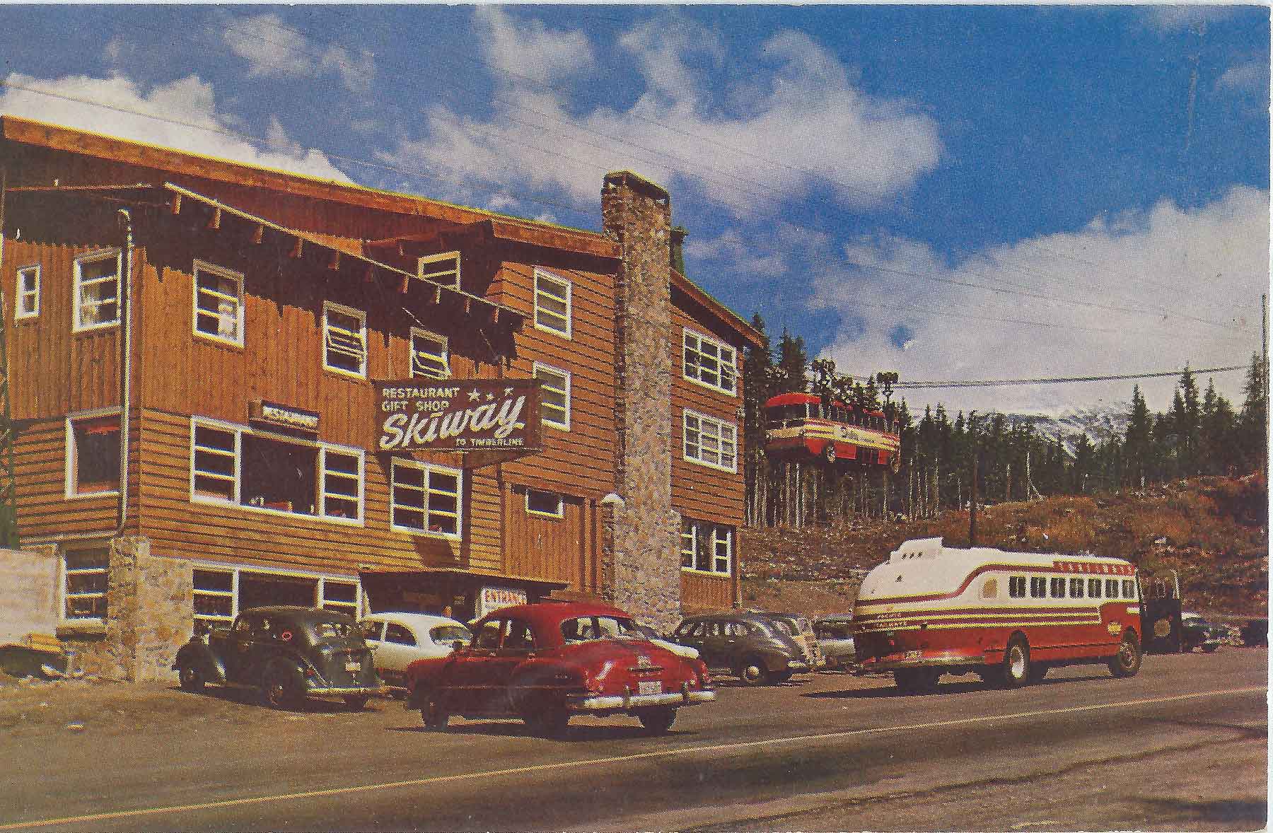
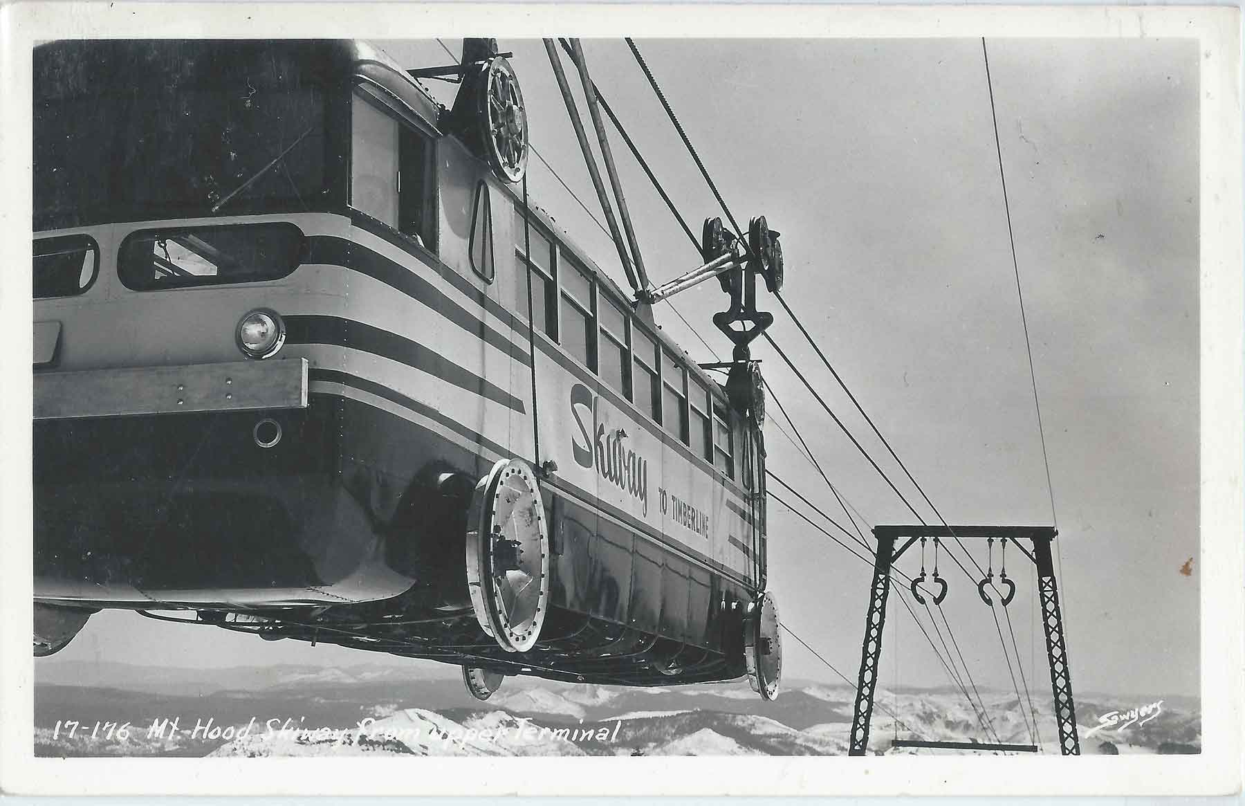
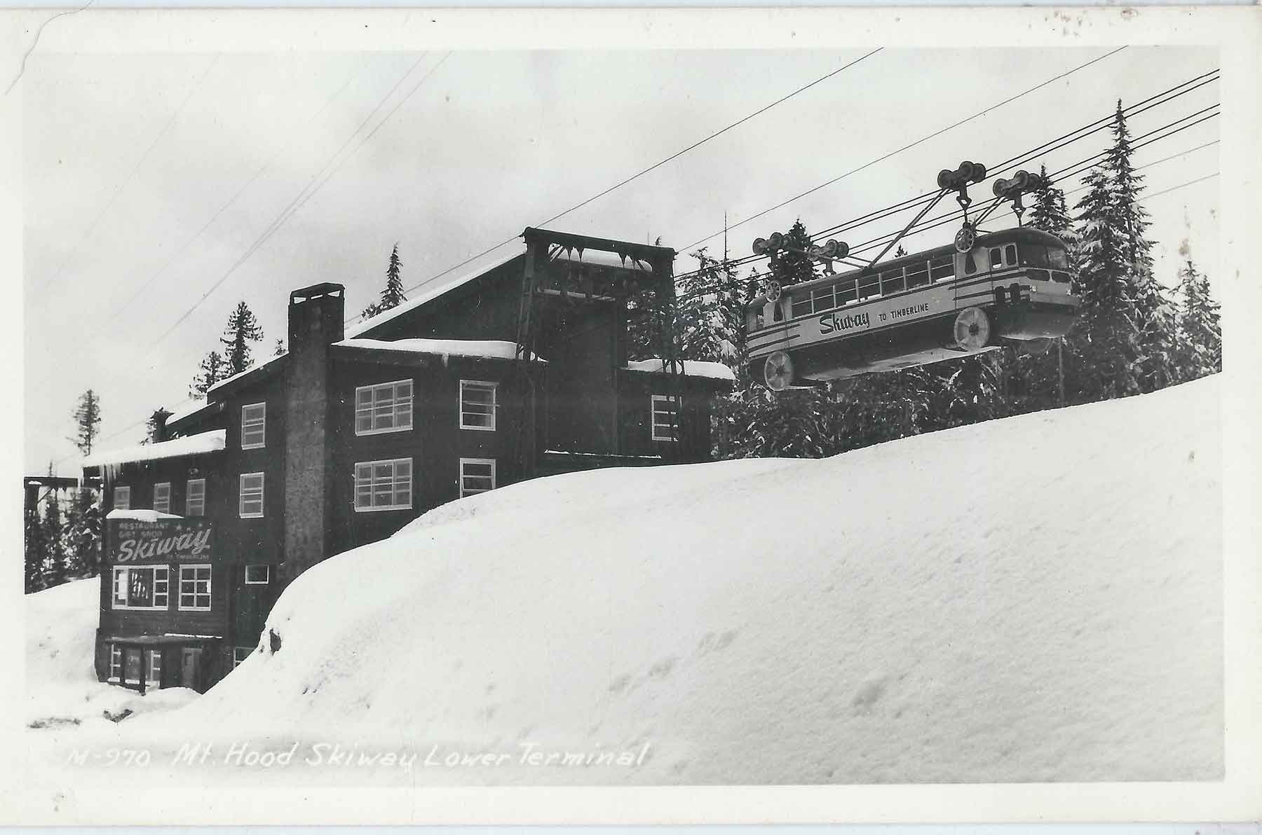
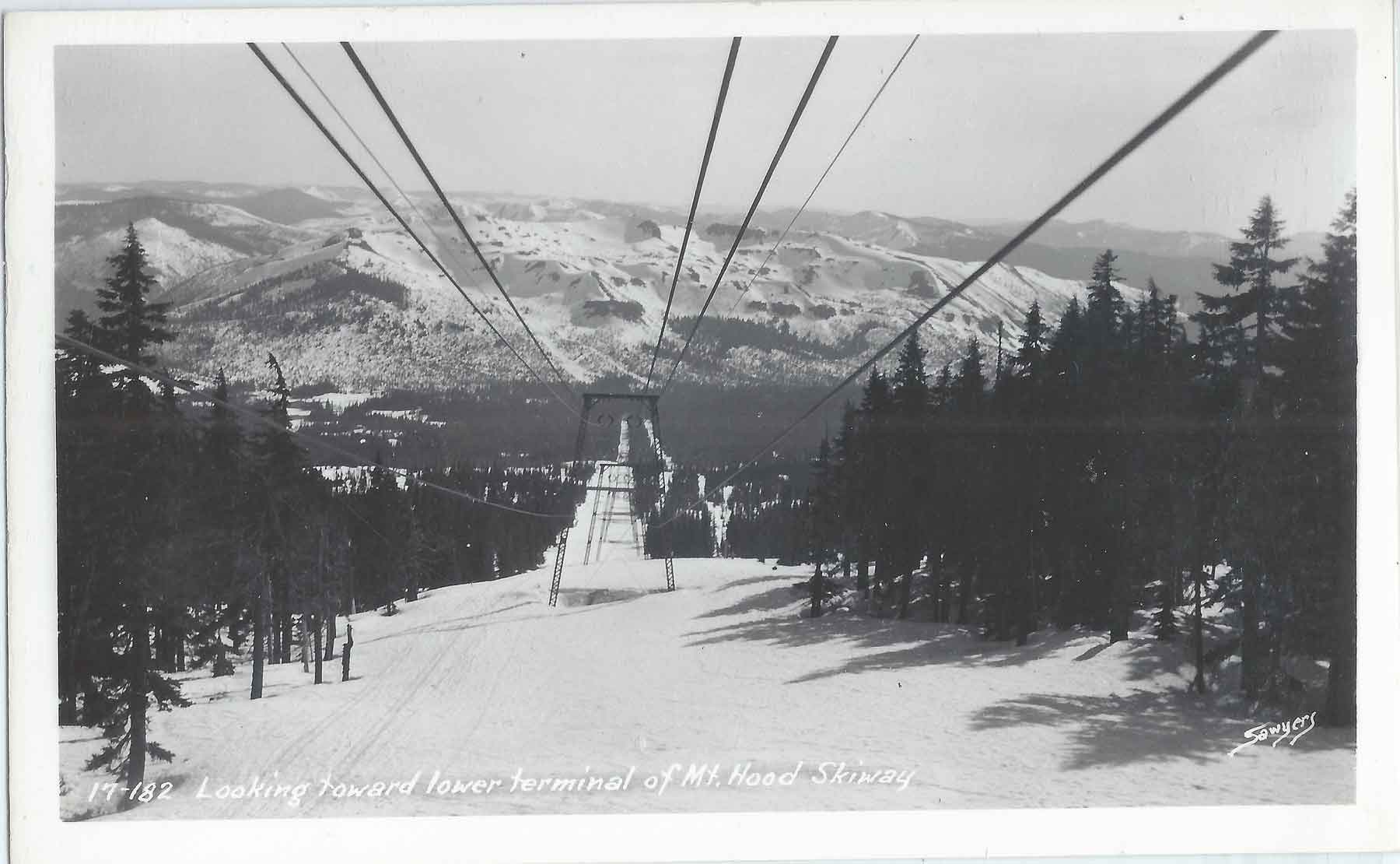
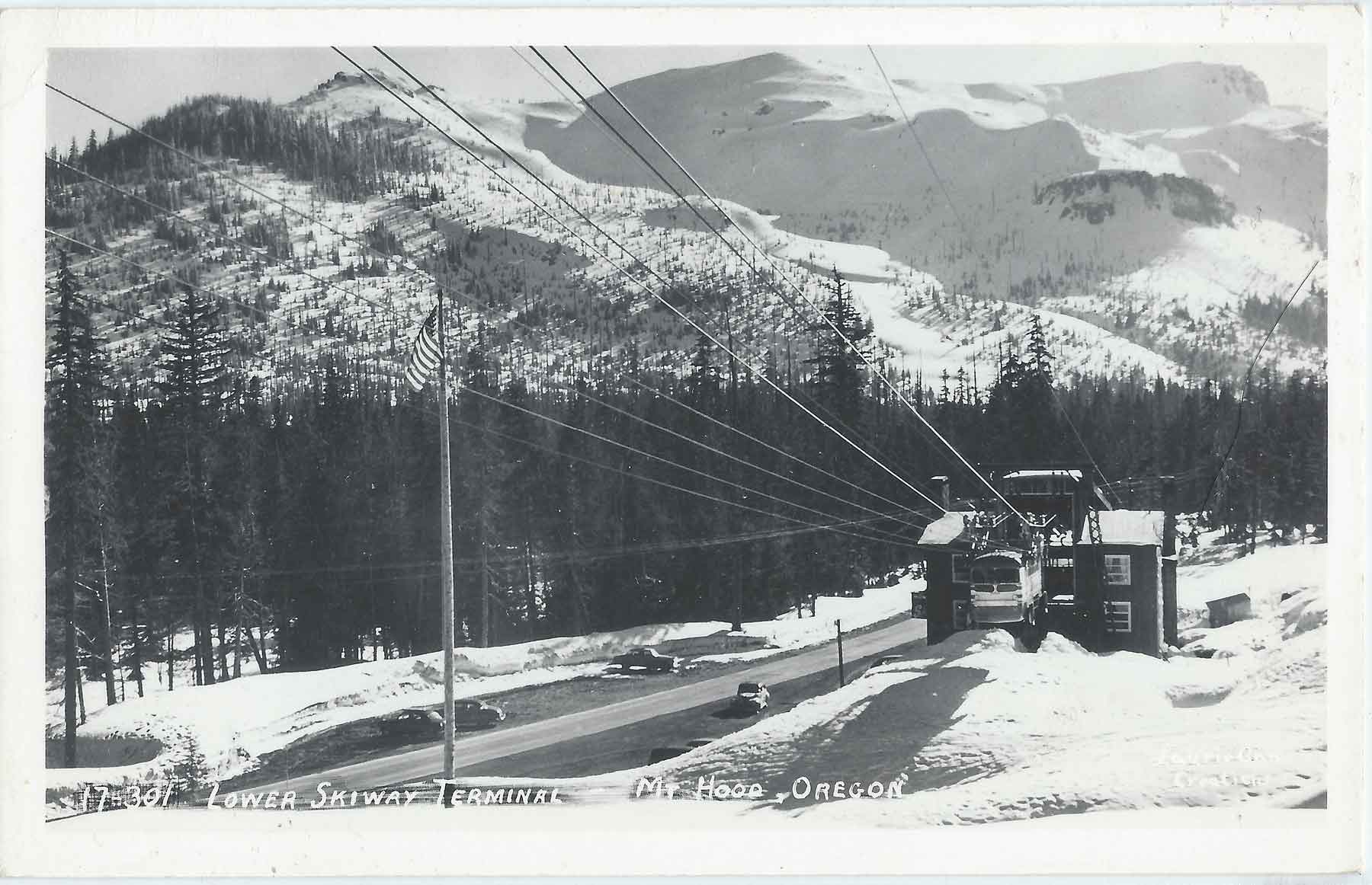
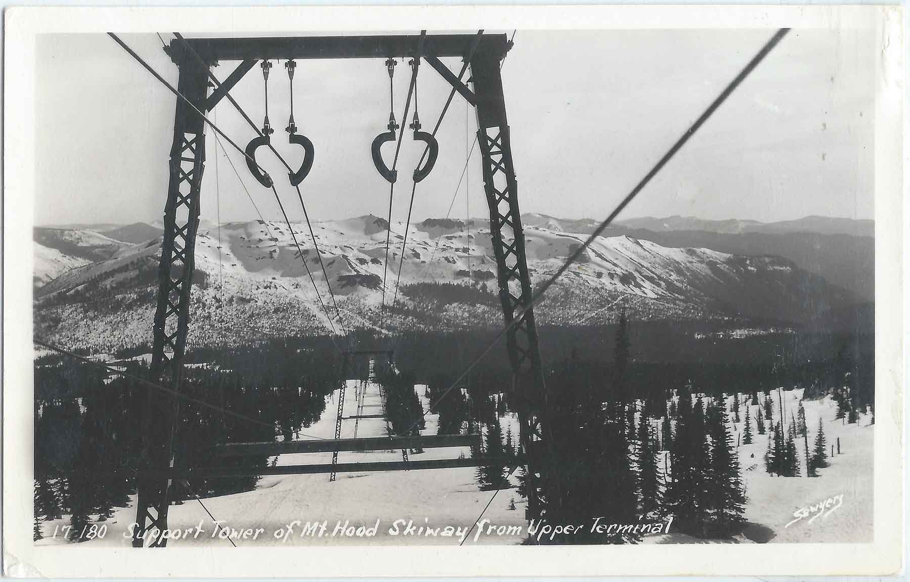
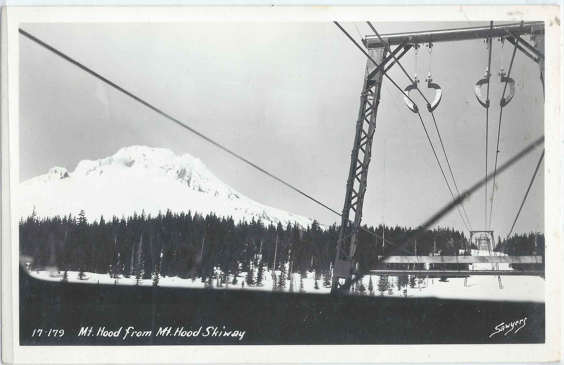
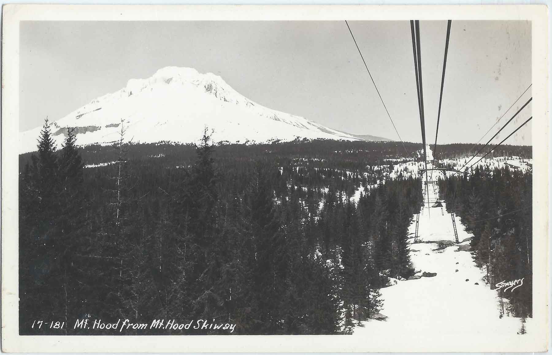
. The Mount Hood Aerial Transportation Company was formed with a plan to create an aerial tramway to Timberline Lodge on the south slope of Mount Hood from Government Camp, the gathering spot for every activity on The Mountain. It was to be called The Skiway
It is 1947 and World War Two was over. Skiing was just getting started before the war, and now that there was peace, people wanted to ski. Mount Hood’s skiing glory days were just getting started again.
Mt Hood Skiway Tram
This was the year that a group of people got together with a vision that was before its time. The Mount Hood Aerial Transportation Company was formed with a plan to create an aerial tramway to Timberline Lodge on the south slope of Mount Hood from Government Camp, the gathering spot for every activity on The Mountain. It was to be called The Skiway, pronounced “Skyway.”
Mt Hood Skiway Tram
Transportation to Timberline consisted of riding, driving your own car up the old road to the lodge, the Timberline bus which cost .50 or one could hitchhike. If you drove up, typically a group would carpool. The group would ski the trail to Government Camp, and the driver would drive the car back down at the end of the day. The tramway made sense. A person could take the tram from Government camp to Timberline Lodge, ski the day at the lodge and then ski the Glade or Alpine Trails back down to Government Camp; or ride the tram back down.
Mt Hood Skiway Tram
Skiers were excited about the prospect and the construction of the towers that would support the cable system was started in 1948. The plan was to build the system using a city bus as a tram car, suspend it from cables and drive it with a method used by loggers in their sky hook log yarding mechanism. The bus would be self-propelled and would pull itself along with a set of pulleys positioned where the wheels would be, drawing the drive cable through and moving the bus up or down the hill.
Mt Hood Skiway Tram
The company planned a lodge at the lower terminus of the cable line. This served as the terminal for loading and unloading passengers, which was done on a deck or platform located on the upper level just under the roof. There was also a restaurant, restrooms, a waiting lounge, and a gift shop in the lodge. The upper terminus was located at the west end of Timberline Lodge.
Mt Hood Skiway Tram
The lodge was completed, and the towers were erected in 1949. This was the same year that the new road to Timberline was opened, creating a shorter trip with a slighter grade and less curves than the old road, making access much easier for personal automobiles, which would be a strike against the success of the Skiway.
Mt Hood Skiway Tram
The winters of 1950 and 1951 were very heavy snow winters. This delayed construction and crews had to scramble to get the operation completed. It was scheduled to be opened in early 1950 but was delayed until the Fall. The day finally came, January 3rd, 1951. The skiers were very enthusiastic, but the novelty wore off quickly. Also consider that with the new road in place and with the Timberline Lodge bus fare being .50 cents and the tramway costing .75 cents, all these factors attributed to its ultimate demise. The Skiway struggled to make a profit for its stockholders and was finally closed in 1956.
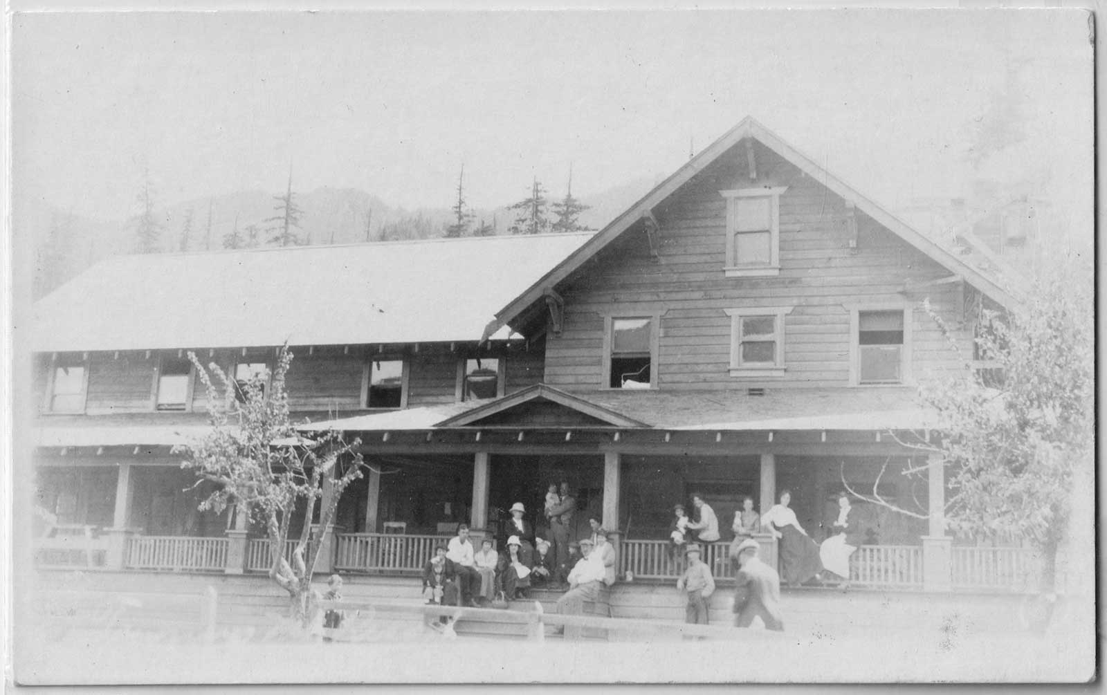
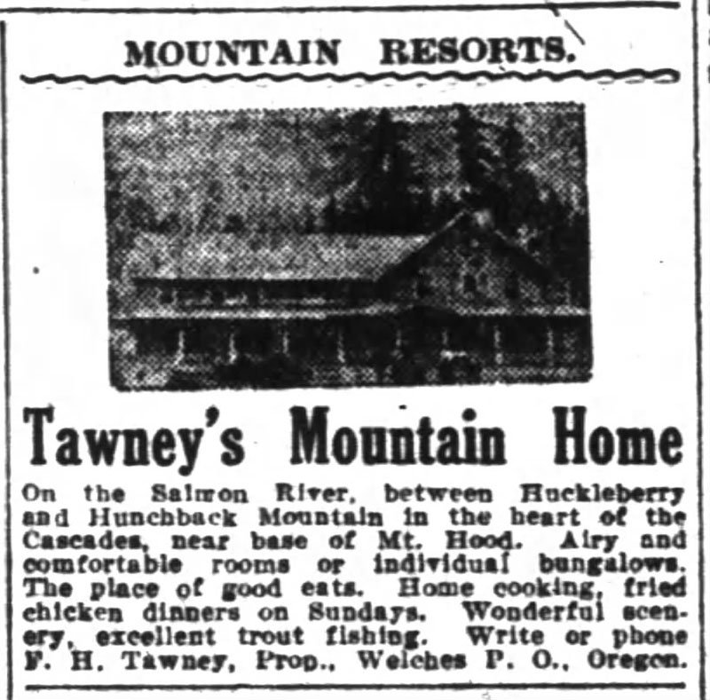
In the early days the Welches Hotel wasn’t the only resort in the Salmon River Valley in the foothills of Mount Hood, Oregon. About a mile past the Welch’s place, at the end of the road, was Tawney’s Mountain Home. Situated along the Salmon River with vast stretches of wilderness surrounding it, Tawney’s Hotel was an outdoor vacation destination from 1910 to 1945.
Hotel Maulding, Welches, Oregon
The hotel was built on a portion of the old Walkley family homestead south of Welches. The Walkley’s didn’t operate a hotel, but they kept boarders in their home. John Maulding and his wife bought the property in 1906, which included 100 acres and the Walkley home. The home was remodeled and enlarged using the homestead house for the dining room, with an addition for lodging, turning it into what was known as the Maulding’s Hotel.
In 1909 Francis H. Tawney and his wife Henriett leased the property and in 1910 they purchased it and started improvements to the hotel. In 1913 a fire burned a large portion of the old hotel building. A new two story addition was quickly built and new hotel was ready for guests in 1914.
Tawney’s Hotel, Welches Oregon before the fire
Tawney’s Hotel was a large building with 15 guest rooms. Because the hotel was so popular, they erected tent cabins on the grounds outside to accommodate more guests. As you entered the building you came into a huge living area with a large rock fireplace. There was a large staircase leading to the upper floor where the guest rooms were located. Adjoining the living room was a huge dining room with its own fireplace and a large dining table. There was only one indoor bathroom, with commode and a bathtub. It was located off the dining room. It was said that you practically needed a reservation if you wanted to use it.
Back then a week’s stay cost $10, including meals. Mrs. Tawney, with the help of Emily, the wife of their only son Clyde, cooked for the guests. She served the meals Family Style with full platters of chicken, roast beef, and steak. She always had jams, fresh bread, pies, and canned foods available. She made large sugar cookies for the children, but it was common for the adults to raid the cookie jar.
Tent Bungalows at Tawney’s Hotel, Welches Oregon
Keeping the hotel supplied with food could be challenging during busy times. There could be up to 150 people there to enjoy a Sunday dinner. In addition to the food that they supplied themselves some staples and canned goods were delivered once a week from Portland. There was also a butcher wagon who would make daily deliveries from Sandy to the hotels and cabin residents during the summer. He would arrive and open the doors to the insulated wagon to show different cuts of beef and lamb packed in ice.
The Tawney’s kept their own animals, including cows, pigs, and chickens. They had horses for guests to ride and a pair of donkeys for the children. Frequently Mr. Tawney would take a party of people on a wagon trip to Government Camp to pick huckleberries and have a picnic lunch.
Tawney’s Hotel, Welches Oregon after the fire showing new addition.
They had a garden, an apple orchard and had berries for pies. They also used wild game and trout from the river and local creeks, sometimes supplied by the guests. The Salmon River was located nearby and provided lots of swimming and fishing. In 1910, B. Trenkman, C.J. Cook, and L. Therleson made a 1.5-hour trip up to Camp Creek for fishing. The three men came back with 286 trout. It was said to be one of the best meals at the Tawney Hotel.
Nell Howe, a longtime resident, remembered on summer days the most wonderful food. She said, “In the summertime the tables in the dining room were full for every meal and sometimes people were waiting their turn.” When guests looked back, they remember their fun summer memories of swimming in the river, fishing, helping with the chores, and enjoying the food.
Guests at Tawney’s Hotel, Welches Oregon
The hotel closed its doors in 1945, most likely due to the loss of business and the scarcity and cost of goods during World War II. The Tawney’s were in their later years by this time and the work involved in running a business like that was in their past. Mr. Tawney passed away in 1947 and soon after Mrs. Tawney moved to Portland with her daughter and son-in-law. She lived until 1959.
Sometime in the late 1950’s the old Tawney’s Mountain Home collapsed under the load of a heavy snowstorm. The property sold and the new owner demolished what was left of the old building leaving the two stone fireplaces as the only evidence of the good old days of Tawney’s Mountain Home and a significant part of the history of Welches Oregon.
Oregon pioneer history (1806–1890) is the period in the history of Oregon Country and Oregon Territory, in the present day state of Oregon and Northwestern
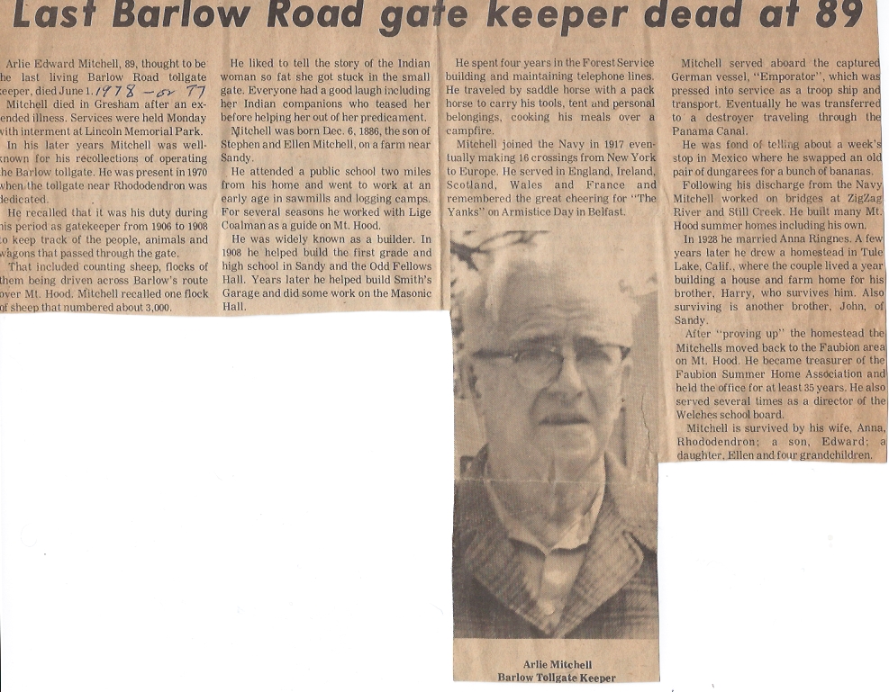
Arlie Edward Mitchell, 89, thought to be the last living Barlow Road tollgate keeper, dies June 1. (1976)
Mitchell died in Gresham after an extended illness. Services were held Monday with internment at Lincoln Memorial Park.
In his later years Mitchell was well known for his recollections of operating the Barlow tollgate. He was present in 1970 when the tollgate near Rhododendron was dedicated.
He recalled that it was his duty during his period as a gatekeeper from 1906 to 1908 to keep track of the people, animals and wagons that passed through the gate.
That included counting sheep, flocks of them brought across the Barlow’s route over Mt. Hood. Mitchell recalled one flock of sheep that numbered about 3000.
He liked to tell the story of the Indian woman so fat that she got stuck in the small gate. Everyone had a good laugh including her Indian companions who teased her before helping her out of her predicament.
Mitchell was born Dec. 6, 1886, the son of Stephen and Ellen Mitchell, on a farm near Sandy.
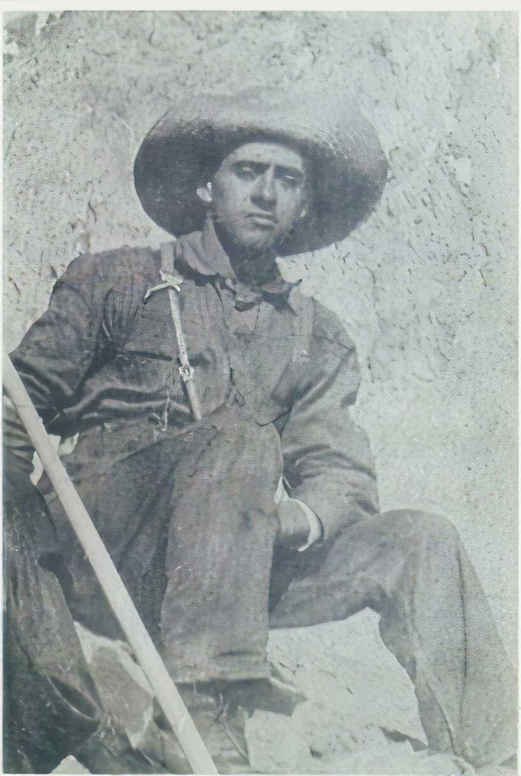
He attended a public school two miles from his home and went to work at an early age in sawmills and logging camps. For several seasons he worked with Lige Coalman as a guide on Mt Hood.
He was widely known as a builder. In 1908 he helped build the first grade and high school in Sandy and the Odd Fellows Hall. Years later he helped build Smith’s Garage and did some work on the Masonic Hall.
He spent four years in the Forest Service building and maintaining telephone lines. He traveled by saddle horse with a pack horse to carry his tools, tent and personal belongings, cooking his meals over a campfire.
Mitchell joined the Navy in 1917 eventually making 16 crossings from New York to Europe. He served in England, Ireland, Scotland, Wales and France and remembered the great cheering for “The Yanks” on Armistice Day in Belfast.
Mitchell served aboard the captured German vessel, “Emporator”, which was pressed into service as a troop ship and transport. Eventually he was transferred to a destroyer travelling through the Panama Canal.
He was fond of telling about a week’s stop in Mexico where he swapped an old pair of dungarees for a bunch of bananas.
Following his discharge. from the Navy Mitchell worked on bridges at Zigzag River znc Sill Creek. He buillt many summer homes including his own.
In 1928 he married Anna Ringness. A few years later he drew a homestead in Tule Lake, Calif., where the couple lived a year building a house and farm home for his brother, Harry, who survives him. Also surviving is another brother, John, of Sandy.
after “proving up” the homestead the Mitchells moved back to the Faubion area on Mt. Hood. He became treasurer of the Faubion Summer Home Association and held office for at least 35 years. He also served several times as a director of the Welches School Board.
Mitchell is survived by his wife, Anna, Rhododendron; a son, Edward; a daughter, Ellen and four grandchildren.
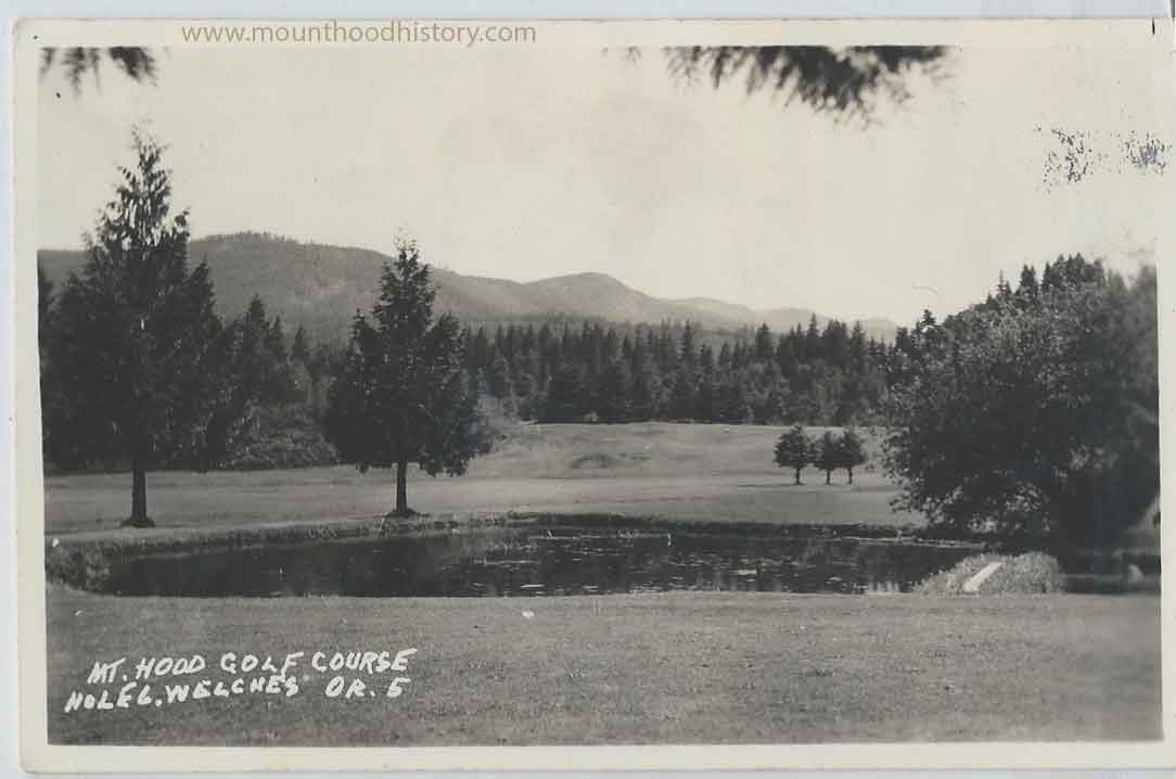
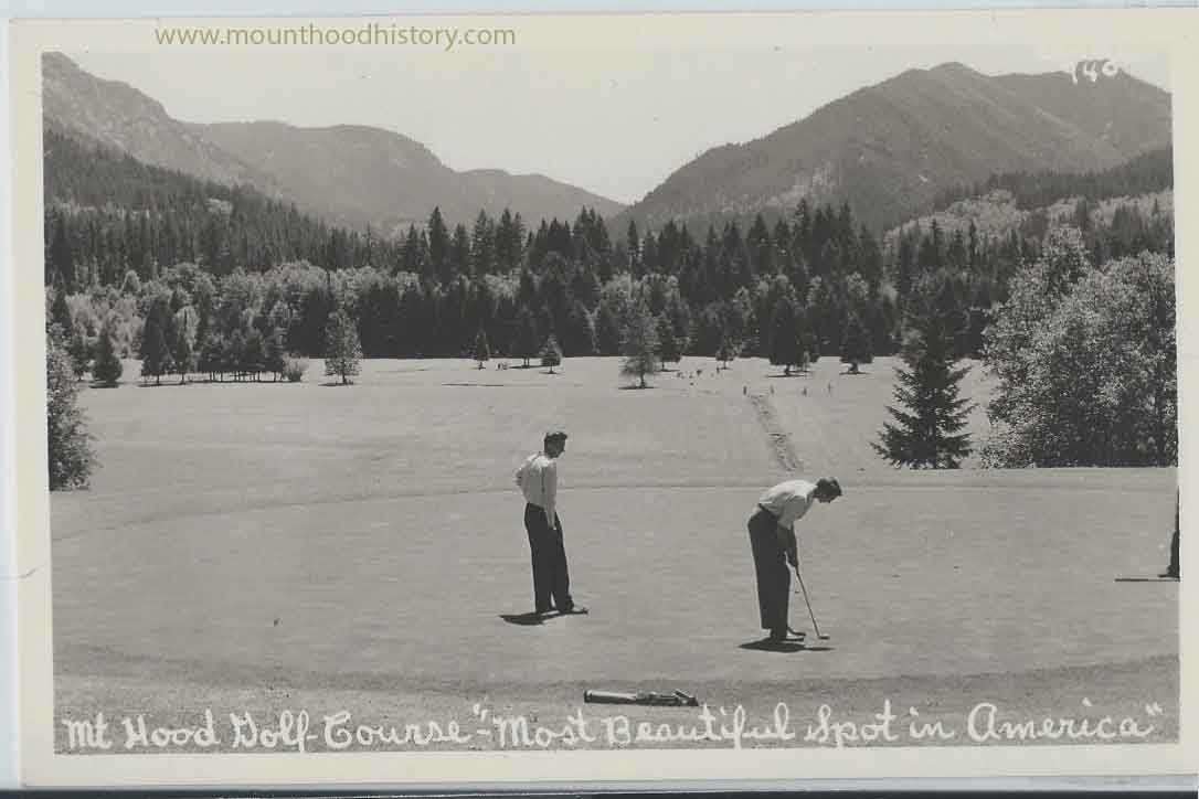
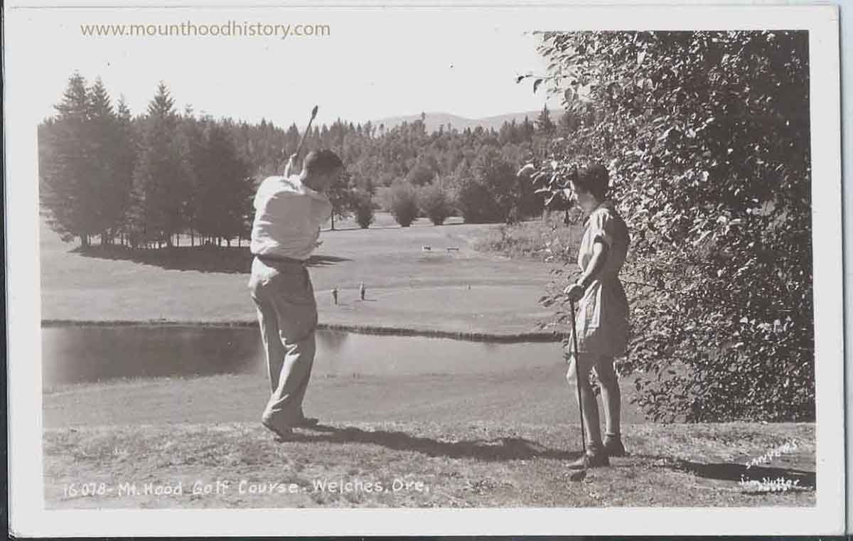
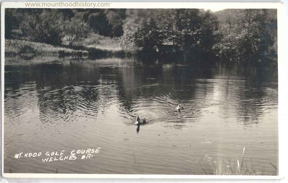
The Mt Hood Golf Course – Nestled deep within the Salmon River Valley in the foothills of Mount Hood is situated one of Oregon first and most beautiful golf courses. Today it includes a resort with all of the luxuries and amenities needed for a restful and enjoyable day on the links or for an extended vacation and base for day trips to the iconic Mount Hood territory.
In 1928 Ralph Shattuck and George Waale envisioned a golf course in Billy Welch’s pasture. The original name was “The Mt Hood Golf Course”. They leased the land from Billy with an option to buy, where they built the first nine holes and made Welches the first Oregon golf resort. Today these first nine holes, named “The Original Nine”, are known as “Pinecone”. Shattuck and Waale operated the course until 1939, when Billy and Jennie Welch took back the land and the course. Billy Welch died in 1942, leaving Jennie to operate the business.
In 1944 Jennie sold the property to J. P. Lich and his wife Oberta. J.P. Lich sold the property to Leo Hueval. Leo Hueval struggled to pay the mortgage and the property returned to J.P. Lich, who then sold to Eugene and Peggy Bowman in 1948. The Bowman’s changed the name to “Bowman’s Golf Club”. The Bowman’s added an additional nine holes named “Thistle” on land cleared by J. P. Lich for that purpose, making it an 18 hole course. The Bowman’s operated the business until 1978.
In 1973 American Guaranty purchased land across the road from the course where they built a conference center, restaurant and additional rooms for lodging. In 1979 they bought out Bowman and consolidated the two businesses and named the operation “Rippling River Resort”. A third nine holes were added which was named “The Red Side” but is known today as “Foxglove” which, at the time, made the course the only 27 hole course in Oregon.
Ed and Janice Hopper bought the resort in 1989 and changed the name to “The Resort at The Mountain”. Ed Hopper had Scottish ancestry and introduced a Scottish theme throughout the resort. The Hoppers operated the resort until 2007 where it has gone through several owners and is now named the “Mt Hood Resort”.
The photos included with this story are all real photo postcards of the resort circa ~1950-1960 and are a part of my personal collection.
Pinecone was established in 1928 and is often referred to as the “Original Nine.”
This scenic course offers 360-degree views of the cascading hills of the Mount …
George Pinner built most of the stone fireplace through the Mount Hood corridor during the 1920’s and 1930’s, many for Henry Steiner’s cabins. He was known for his shaped arched facing of solid stone and his use of convex mortar coving. George Pinner didn’t use round river run but, instead, would split and shape the stones to fit together, typically with a keystone in the center of the arch. George Pinner also carved the stone curbing for the White House in Washington DC.
George Pinner lived in the little settlement of Faubion situated between the towns of Zigzag and Rhododendron. He built his home out of solid stone. His home is still there and is located on what is now Faubion Loop Road.
Apr 24, 2015 … Signature aspects of most Steiner Cabins include a “wagon wheel” or “sunburst”
gable, a basalt rock fireplace, arc-shaped front door made of a …
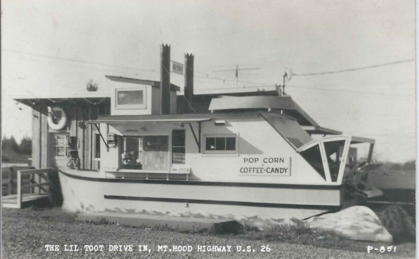
Wimpey’s Lil Toot Drive In, Mt Hood Highway, Kelso Oregon
Whimpy’s Lil Toot Drive In, Kelso Oregon was located across the street from the Kelso Store when today’s Orient Drive was the highway to Mount Hood. It was owned and operated by Clarence “Whimpy” Eri. Once the modern Highway 26 was built, in the mid 1960’s, it bypassed the old route to Mount Hood and many small businesses such as this had to close their doors.
Kelso Oregon is located just west of the town of Sandy between Sandy and Boring.