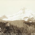
A collection of photos taken by Harry Calvert with his wife Alvida on a trip to the Columbia River Gorge and Mount Hood.


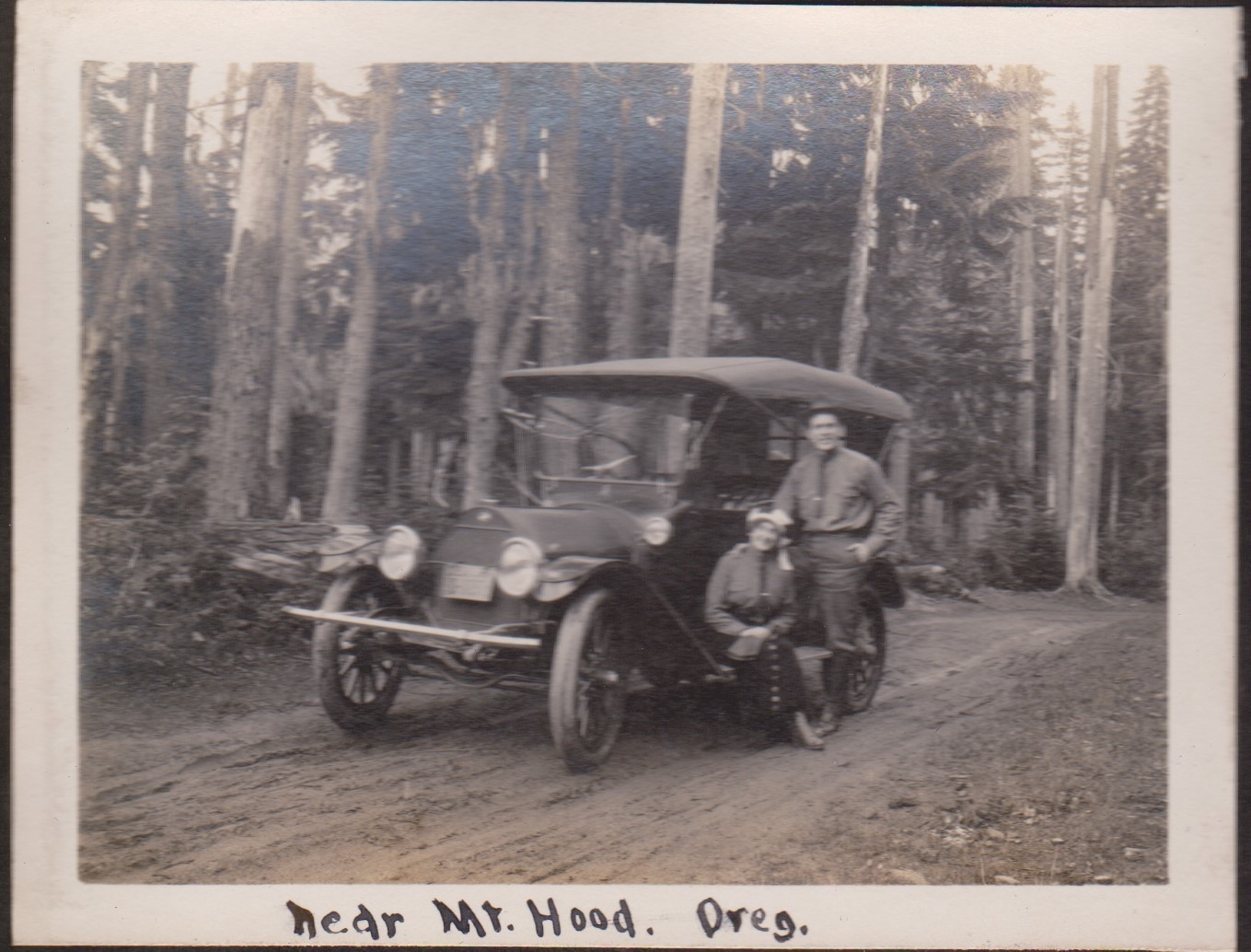


A collection of photos taken by Harry Calvert with his wife Alvida on a trip to the Columbia River Gorge and Mount Hood.
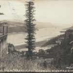
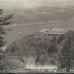
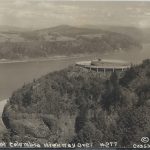
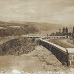
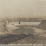
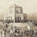
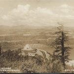
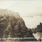
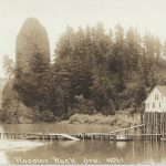
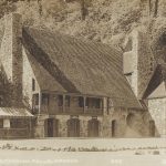
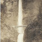
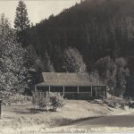
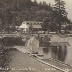
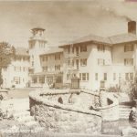
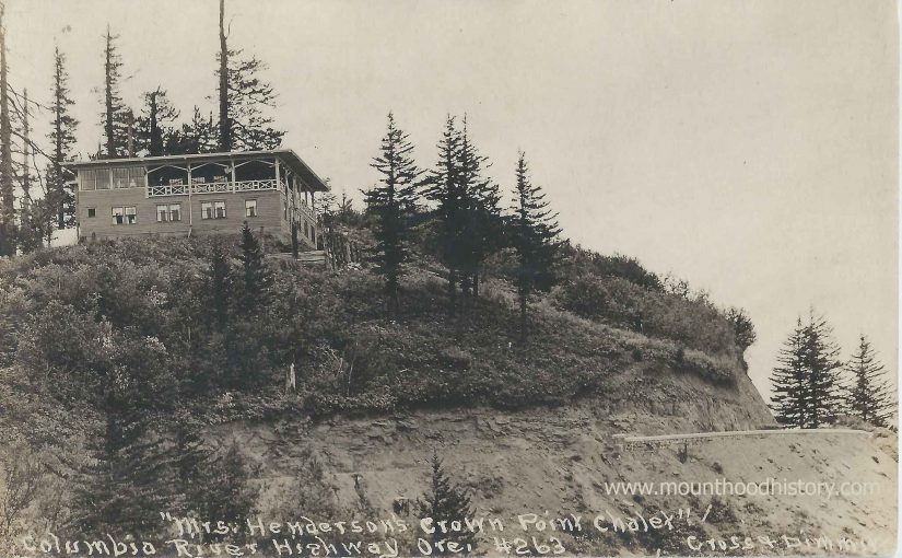
The Crown Point Chalet was one of the premier roadhouses along the Historic Columbia River Highway back in the day. And the indefatigable Mrs M. E. Henderson was a key player in the early days of hospitality along the old road.
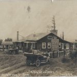
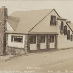
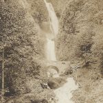
In 1912 a Mr. & Mrs. A.R. Morgan built the Chanticleer Inn on a promontory just east of Corbett, with an incredible view to the east of the scenic Columbia River Gorge, the Chanticleer Inn became a popular destination for Portland’s affluent on their forays into the scenic Columbia River Gorge. Managed by Mrs. M. E. (Margaret) “Bidy” Henderson the inn became known for its hospitality and its delicious meals. By the following year the new Columbia River Highway was being pushed through the Gorge. Mrs. Henderson left the Chanticleer Inn to start her own venture at Latourell Falls. She named it The Falls Chalet. She enjoyed great success at this beautiful road house with a spectacular view of the falls, but within a year it was destroyed by a fire.
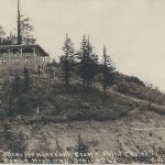
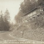
Leaving Latourell and returning to the vicinity of the Chanticleer Inn she acquired a site on a promontory of land that would soon be the site of the Vista House, and a very popular stopping point for automobile tourists. It was here she decided to build The Crown Point Chalet.
The Inn had a commanding view situated above and to the south of Crown Point.
The Crown Point Chalet opened for business in May of 1915. For over ten years Margaret enjoyed great success. But with the Depression looming and Mrs. Henderson’s health fading she sold the Chalet in 1927. Moving to Portland she started a very small dining room on Alder St. The Depression was the final blow and she went bankrupt. Her health worsened and in April of 1930 she passed away at the age of 58. Mrs. Henderson contributed greatly in the promotion and the successful completion of the Columbia River Highway.
The old lodge fell into disrepair and was demolished sometime in the early 1950’s.


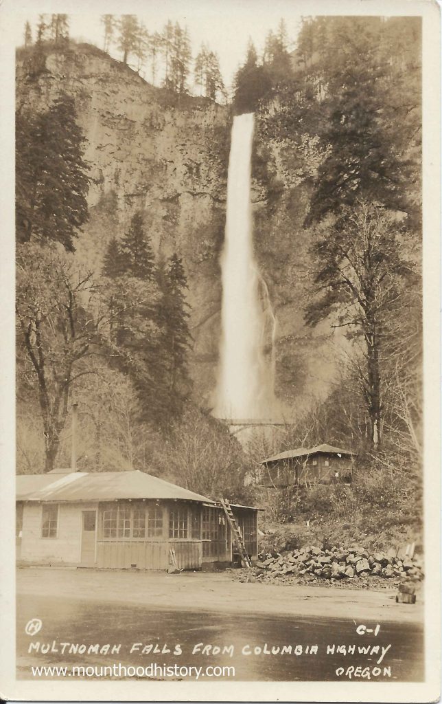
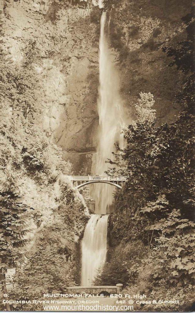
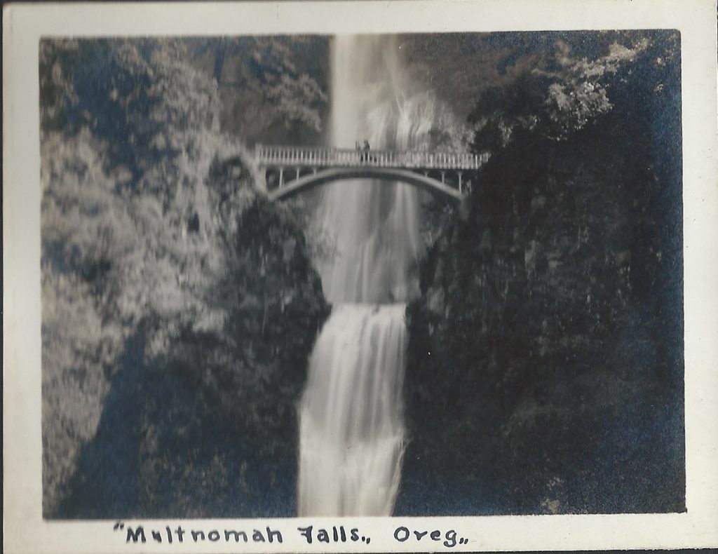
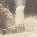
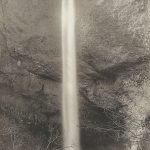
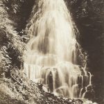
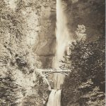
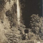
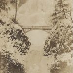
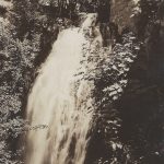
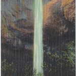
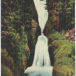
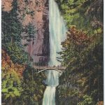
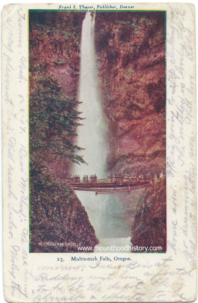
Multnomah Falls History – The Bridge Over the Falls – Multnomah Falls is a two tiered waterfall located in the scenic Columbia River Gorge just east of the city of Portland. It was formed about 15,000 years ago as a result of the cataclysmic Missoula Floods, a series of massive floods that scoured out the Columbia River Gorge. It has a total height of 620 feet, with the upper falls being 542 feet and the lower segment being 69 feet. It’s the tallest waterfall in Oregon and the second tallest year-round waterfall in the United States, fourth largest if seasonal falls are included.
Multnomah Falls was named according to a legend of the local native Multnomah people that tells the story of how a beautiful maiden sacrificed herself to save the tribe from a plague by throwing herself from the top of a cliff. The tribe was saved and a creek formed at the top of the cliff creating Multnomah Falls.
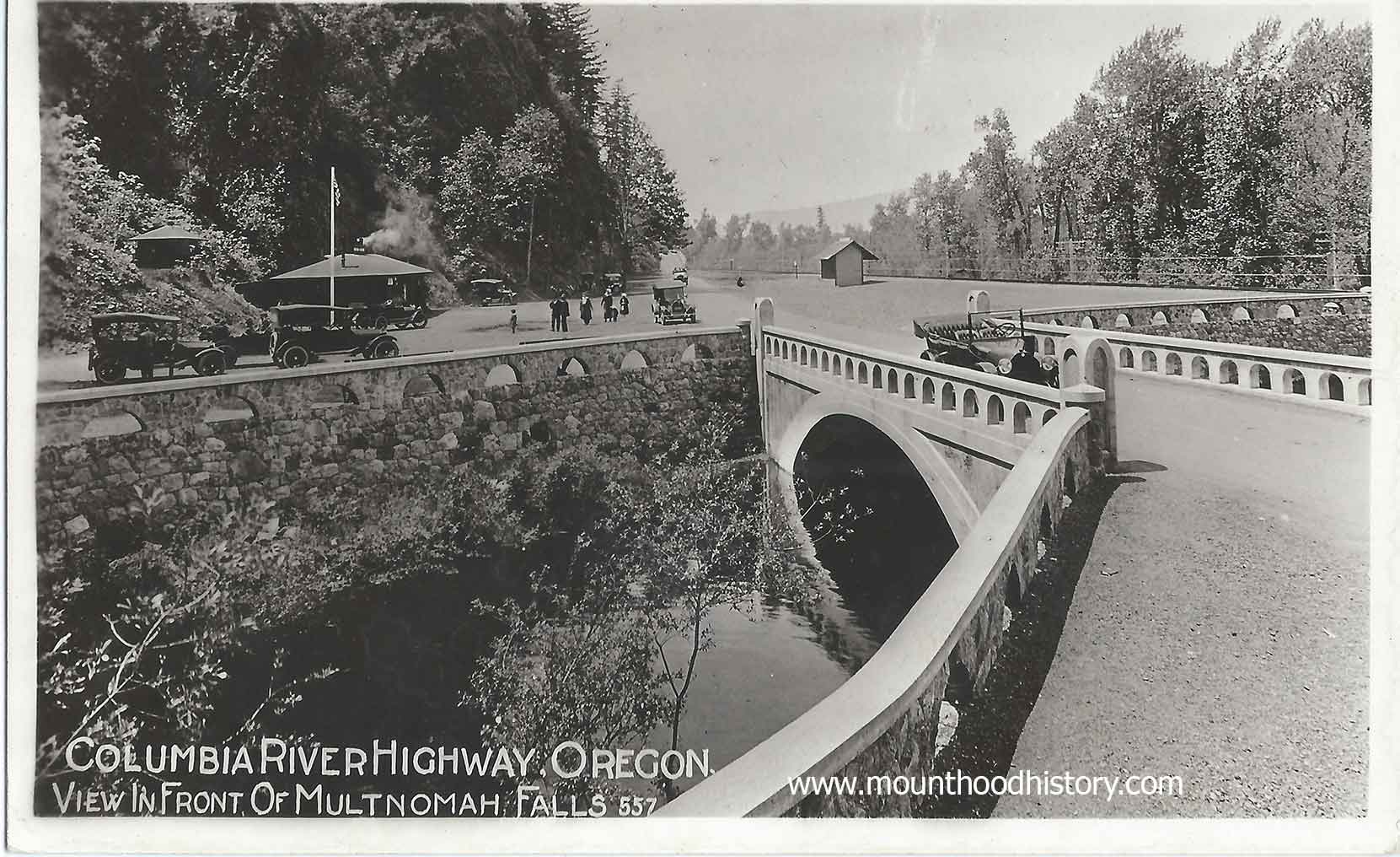
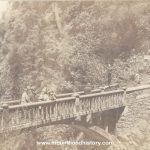
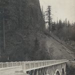
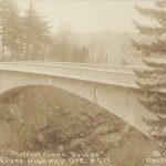
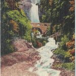
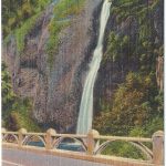
From 1884 until World War II the ORNCo Oregon Railroad and Navigation Company operated a train stop at Multnomah Falls. It was around this time that the “bow string truss” bridge across Multnomah Creek, at the same location as the present Benson Bridge, was built. Somewhere around 1891 the bridge was reinforced but by 1899 the bridge was gone, most likely decayed and washed into the creek.
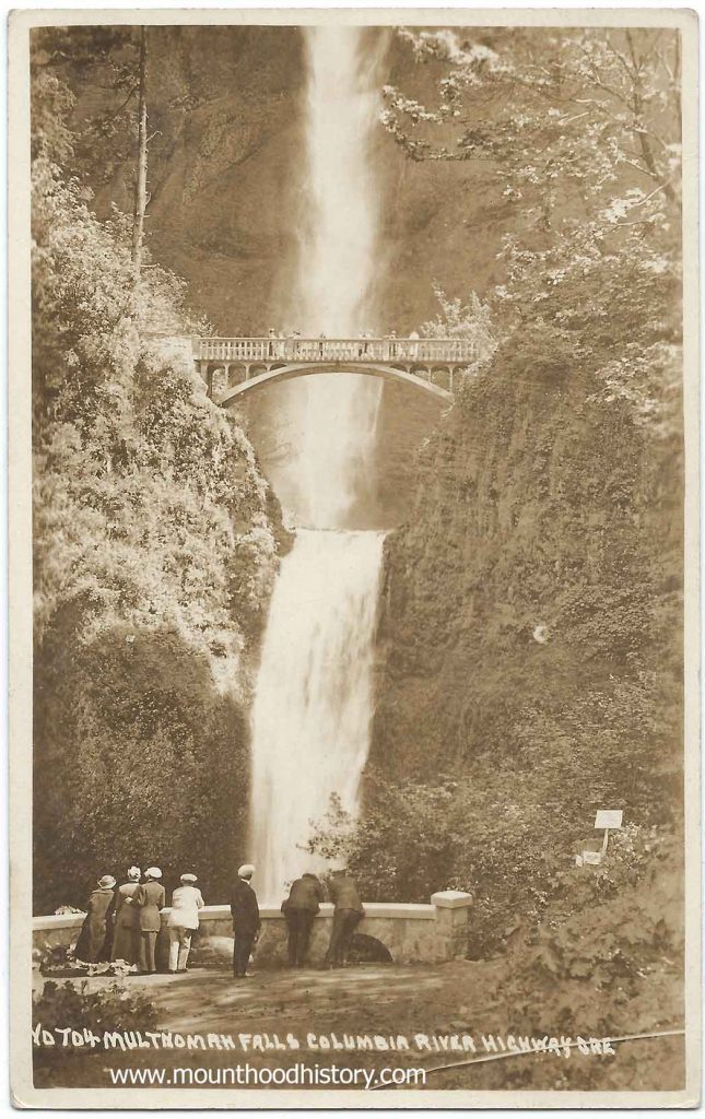
In 1915 a lot was happening in the gorge. Tourism was increasing on the steam powered sternwheelers and train excursions but would soon be replaced by automobile traffic on the soon to be completed, and now historic, Columbia River Highway. With this tourism comes the need for hiking trails. Many of the established trails were being improved and new ones were being made. One in particular was recommended by Samuel Lancaster to the Progressive Business Men’s Club of Portland to build a trail from the base of Multnomah Falls to the top of Larch Mountain to the south and the source of Multnomah Creek.
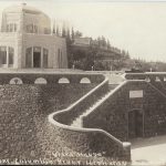
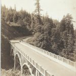
The club raised money and with donations from Portland businessman Simon Benson and his son Amos worked with the US Forest Service to establish the trail and a fire lookout on Larch Mountain. Simon Benson then hired Italian stonemasons to construct a bridge to allow access to the trail for visitors to the falls. The bridge is named Simon Benson Bridge in his honor.
That same year Benson donated 1,400 acres of land, including the land where Multnomah Falls is located to the city of Portland. Subsequently the ORNCo donated the land at the base of the falls, where their train station was located, to the city in agreement that a lodge would be built there the same year. The stone Multnomah Falls Lodge’s construction was commissioned that year and the lodge was completed in 1925.
The historic Columbia River Highway was completed and dedicated in 1917 allowing Portlanders to easily take a bus or drive an automobile through the gorge while stopping at it’s amazing waterfalls, especially Multnomah Falls. The Benson Bridge is still used today and provides breathtaking views of the falls up close and personal. It has become a part of Multnomah Fall’s history.

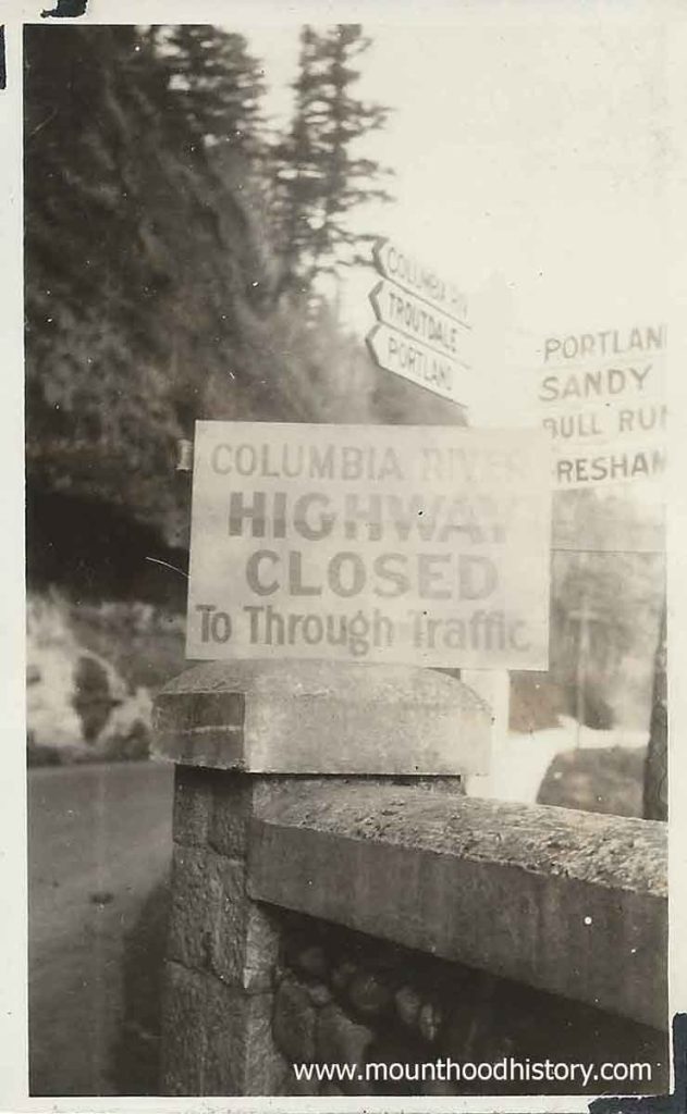
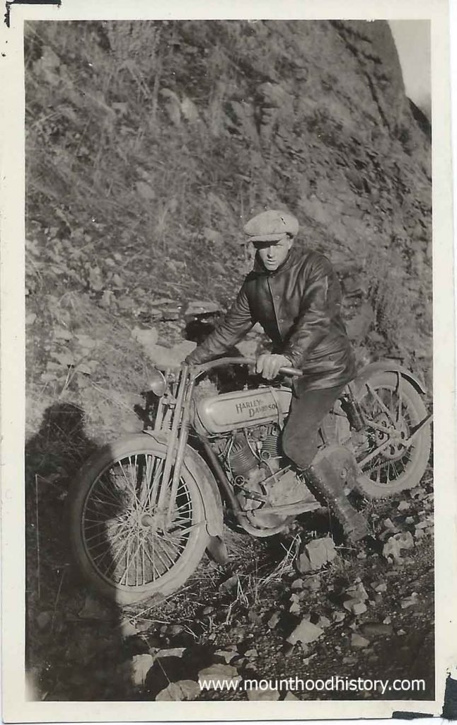
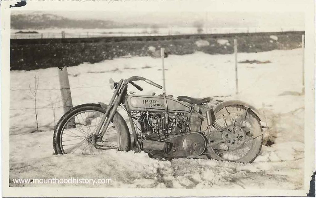
Here’s a series of photos from 1927, ten years after the opening of the Historic Highway, showing a young man and his Harley Davidson motorcycle. It must have been in the Winter as there seems to be snow and rock fall in the photos.
One of the photos clearly shows road signs with familiar destinations – Portland, Sandy, Bull Run, Gresham, Troutdale and the Columbia River Highway. The best part of the photo is the additional temporary sign that reads “Columbia River Highway Closed To Through Traffic” placed in on top of one of the road’s stone and concrete guard rails. The second one shows some stone rubble along a roadway which looks much like a winter day at unstable spots along the old road today.
It was 1915 and a lot was going on just east of Troutdale Oregon in the beautiful Columbia River Gorge. Planning was taking place for the construction of the now Historic Columbia River Highway.
The Columbia River Gorge back then had only limited ways of accessing it. Traditionally excursions from Portland on steam powered sternwheeler paddle boats were the way that most transportation took place. In time the railroads were built, primarily for trade but in time passenger trains started taking people there on day trips. Tourist excursions to the waterfalls on the south side of the river were common. Locations such as Multnomah Falls were the main attractions.
Of course many people rode horses or travelled in horse drawn wagons back then but with the advent of automobiles the old primitive roads were improved and new roads were made but they were still dirt wagon roads. Not long after the idea to create one of the first paved scenic automobile roads in America was imagined by several prominent Portland businessmen. Thus was created the Scenic Columbia River Highway.
Although a cultural treasure today, not all who lived in the area back then supported this idea. Many people still used horses and automobiles were owned by the wealthy. Many people back then never thought that they would ever own a car let alone use one to tour the Columbia River Gorge. Public support for financing the highway was tenuous at best.
As we all know, the highway was built and within a couple of decades was being used heavily for transporting cars from central Oregon to the Willamette Valley. Heavy trucks had been developed to carry commodities and products and most everyone had a car in their garage. It didn’t take long to see how those who imagined the highway were visionaries. The highway was quickly becoming overused and plans for a riverside highway, which would become Highway 84, was in the works.
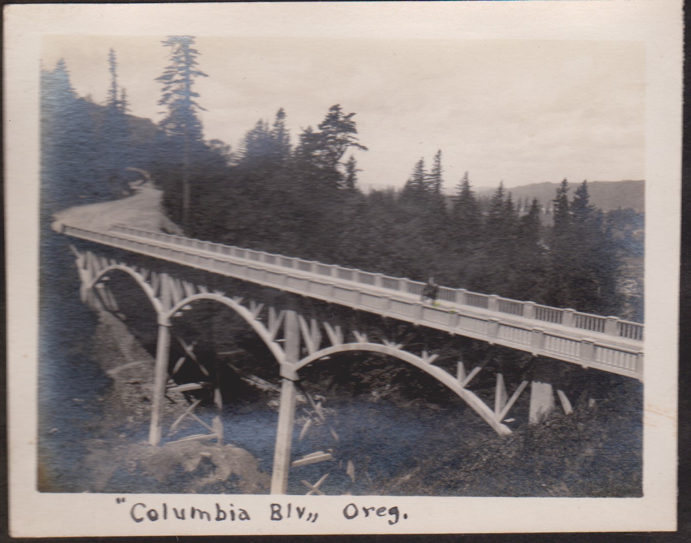
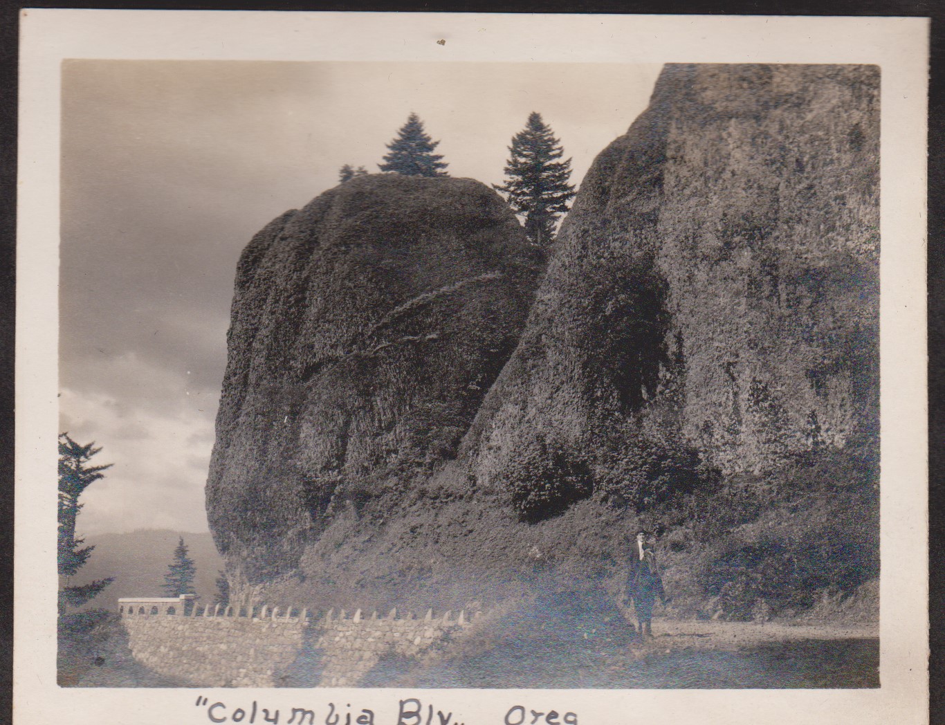
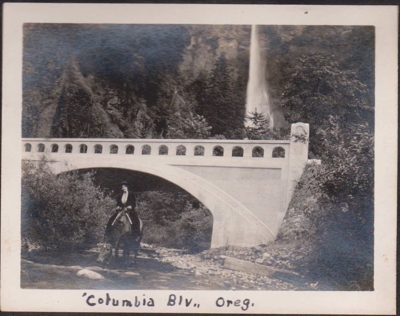
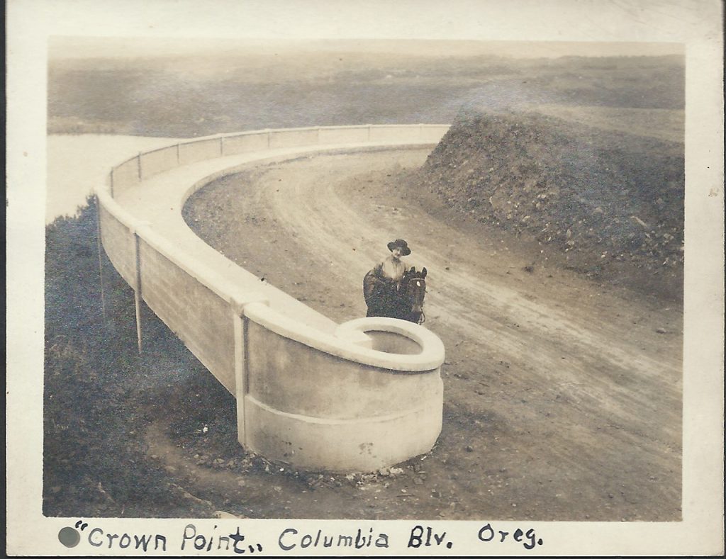
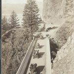
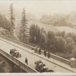
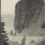
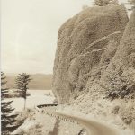
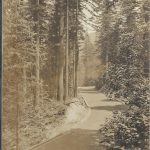
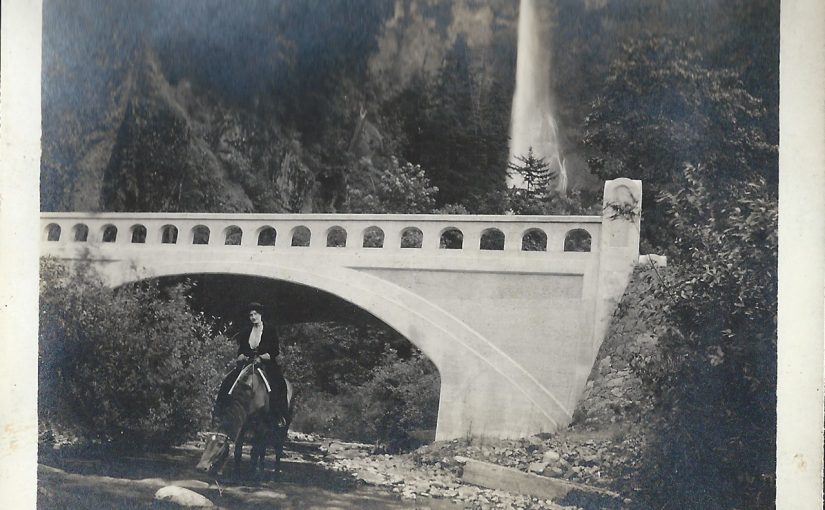
And so back in 1915 the Historic Columbia River Highway was in construction. It would be dedicated a couple years later in 1917, but that didn’t keep people from going out to explore the modern engineering marvel. Of course traffic was minimal back then. Today we can only imagine a peaceful horseback ride along it’s path to familiar waterfalls along the way, but that’s just what this couple did.
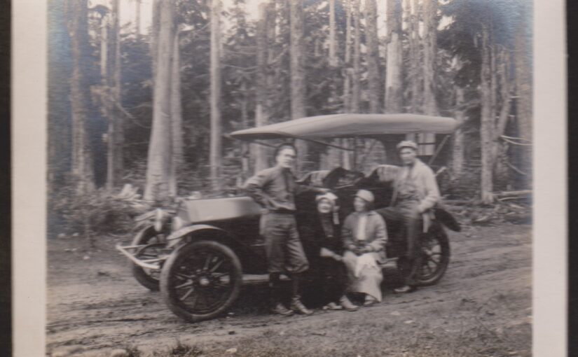
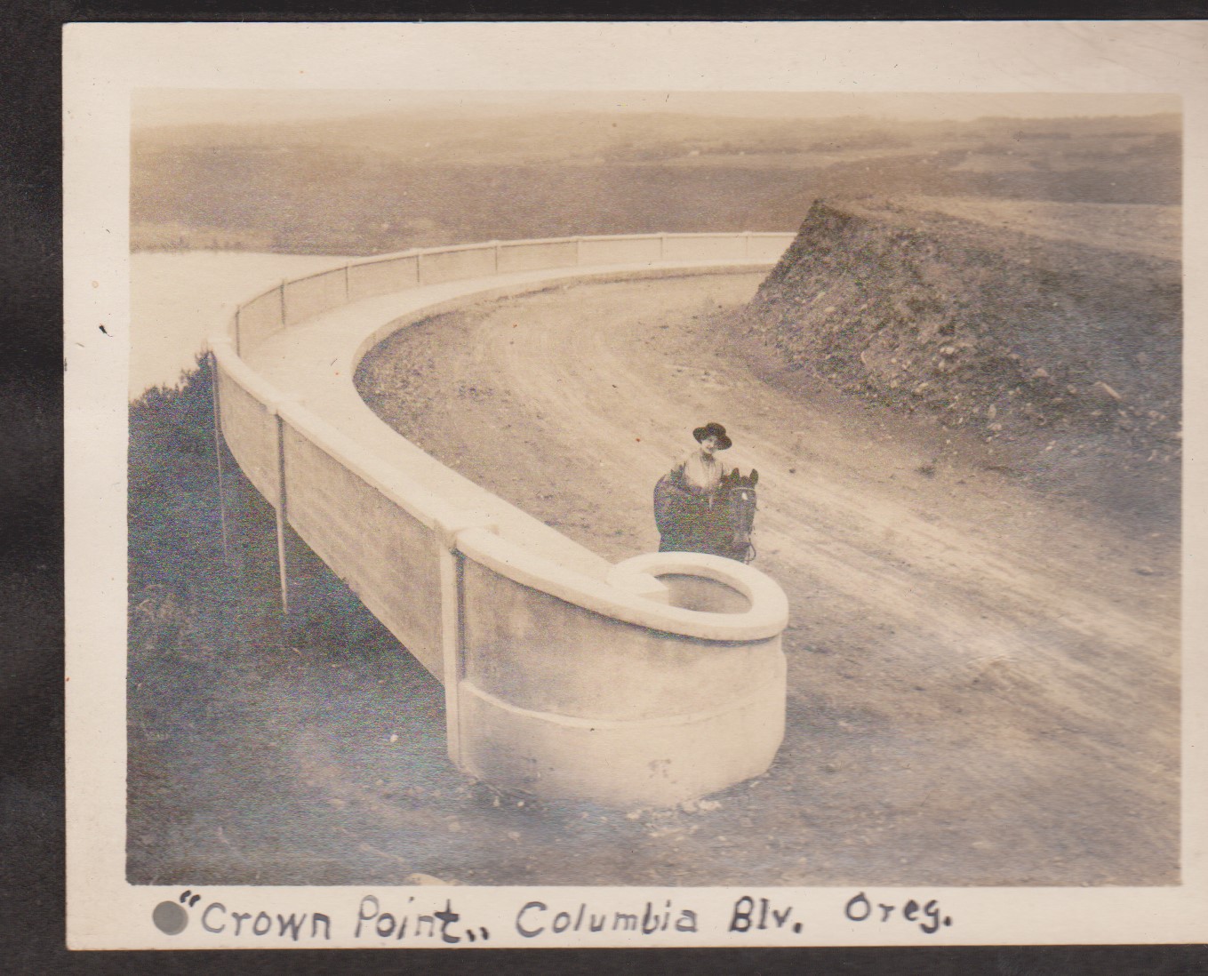
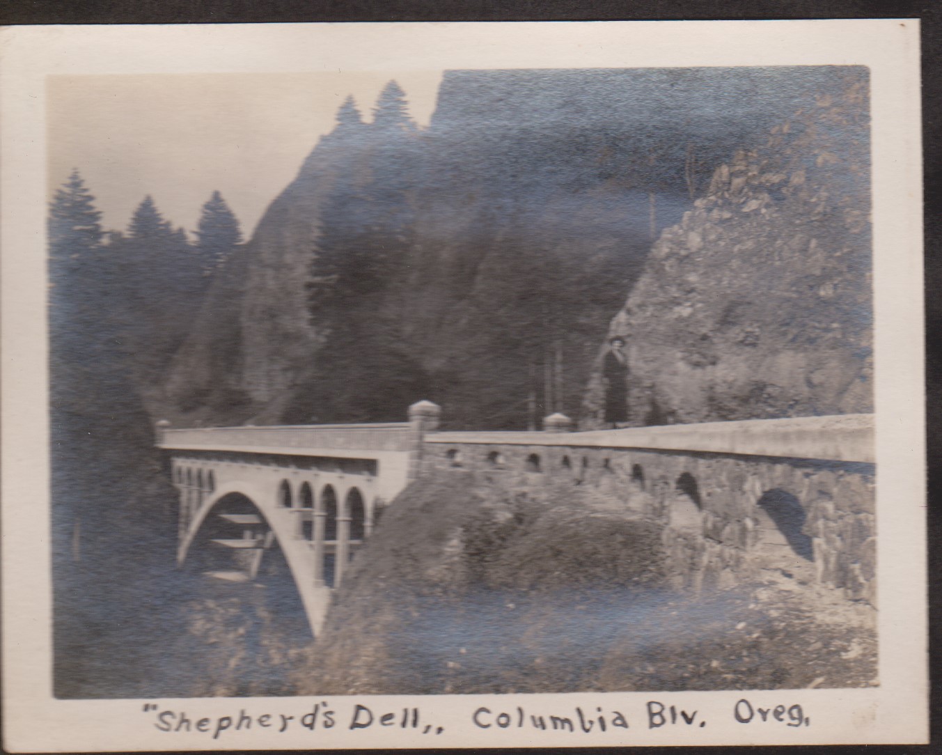
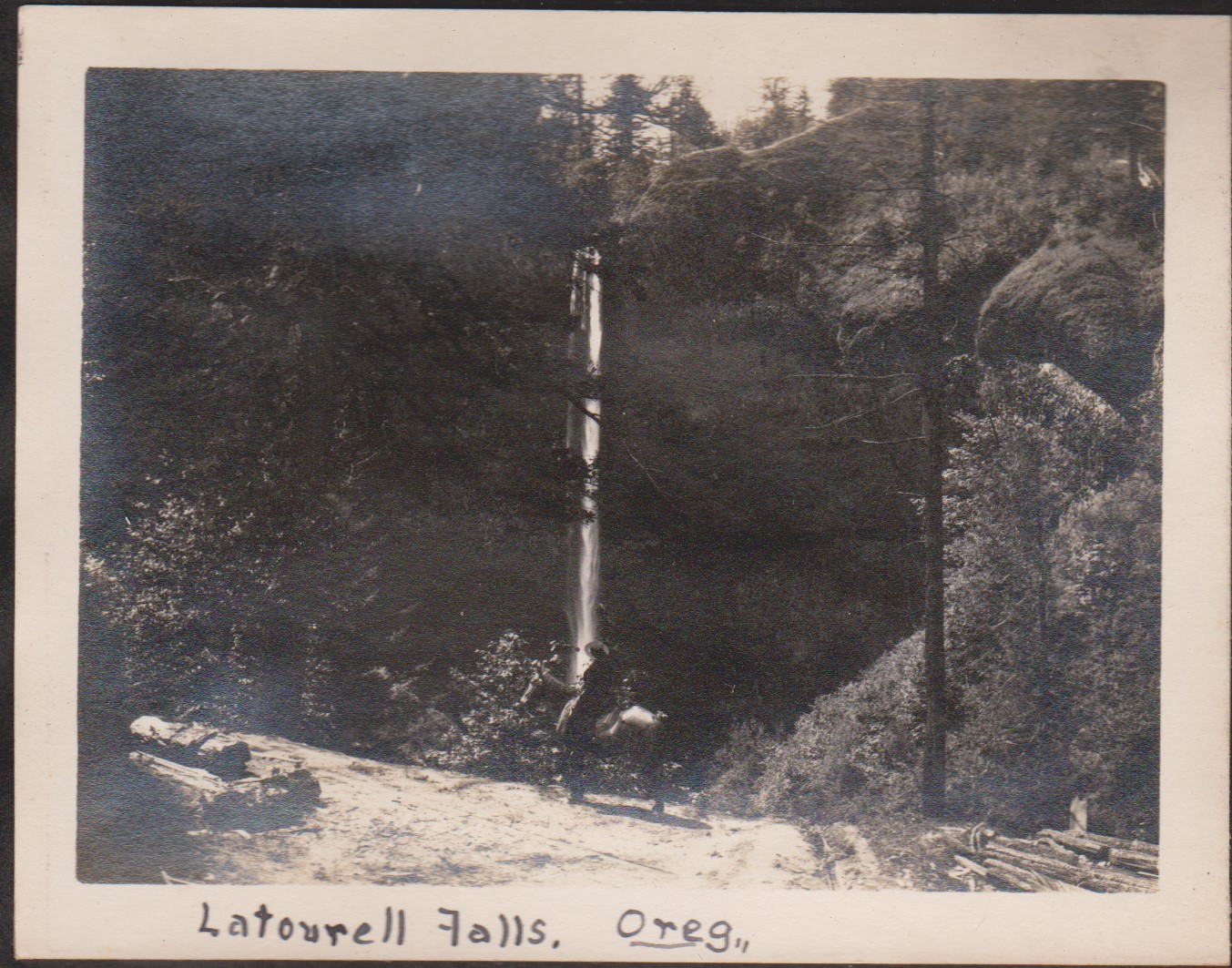
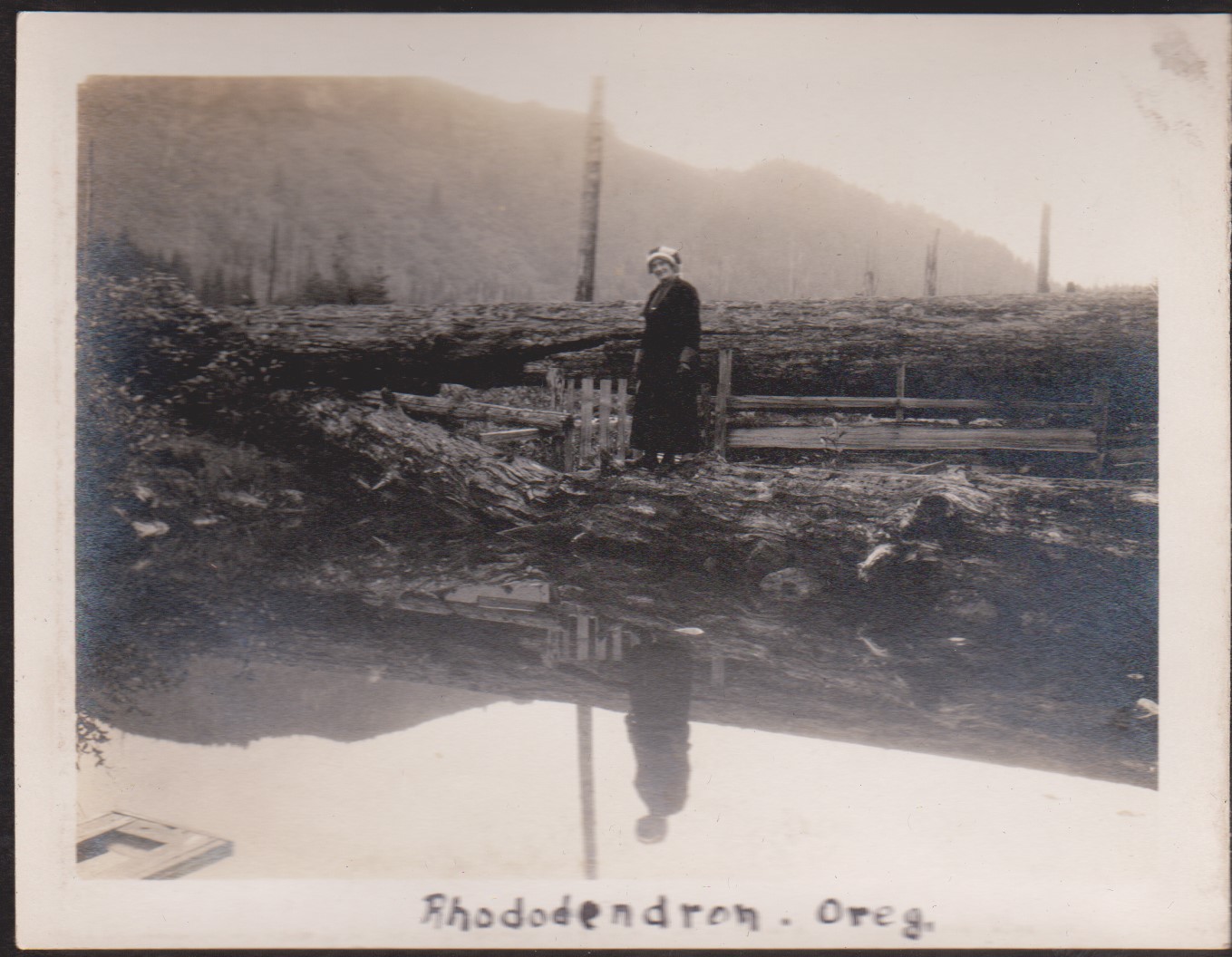
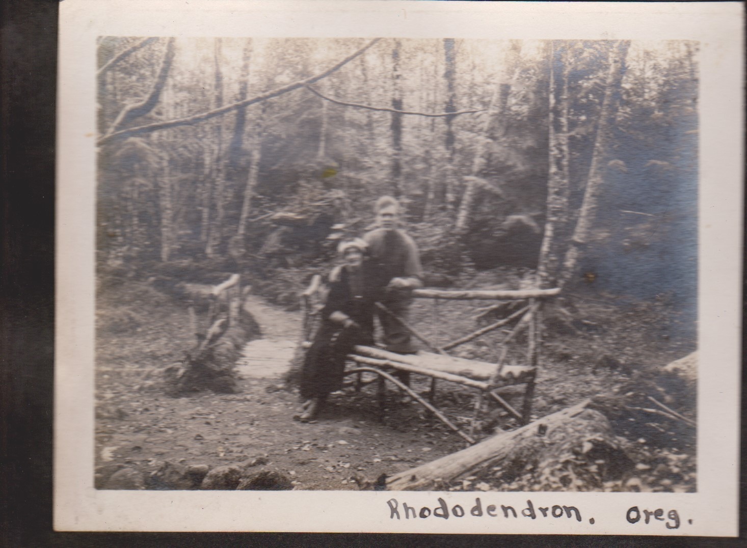
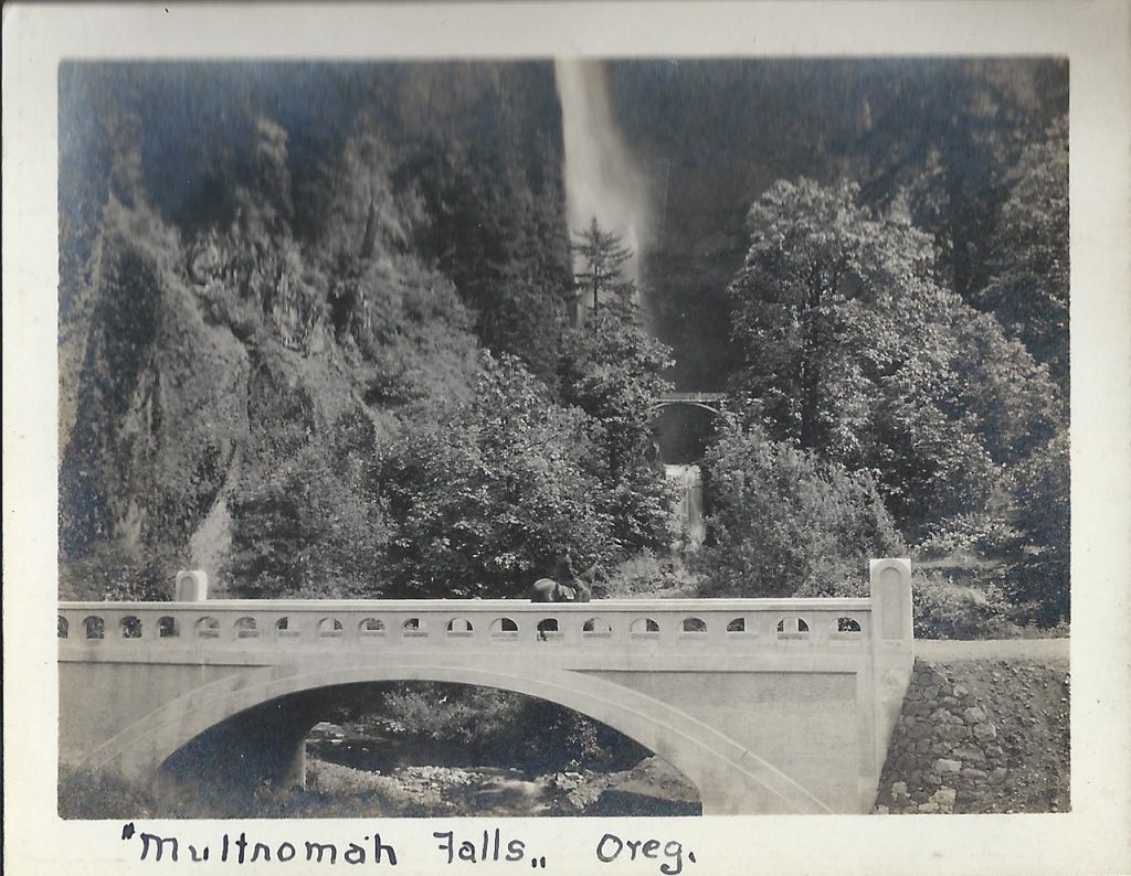
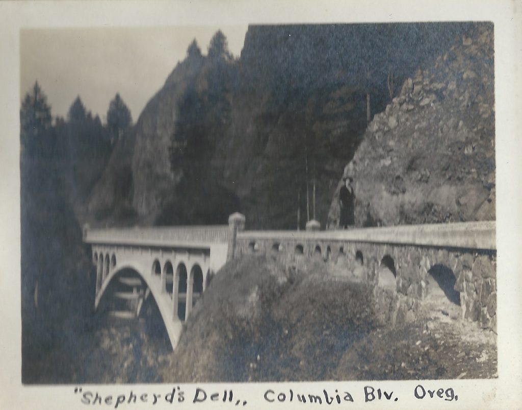
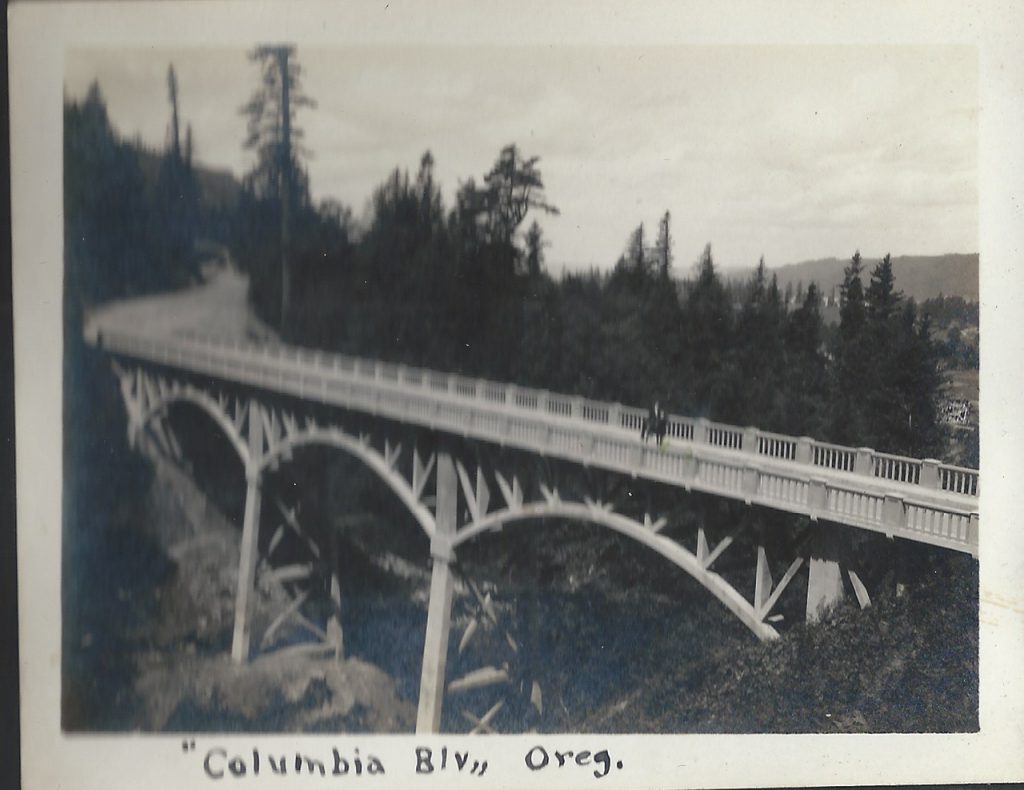
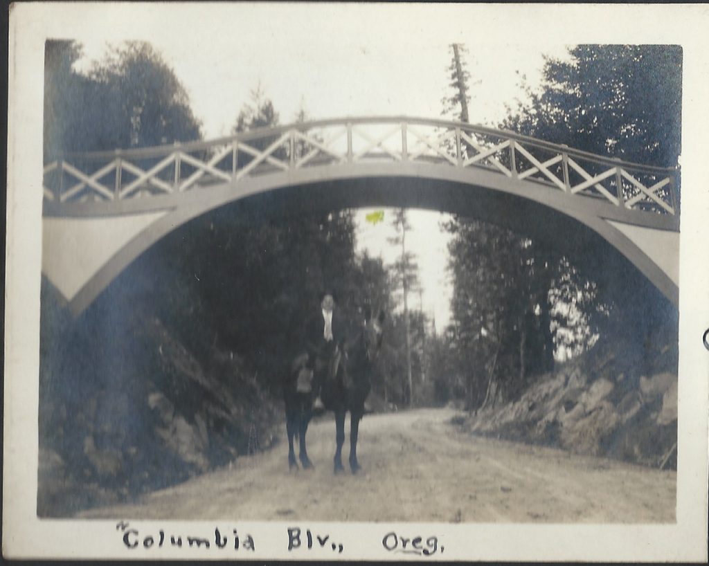
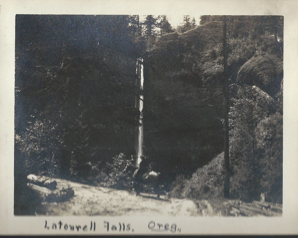
Harry and Alvida Calvert decided to take a trip out to survey the progress on the new highway via horseback. Harry Calvert was a photographer from Oregon City, Oregon.
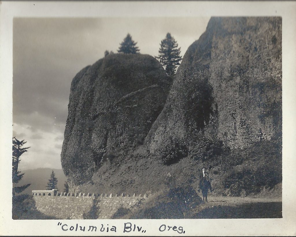
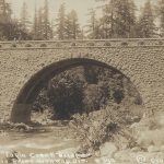
These photos are some of his personal photos. Snapshots into his and his wife Alvida’s life. In these photos you can see familiar places along the Historic Columbia River Highway such as Crown Point, Latourell including the falls and the old arched footbridge that was removed due to obstruction of trucks that needed to pass as well as the recently constructed highway bridge. Other locations include Bishops Cap and the Sheppards Dell Bridge, as well as Multnomah Falls. Alvida and Harry take turns posing in the photos with their horse Pat, including one where one of them made their way to the Simon Benson bridge between the upper and lower tier of Multnomah Falls.
Needless to say a horse ride on the old Historic Columbia River Highway is totally impractical today, but there once was a time. I’m certainly glad that Harry and Alvida took the time to document their day in the Scenic Columbia River Gorge.

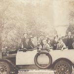
“Dear Flo – Just a postal of us on a Trip Up The Columbia River Highway, Portland, Ore. Love to all.”
Addressed to:
Miss Flo. McGuiness.
38 Gardner Avenue,
Jersey City,
New Jersey.
This is a unique set of postal cards that were made by the family using the photos that they made that day. It was quite common back in the early part of the 20th Century to have your photos printed on postcard stock. You could then send the cards off to friends and relatives across the country. In the group photo a camera is clearly seen in the left hand of the gentleman on the right. Most likely an early Kodak.
Although we don’t know how the folks in the photos area, I’m sure that their “Trip up The Columbia Highway” was very similar to a day on the Historic Columbia River Highway in today’s Columbia River Gorge.


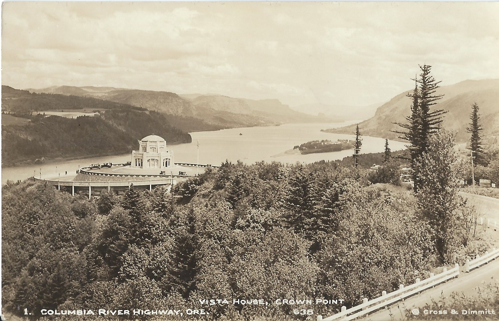
Cross and Dimmit Postcards of The Columbia River Gorge and Historic Columbia River Highway.
Cross and Dimit were two of the most successful photographers in Portland back in the first part of the 20th Century.
Arthur B. Cross opened his photography studio in Portland Oregon in 1909. Five years later Edward L. Dimmit began working at Cross’s at his studio and two years later became partners with Cross, naming it “Cross and Dimmit”.
The Historic Columbia River Highway was dedicated in 1917 and quickly became a huge tourist draw. All along the new road built through the pristine and deeply beautiful Columbia River Gorge, roadhouses, restaurants and gift shops sprung up to supply the needs of the tourist traffic.
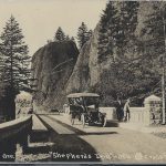
And around that very same time postcards became extremely popular due to the fact that one could buy a package of cards and forego lugging their own camera long, or to allow those without ne to have photos of the views, streams and waterfalls along the road. All of these factors came together to provide the new Cross and Dimmit venture with a steady stream of potential customers via the souvenirs shops as well as from the running boards of their Model T Ford. In time they had their own gift shop located at Crown Point near Vista House.
Cross and Dimmit created real photo postcards in large quantities and sold them individually as well as packs of a variety of scenes. Most everyone who toured the gorge back then bought some. Cross and Dimmit sold scenes from other areas, but the photos of the gorge are their most iconic photos. Today they’re some of the best photos of the Columbia River Gorge and the historic Columbia River Highway from that era, and because of the quantities that they made, are still easy to find.
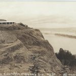
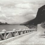
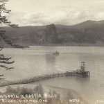
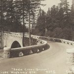
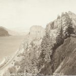
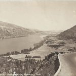
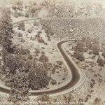
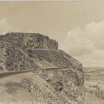
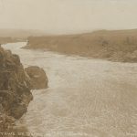
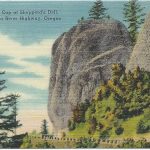
This is a series of their most common cards of the Columbia Gorge. They start from Chanticleer Point, today referred to as The Women’s Forum near the town of Corbett. They then go along the highway from Crown Point and Vista House to the Rowena Loops near The Dalles Oregon.
Arthur Cross died in 1940 and Dimmit lived until 1963.


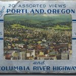
20 Assorted Views of Portland Oregon.
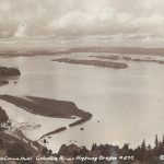
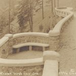
Here’s a great assortment of views of Portland Oregon and the Columbia River Gorge circa 1950. They’re printed using an offset printing process on canvas textured paper. Printed by the Angelus Commercial Studio in Portland, Oregon. The cards are the same as the postcards that the company printed but are half the size.
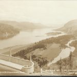
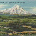
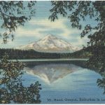
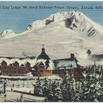
The set, labeled 20 Views of Portland Oregon and the Columbia River Gorge, takes one on a tour from Portland Oregon east through the Columbia River Gorge on the Historic Columbia River Highway to the Hood River Valley and then south on what is now Highway 35 to the south side of Mount Hood and the iconic historic Timberline Lodge.
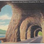
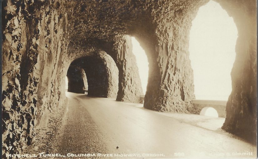
This very same tour can be taken today via modern cars and improved highways in a day; A very full and satisfying day. The only things that have changed since the era that these cards were made are that the Columbia River Highway, Historic Highway 30 has been replaced with the more modern Highway 84 through the gorge. Also the old Mitchell Point Tunnel was demolished in 1966 during construction of Hwy 84, but there are efforts through the restoration of the old highway to consider restoring the tunnel by boring a new tunnel through Mitchell Point.
All of these Views of Portland Oregon and the Columbia River Gorge are available for your enjoyment today, but these old photos bring back a more bucolic era in the Portland and the Mount Hood countryside. One where tourism was more slow and laid back. One where the trip was about the ride and not the destination. One that allowed us to stop along the way and send a postcard or two.


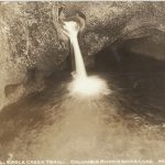
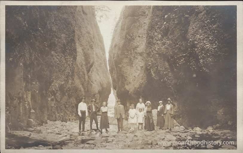
Here’s a happy group of hikers exploring Columbia River Gorge Gorge around 1910 becoming a part of the Oneonta Gorge History . This slot canyon within the Columbia River Gorge and on the scenic Historic Columbia River Highway has been a popular location to explore for a very long time. Today on a hot Summer day it can be elbow to elbow with people.
Today there’s a log pile to negotiate and a stretch of water that can be chest to chin deep to make your way into the little canyon, but there’s an amazing waterfall at the end as a reward for the trek.
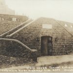
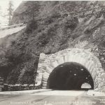
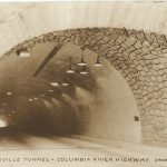
Here’s a rare view of Oneonta Bluff and the old railway bed prior to the construction of the Historic Columbia River Highway.
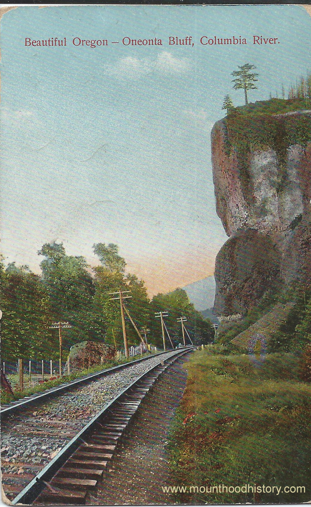
Once construction of the road took place the construction of the tunnel allowed automobile passage through the basalt promontory. In time increased traffic and larger cars and trucks necessitated the relocation of the railroad and the highway to allow the cars to bypass the tunnel altogether. The tunnel was filled in 1948.

Covered up and virtually forgotten, many people would stand on the old bridge that seemed to direct traffic directly into a solid rock wall.
In 2009, as a part of the restoration of the remaining segments of the old road, the tunnel was excavated and restored, including the wooden cribbing and rock facades.
Today the old tunnel is a pedestrian passage and witness to the old Columbia River’s history.


