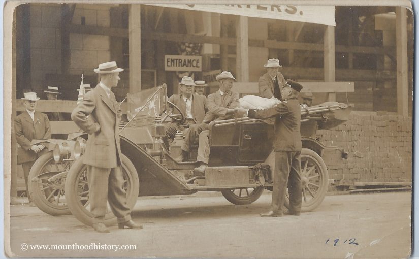
Continue reading The First West Coast Trip by Automobile – 1912
Tag: Oregon
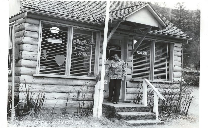
The Brightwood Post Office 1979
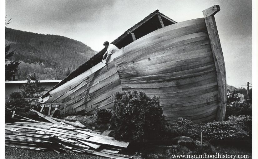
The Oregon Ark Motel
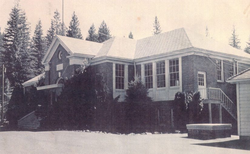
Welches School
Murder on Mount Hood
Murder on Mount Hood
When one thinks of Mount Hood they do not usually think of crime, especially such severe crimes as murder, but there is one story that is a part of Mount Hood’s past that should be told. The first murder on Mount Hood.
The Oregon Trail had been active for about 40 years, with the Barlow Road becoming the main route to the Willamette Valley. The Barlow Road was a toll road with toll gates placed on the route to gather toll from the travelers. One toll gate keeper will be remembered as an integral part of Mount Hood’s cultural history.
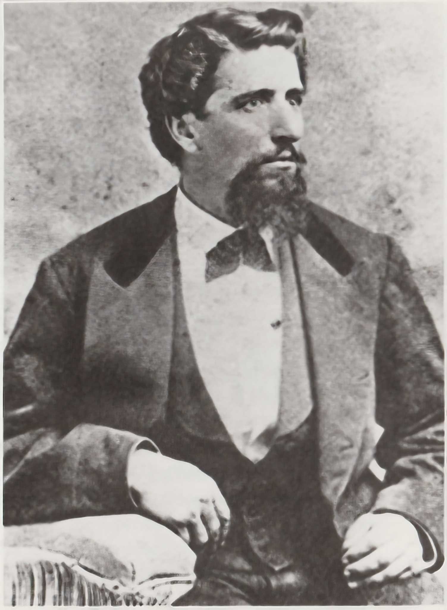
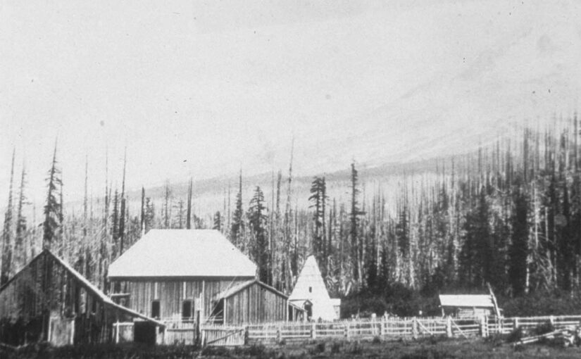
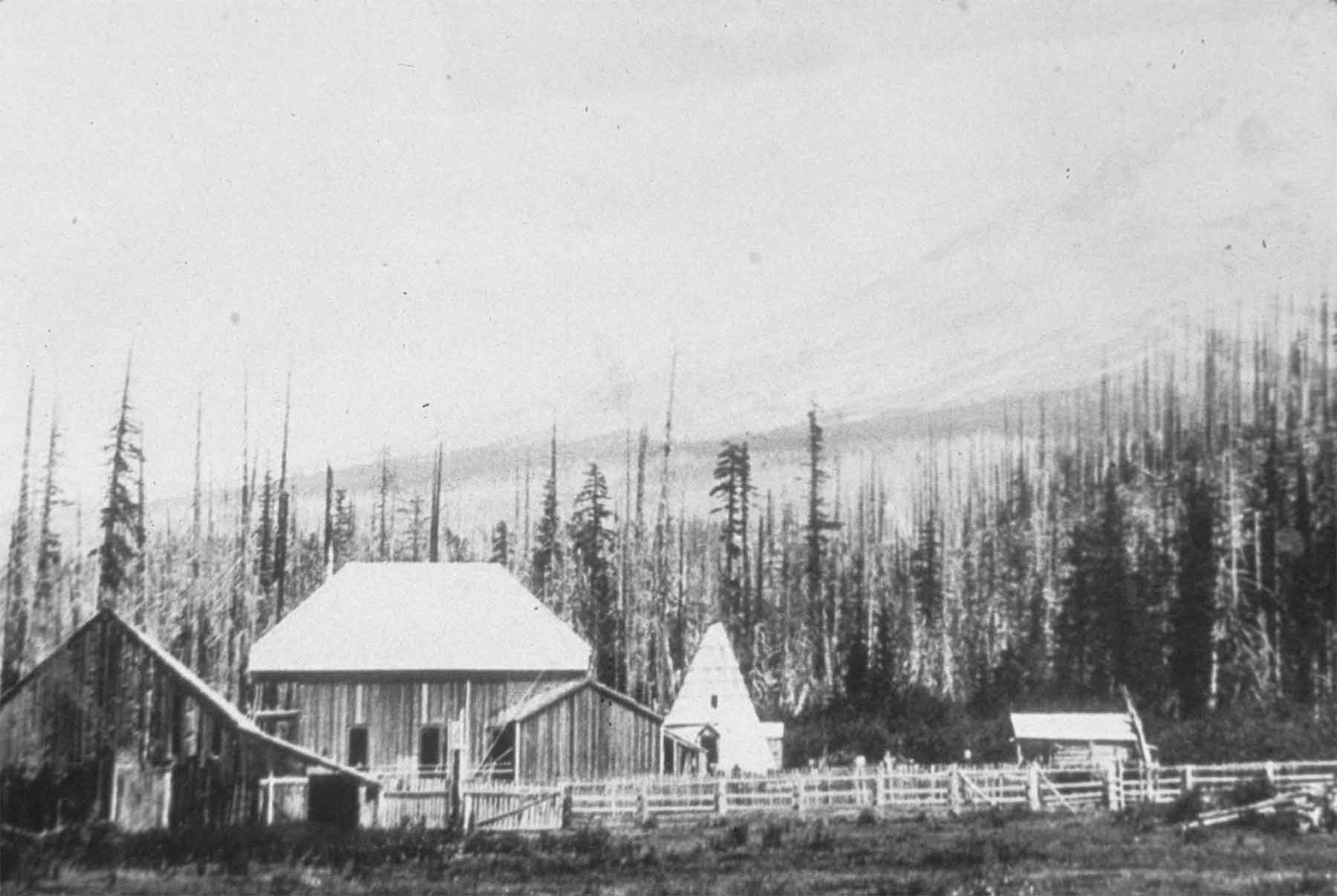
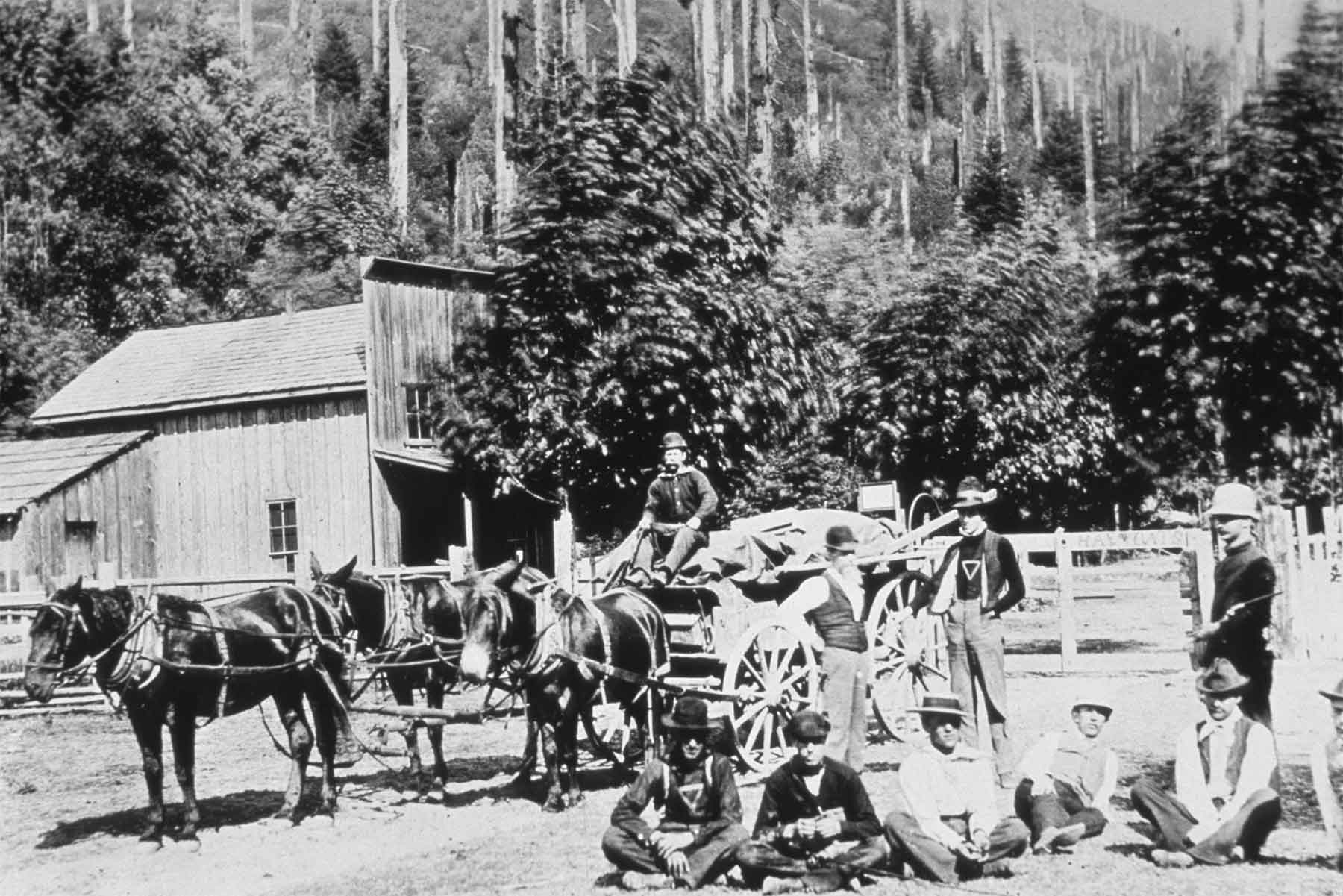
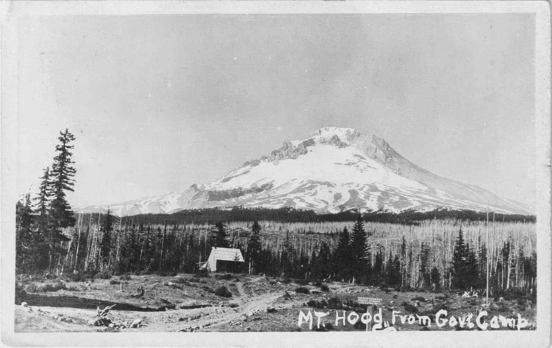
Perry Vickers was one of the first residents of the south side of Mount Hood, an area that today includes the little ski town of Government Camp. He was well liked by everyone in the area especially those who were passing over the south side of Mount Hood on the Barlow Road in their wagons. He had squatter’s rights at Summit Meadow, a natural clearing at the top of the pass as the road began to descend the west slope of Mount Hood and the last stretch before arriving at their destination in the Willamette Valley from points east. He built the first traveler’s accommodations in the area when he built the Summit House in Summit Meadow. He had a corralled field for grazing the stock as well as a series of buildings including a lodge, a store, and barns.
During his time on Mount Hood Portland grew exponentially with the new settlers that poured into the Oregon country. A trend was to return to the mountain that held so many challenges to them and their families during the immigration to recreate. Perry Vickers was Mount Hood’s first climbing guide. Hiking and climbing the peak was very popular at the end of the 19th and early 20th centuries. He was an enthusiastic promoter of early visitation and recreation on Mount Hood. He even created a tradition of illuminating the mountain by carrying fuel for a large fire near what is now known as Illumination Rock. He is attributed to being the first person to spend a night on the top of Mount Hood.

Perry Vickers was described as a dreamer and a poet. The Oregon Historical Society has some of his verses of sunrises and sunsets and of his beloved mountain. He did not start out his residence in Oregon on quite a solid footing. His early days here are said to have been troublesome. Perry Vickers arrived in Vancouver Washington in 1865. As he was looking for work, he fell into the company of three other young strangers in a seemingly similar situation. As it turned out their situation was different to his.
As he was in the company of his three new friends military officers from Fort Vancouver arrested the group and charged them with horse theft, quite a serious crime back then. They were held for about two months as they awaited trial, each wearing what was referred to as an “Oregon Boot,” a seven-pound iron clevis that was worn on an ankle to impede any progress of escape similar to a steel ball and chain.
As they were arrested together, held together in the same cell, and although unsure of the guilt of his cellmates, he was sure that he would be found guilty by association. He felt that he needed to escape. Their cell was made of wood and so in time the method was created for the breakout. Several 2″x4″ wooden window bars were removed, and the group escaped into the night. Once Vickers was away, he separated from his undesirable companions as he heard activity indicating that their escape had been discovered. Still weighed down by his Oregon Boot, he stumbled his way away from the fort toward the Columbia River. The sounds of those in pursuit became louder and he soon found himself about to be surrounded as he stood on the bank of the river.
His ankle was becoming chaffed and painful, and he tried for a moment to find a way to pry off the iron implement around his ankle. As the sounds of pursuit became louder, he knew that he had only one choice, to attempt to swim the mile wide and swift Columbia River. It is not sure how he learned to swim, but he indeed made it to the other side still carrying the weight of his seven-pound clevis attached to his ankle.
Once across the river he came across a small farm where he was able to find some tools to remove the iron device. He found an old wagon wheel wrench that he used as a hammer and a bolt to use as a punch to remove the pin that held it together. The next morning, he came across some wood cutters who fed him and gave him directions to Powell Valley where his brother lived. Once there his brother gave him clothes and supplies and advised him to head to Eastern Oregon by way of the Barlow Road and seek work until things cooled down for him.
As he headed east, he came across Stephen Coalman, the one who oversaw maintaining the old Barlow Road. He told Vickers that he would be hiring help to clear the road after the Winter storm’s damage. That June he went to work for Coalman and developed a lifelong friendship. Stephen Coalman and his son Elijah “Lige” Coalman became legendary on Mount Hood for their many adventures. Stephen Coalman had said that through time Vickers proved that his character was not one of a horse thief and was convinced that Vickers was a victim of circumstances.
That June the crew set up camp at Summit Meadow and Vickers took time to explore the area from there to the timberline level of Mount Hood. Thrilled by his hikes he swore that he would climb to the top of the mountain.
Vickers took the job of gatekeeper on the eastern entrance to the old road, away from the chance of being recognized as a fugitive. In time his friend Stephen Coalman persuaded him to return to the west side of Mount Hood, assuring him that if needed he would secure legal services to defend the horse stealing charges if necessary.
No charges were ever brought against Vickers, but on his trips to the west side he fell in love with the area, especially the area around the summit meadows right under the looming view of the south side of Mount Hood. He envisioned a business. One that would help travelers as they passed through. He filed for a squatter’s claim at Summit Meadow and went to work on the buildings there between his work on the old toll road.
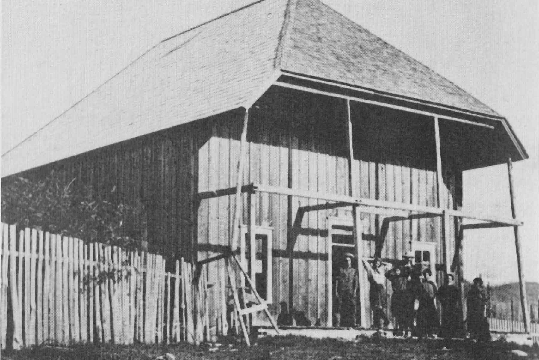
By 1866 work on the Summit House was underway. It was a large building, 20x20x32 feet with a huge fireplace at one end and sleeping quarters upstairs and spacious cooking arrangements. He built all the furniture from natural materials. In the Spring of 1868, he opened the Summit House as soon as the snow melted, and the road was cleared. He provided food for travelers as well as their livestock, spaces for camping and in many cases insisting in having folks in for a meal.
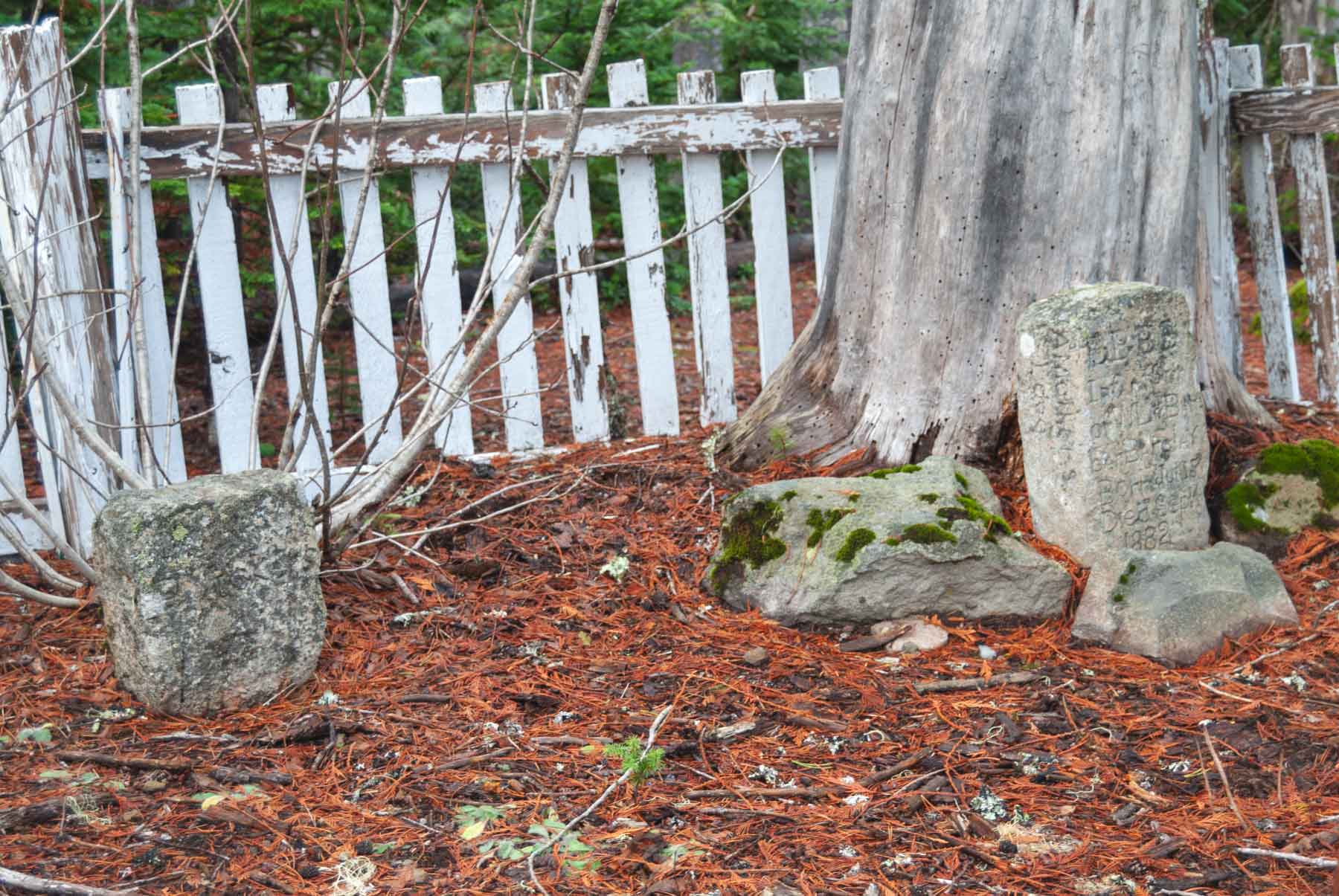
An enduring story is told of a day when a group of wagons came to Summit Meadow in 1882. A baby boy from one of the parties, the Barclay family, was ill and died at the meadow. Vickers granted permission for the baby to be buried at the meadow. The little graveyard and headstone are still there today.
For many years Vickers resided at Summit Meadows and helped countless travelers that passed by and hundreds of people to the top of the mountain, until one day in August of 1893 when a man named Steele, a farm hand near the Columbia Slough, stole his employer’s shotgun and headed east. Few more details are known, but the Multnomah County Sheriff was called, and two men were deputized, one being the owner of the stolen gun a man named Roarke and sent after Steele.
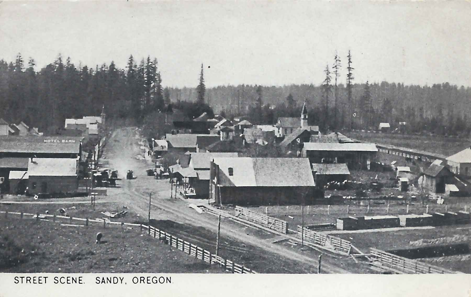
The deputies reached Eagle Creek and had to have their Multnomah County warrant re-issued in Clackamas County, where they learned that Steele had traded the shotgun for a Sharps rifle. They reached the town of Sandy where the weather turned bad. They stayed only long enough to buy a bottle of whiskey and then they went on their way. The two men reached the town of Salmon, near the present town of Brightwood where they met local resident John McIntyre who owned a trading post there. It was then that one of the deputies decided to return home as he became ill. At that time John McIntyre was deputized and the two men proceeded to travel east toward Summit Meadow.

Once the men reached Summit Meadow and Perry Vickers’ Summit House, Vickers advised them that Steele had stayed there the night before and he had judged him to be an unsavory character and said that he knew nothing of the gun theft. He also told them that he had mentioned that he was going to camp at White River, further to the north and east from where they were. Because the deputies had drank some of their whiskey Vickers told them that he would advise them to get some sleep and to proceed in the daytime. He also thought that they would be at a disadvantage in the dark. Roarke insisted that they push on into the night. Vickers told them that they would eat and then he would go with them after Steele.
With Vickers deputized the men mounted their horses and, because of his familiarity of the area, Vickers took the lead. The group made it to the White River Trading Post which was operated by a man named Gray and his family. It was there beyond the buildings that the men spotted a campfire. They figured that it was Steele. Being concerned for the condition of his companions, and because he was equipped with a set of Colt Revolvers, Vickers volunteered to proceed toward the fire while the other two stood back to provide back up in case of trouble.
Vickers rode toward the campfire that would make the two horsemen barely visible in the background and confirmed that it was indeed Steele. Steele was aroused as Vickers approached and appeared to come forward to talk. Vickers went to dismount his horse and as he was in a helpless position Steele picked up the Sharps rifle and shot Vickers in the stomach. As he fell from the horse, he grabbed one of his revolvers but did not get off a shot before Steele disappeared into the darkness of the night. Vickers emptied his revolvers into the night, thought that he hit Steele, but this was never proven.
Cornelius Gray heard the gunshots from his trading post, grabbed his rifle and came running. Two other men who were at the trading post as well as the two deputies got to Vickers who was on the ground in agonizing pain and mortally wounded. They took Vickers inside Gray’s home.
Vickers claimed that he saw his companions come toward him, but not until after they drew away during the gunshots. The men claimed that their horses bolted from the shots. As he lay there, he confronted the two men, say that they were too experienced with guns and horses to believe them and that he claimed them to be cowards, this account being from Cornelius Gray.
A rider was sent to get Stephen Coalman, Vickers’ best friend, but Vickers knew that he did not have much time. Vickers said that he had some laudanum at his place and that he had killed the pain in a lot of other people, and he said that no one will be able to help him much. Vickers died before his friend could return.
Many of the locals from the era helped with his burial. Samuel Welch and Stephen Mitchell split the boards for his coffin. Oliver Yocum, the man who established the town of Government Camp officiated the ceremony. Perry Vickers was laid to rest in the little graveyard next to the baby Barclay, as were his last wishes. Their headstones can still be seen today at the west side of the meadow.
Stephen Coalman kept Vickers blood-stained coveralls for years after with the hope that they may be used as evidence to convict Steele of Vickers’ murder. A couple of years later a horse thief was hanged in eastern Oregon that claimed that he had killed a man in the Cascade Mountains. It was assumed that this was Steele. Not long after that Stephen Coalman burned Vickers coveralls, closing a chapter of an era on Mount Hood, and the case of Mount Hood’s first murder.
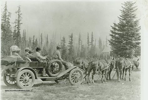
Four Horsepower
Four Horsepower.
An early automobile pulls in to Government Camp, Oregon under auxiliary power.

Protest at Timberline Lodge

Remembering Joie Smith – Mount Hood Legend
James Harlow’s Mount Hood Climb 1931
The Town of Faubion
Much has been written about how our local village of Welches got its name, but Welches isn’t the only town that is identified by the family that established it.
Just east of Welches and just past the historic Zigzag Ranger Station you will find Faubion Loop Road. Although a sleepy little residential area now, it once was the settlement of the William J. Faubion family.
 William Faubion moved his family to the area in 1907 from the Lents District of Portland. He and his wife Anna settled along the old Barlow Road, which was soon to become the Mount Hood Loop Highway. Just past Zigzag and at the base of Hunchback Mountain they built a home, which they later converted into a roadhouse, similar to our modern day bed and breakfasts. They named it “La Casa Monte”, Spanish for “The Mountain House”.
William harvested the huge old cedar on his land, cut shake bolts and hunted to support his family. Several large stumps with springboard notches can still be seen from Highway 26 as you pass by the area. La Casa Monte was completely built from standard dimension hand split cedar boards, with no milled lumber. It was two story with cedar shingle siding, gabled roof and wide eaves. The recessed front porch had arched openings, the center one was reached by a short set of stairs leading to the front door. The interior was rustic with handmade furniture and many animals mounted and displayed, indicating Mr. Faubion’s hunting prowess and the abundance of game in the area. Mrs. Faubion was known for her cooking, particularly her huckleberry pies, making La Casa Monte an ideal destination.
 In time, the addition of a store with a post office made Faubion a spot on the map. The post office was established in 1924, and was discontinued in 1932. The store and post office was operated by one of William and Anna’s daughters and son in law, Aneita (Faubion) and Thomas Brown. Many of the early motor car tourists travelling along the old Mount Hood road made La Casa Monte their first stop on their way to adventure on Mount Hood.
The Faubion’s had seven children, three boys and four girls. The oldest, a girl born in Gladstone, Oregon in 1890, was named Wilhelmina Jane (Jennie) Faubion. At twenty years old, Jennie married William “Billy” Welch, the son of Barlow Trail pioneers, and homesteaders of the area that would later become the village of Welches, Oregon. Jennie lived in Welches until she died in 1985 at 95 years old. Most of the other Faubion children lived in the area, and were well known and an important part of the history of the Mount Hood area.
Today, the Faubion Area is bypassed by the modern Mount Hood Highway 26, and is known now as Faubion Loop Road. La Casa Monte is gone, the store is still there, but is a private residence now. The residents that live there still know the history of their neighborhood, and identify themselves as living “At Faubion”.