Multnomah Falls History – The Bridge Over the Falls

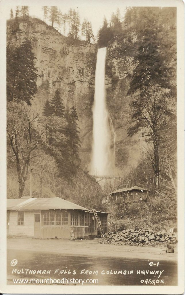
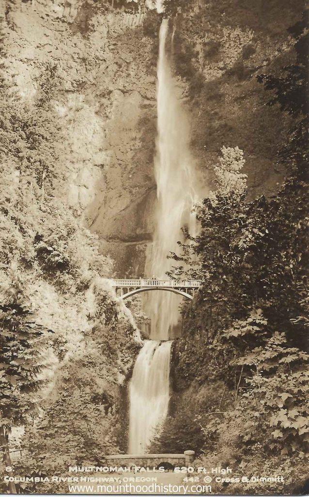
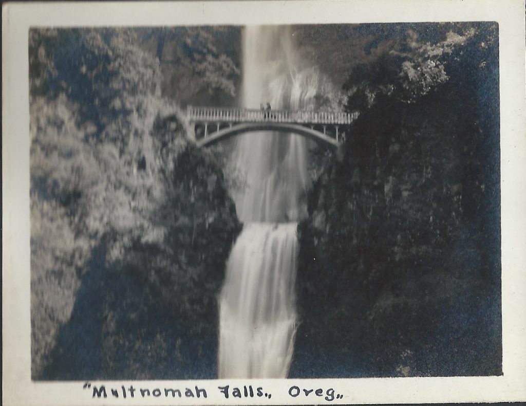
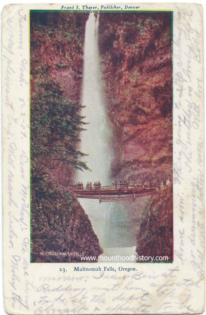
Multnomah Falls History – The Bridge Over the Falls – Multnomah Falls is a two tiered waterfall located in the scenic Columbia River Gorge just east of the city of Portland. It was formed about 15,000 years ago as a result of the cataclysmic Missoula Floods, a series of massive floods that scoured out the Columbia River Gorge. It has a total height of 620 feet, with the upper falls being 542 feet and the lower segment being 69 feet. It’s the tallest waterfall in Oregon and the second tallest year-round waterfall in the United States, fourth largest if seasonal falls are included.

Multnomah Falls was named according to a legend of the local native Multnomah people that tells the story of how a beautiful maiden sacrificed herself to save the tribe from a plague by throwing herself from the top of a cliff. The tribe was saved and a creek formed at the top of the cliff creating Multnomah Falls.

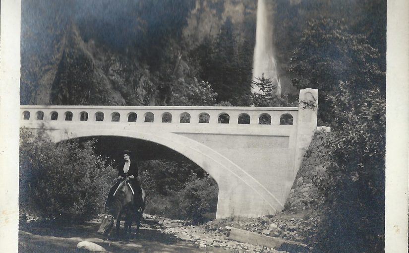
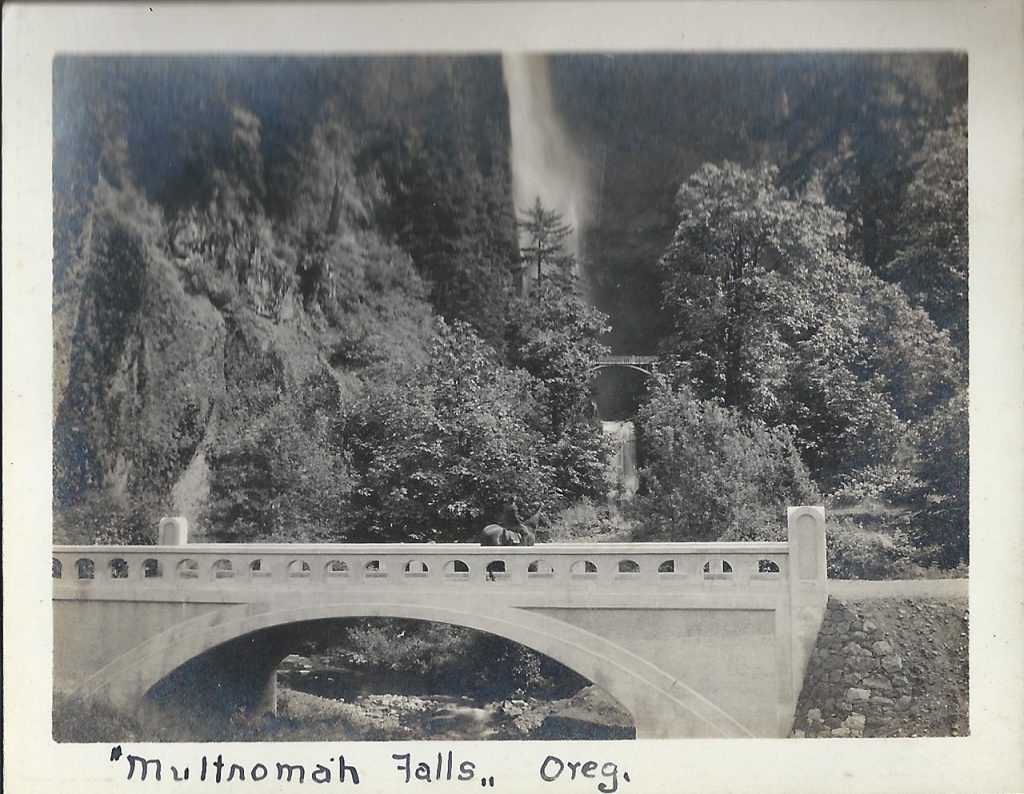
From 1884 until World War II the ORNCo Oregon Railroad and Navigation Company operated a train stop at Multnomah Falls. It was around this time that the “bow string truss” bridge across Multnomah Creek, at the same location as the present Benson Bridge, was built. Somewhere around 1891 the bridge was reinforced but by 1899 the bridge was gone, most likely decayed and washed into the creek.

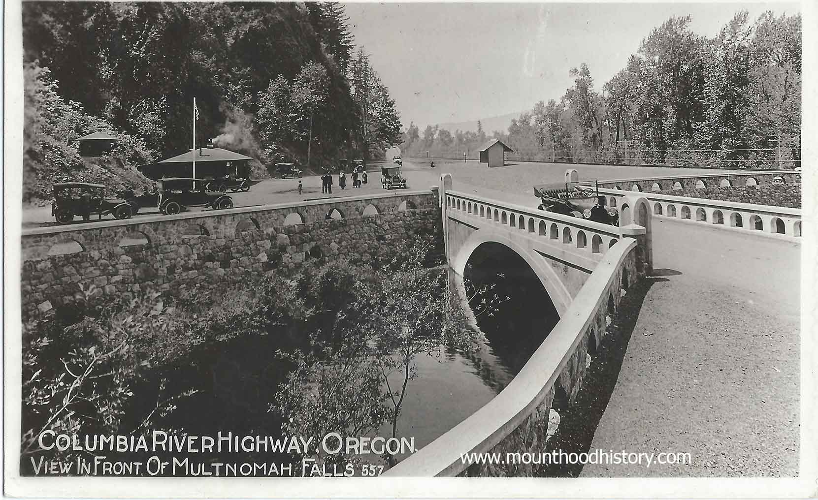
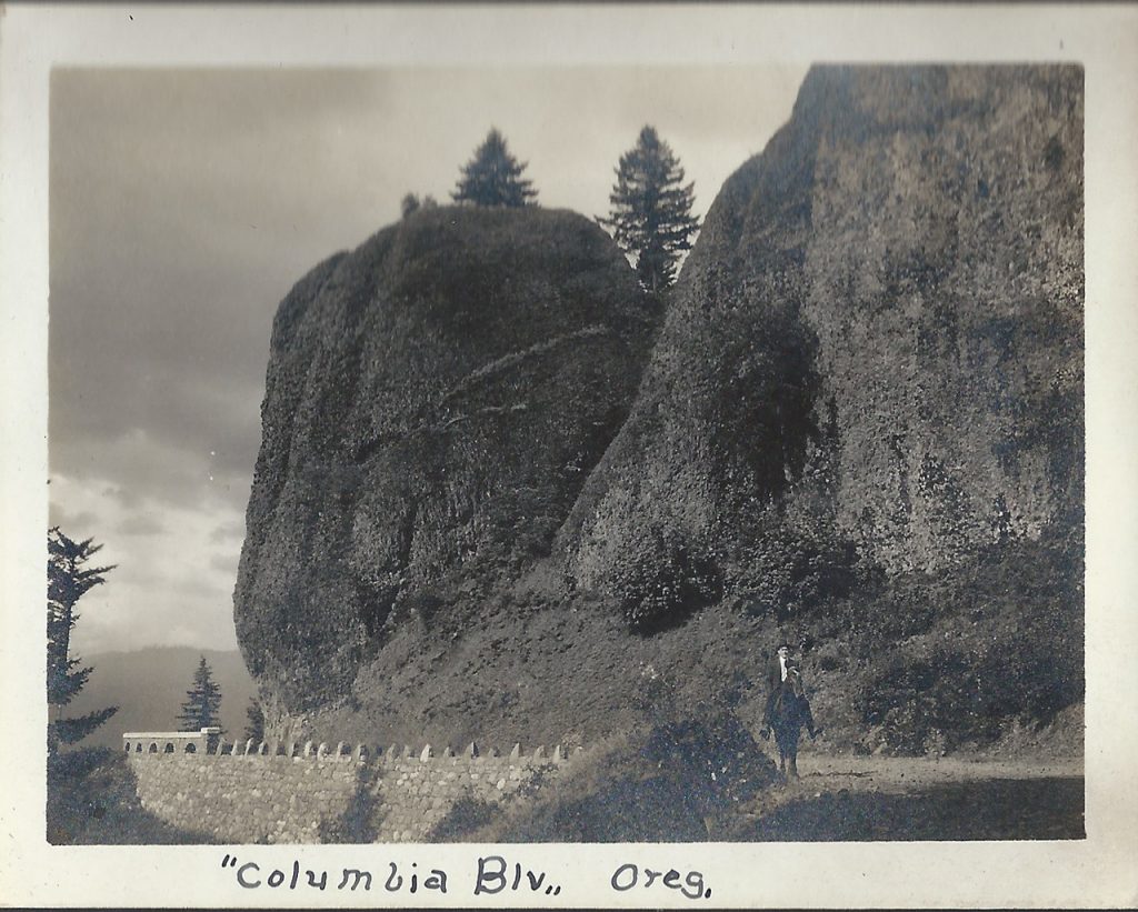
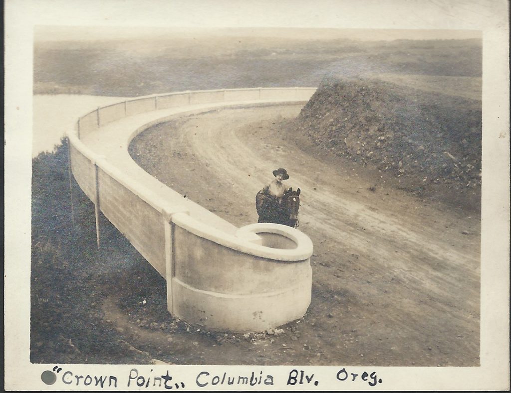
In 1915 a lot was happening in the gorge. Tourism was increasing on the steam powered sternwheelers and train excursions but would soon be replaced by automobile traffic on the soon to be completed, and now historic, Columbia River Highway. With this tourism comes the need for hiking trails. Many of the established trails were being improved and new ones were being made. One in particular was recommended by Samuel Lancaster to the Progressive Business Men’s Club of Portland to build a trail from the base of Multnomah Falls to the top of Larch Mountain to the south and the source of Multnomah Creek.

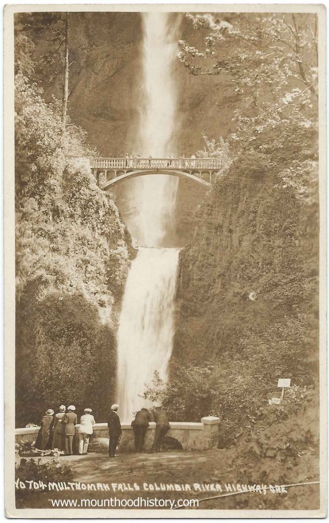
The club raised money and with donations from Portland businessman Simon Benson and his son Amos worked with the US Forest Service to establish the trail and a fire lookout on Larch Mountain. Simon Benson then hired Italian stonemasons to construct a bridge to allow access to the trail for visitors to the falls. The bridge is named Simon Benson Bridge in his honor.

That same year Benson donated 1,400 acres of land, including the land where Multnomah Falls is located to the city of Portland. Subsequently the ORNCo donated the land at the base of the falls, where their train station was located, to the city in agreement that a lodge would be built there the same year.  The stone Multnomah Falls Lodge’s construction was commissioned that year and the lodge was completed in 1925.

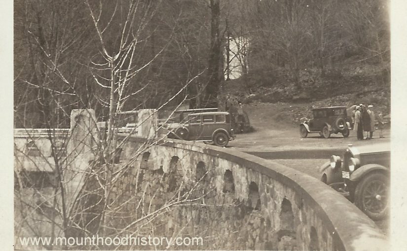
The historic Columbia River Highway was completed and dedicated in 1917 allowing Portlanders to easily take a bus or drive an automobile through the gorge while stopping at it’s amazing waterfalls, especially Multnomah Falls. The Benson Bridge is still used today and provides breathtaking views of the falls up close and personal. It has become a part of Multnomah Fall’s history.

The Legend of Multnomah Falls – Native American Antiquity
31 Jan 2013 Multnomah Falls is located on the Oregon side of the Columbia River … I AM mixed Native and Rainbow Child and have heard this story many …

Horseback Riding on The Historic Columbia River Highway

A Day on Historic Columbia River Highway when it was new.

It was 1915 and a lot was going on just east of Troutdale Oregon in the beautiful Columbia River Gorge. Planning was taking place for the construction of the now Historic Columbia River Highway.

The Columbia River Gorge back then had only limited ways of accessing it. Traditionally excursions from Portland on steam powered sternwheeler paddle boats were the way that most transportation took place. In time the railroads were built, primarily for trade but in time passenger trains started taking people there on day trips. Tourist excursions to the waterfalls on the south side of the river were common. Locations such as Multnomah Falls were the main attractions.

Of course many people rode horses or travelled in horse drawn wagons back then but with the advent of automobiles the old primitive roads were improved and new roads were made but they were still dirt wagon roads. Not long after the idea to create one of the first paved scenic automobile roads in America was imagined by several prominent Portland businessmen. Thus was created the Scenic Columbia River Highway.

Although a cultural treasure today, not all who lived in the area back then supported this idea. Many people still used horses and automobiles were owned by the wealthy. Many people back then never thought that they would ever own a car let alone use one to tour the Columbia River Gorge. Public support for financing the highway was tenuous at best.

As we all know, the highway was built and within a couple of decades was being used heavily for transporting cars from central Oregon to the Willamette Valley. Heavy trucks had been developed to carry commodities and products and most everyone had a car in their garage. It didn’t take long to see how those who imagined the highway were visionaries. The highway was quickly becoming overused and plans for a riverside highway, which would become Highway 84, was in the works.

And so back in 1915 the Historic Columbia River Highway was in construction. It would be dedicated a couple years later in 1917, but that didn’t keep people from going out to explore the modern engineering marvel. Of course traffic was minimal back then. Today we can only imagine a peaceful horseback ride along it’s path to familiar waterfalls along the way, but that’s just what this couple did.

Harry and Alvida Calvert decided to take a trip out to survey the progress on the new highway via horseback. Harry Calvert was a photographer from Oregon City, Oregon. 

These photos are some of his personal photos. Snapshots into his and his wife Alvida’s life. In these photos you can see familiar places along the Historic Columbia River Highway such as Crown Point, Latourell including the falls and the old arched footbridge that was removed due to obstruction of trucks that needed to pass as well as the recently constructed highway bridge. Other locations include Bishops Cap and the Sheppards Dell Bridge, as well as Multnomah Falls. Alvida and Harry take turns posing in the photos with their horse Pat, including one where one of them made their way to the Simon Benson bridge between the upper and lower tier of Multnomah Falls.

Needless to say a horse ride on the old Historic Columbia River Highway is totally impractical today, but there once was a time. I’m certainly glad that Harry and Alvida took the time to document their day in the Scenic Columbia River Gorge.

Historic Columbia River Highway | Columbia River Map
Sep 21, 2011 About 14000 years ago, cataclysmic floods scoured out the Columbia River Gorge. Early visionaries engineered an inspired drive along its …