In many ways the Mt Hood Ski Patrol is an inspiration for a pattern set and accepted worldwide when it comes to skiing safety and rescue organizations and practices.
The Mt Hood Ski Patrol traces its roots back to 1937, the year that Timberline Lodge was completed. At the times there were ski clubs and climbing clubs on Mount Hood that were formed more for camaraderie than for the expressed purpose of safety and rescue. This was to change with increased access and use of Mount Hood’s slopes.
Prior to the construction of Timberline Lodge and its access road, skiers and climbers hiked from Government Camp to small warming huts, or cabins, built in the same general area that Timberline Lodge sits today. The two primary organizations at the time that maintained cabins were The Wy’east Climbers and the Nile River Yacht Club, a ski club that had nothing to do with The Nile River or any yacht that plied its waters.
After recognizing the need for a safety patrol, Wy’East president Everett Darr and Nile River captain Barney McNabb approached the Forest Service with a plan to create a safety patrol on Mount Hood. A.O. Waha, Mt Hood National Forest Supervisor at the time told them that there was no money for such a patrol and furthermore, only one person within the service knew how ski. To which Darr and McNabb told him that Wy’Easter Henry “Hank” Lewis would be perfect for the job. Hank had already performed rescues on the slopes informally and because he worked evenings in Portland at a gas station would be available on weekends; Hank was usually on Mount Hood weekends anyhow.
Waha determined that it would be feasible to have Hank work weekends on the slopes and allotted a wage of $10 per weekend. At that point Hank took the job and proceeded to create his own rescue gear, including an old rolled front wooden toboggan. Through Hanks work and recruitment of others involvement, the Mt Hood Ski Patrol was formed. In March of 1938 a committee was formed and the Mt Hood Ski Patrol became a formal organization.
It is said the original organizers of the National Ski Patrol, Charles Minot “Minnie” Dole and Roger F. Langley came to Mount Hood to learn what the Mt Hood Ski Patrol was doing, and subsequently incorporated many of the established practices in the organization of The National Ski Patrol.
During WW-II many of the patrollers went off to war, and created a legacy within the 10th Mountain Division. After the war the Oregon boys came back to Mount Hood. The post World War Two era brought a renewed surge in skiing activities on Mount Hood, and a renewed purpose for the Mt Hood Ski Patrol. The ski patrol grew and became more organized.
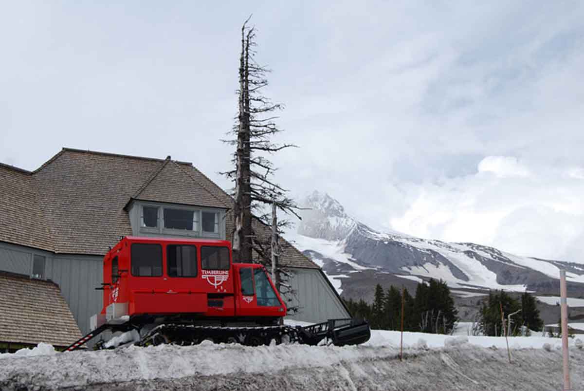
Today, the Mt Hood Ski Patrol is an integral part of the skiing activity on Mount Hood, adhering closely to their purpose as stated in their Mission Statement. “The Mt. Hood Ski Patrol is a member-driven organization dedicated to rescue, emergency care and public safety for the Mt. Hood recreational community”. They serve skiers and snowboarders at Timberline Lodge, Mt Hood Ski Bowl, Summit Ski Area and Mt Hood Meadows.
When you see a patroller on Mount Hood, in their easily recognizable red jackets, give them a tip of the hat and thanks for their dedication and public service.
Much has been written about how our local village of Welches got its name, but Welches isn’t the only town that is identified by the family that established it.
Just east of Welches and just past the historic Zigzag Ranger Station you will find Faubion Loop Road. Although a sleepy little residential area now, it once was the settlement of the William J. Faubion family.
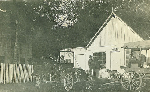
William Faubion moved his family to the area in 1907 from the Lents District of Portland. He and his wife Anna settled along the old Barlow Road, which was soon to become the Mount Hood Loop Highway. Just past Zigzag and at the base of Hunchback Mountain they built a home, which they later converted into a roadhouse, similar to our modern day bed and breakfasts. They named it “La Casa Monte”, Spanish for “The Mountain House”.
William harvested the huge old cedar on his land, cut shake bolts and hunted to support his family. Several large stumps with springboard notches can still be seen from Highway 26 as you pass by the area. La Casa Monte was completely built from standard dimension hand split cedar boards, with no milled lumber. It was two story with cedar shingle siding, gabled roof and wide eaves. The recessed front porch had arched openings, the center one was reached by a short set of stairs leading to the front door. The interior was rustic with handmade furniture and many animals mounted and displayed, indicating Mr. Faubion’s hunting prowess and the abundance of game in the area. Mrs. Faubion was known for her cooking, particularly her huckleberry pies, making La Casa Monte an ideal destination.
In time, the addition of a store with a post office made Faubion a spot on the map. The post office was established in 1924, and was discontinued in 1932. The store and post office was operated by one of William and Anna’s daughters and son in law, Aneita (Faubion) and Thomas Brown. Many of the early motor car tourists travelling along the old Mount Hood road made La Casa Monte their first stop on their way to adventure on Mount Hood.
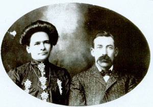
The Faubion’s had seven children, three boys and four girls. The oldest, a girl born in Gladstone, Oregon in 1890, was named Wilhelmina Jane (Jennie) Faubion. At twenty years old, Jennie married William “Billy” Welch, the son of Barlow Trail pioneers, and homesteaders of the area that would later become the village of Welches, Oregon. Jennie lived in Welches until she died in 1985 at 95 years old. Most of the other Faubion children lived in the area, and were well known and an important part of the history of the Mount Hood area.
Today, the Faubion Area is bypassed by the modern Mount Hood Highway 26, and is known now as Faubion Loop Road. La Casa Monte is gone, the store is still there, but is a private residence now. The residents that live there still know the history of their neighborhood, and identify themselves as living “At Faubion”.
Well, it seems that it’s been long enough between posts, that I should at least post the articles that I have written for the Mt Hood Magazine. If you haven’t been to the web site, please take a minute and give it a peak.
The first article is about Wemme, Oregon and the town’s namesake, E. Henry Wemme.
I hope that you enjoy the article.
Wemme, Oregon, the place with an odd name. Is it “Weemy” or “Wemmy”? How in the world did it get its name?
Wemme, pronounced “Wemmy”, is easily overlooked as folks drive past on the highway either to or from their stay at Mount Hood and its Villages. With the highway being four lanes and nearly as straight as an arrow, it hardly indicates how our road to Mount Hood used to be. And, as a matter of fact, the name itself is very much related to the growth of the highway that bypasses it.
The story of the Village of Wemme must start with the establishment of the Barlow Road and its development into a toll road and a two way track from its original westerly Oregon Trail route. In the later part of the 19th century, the Barlow Road, established in 1845 by Oregon Trail immigrant Samuel Barlow, was the route to Mount Hood’s south side and its recreational possibilities for the early Portland area adventurers. The road was a private toll road and, throughout its years, was held by several different companies. It went into many different levels of repair and disrepair over the years.
In 1912, Portland businessman and early automobile enthusiast, E. Henry Wemme purchased the old road for $5,400. Mr. Wemme is considered Oregon’s first motorist as he purchased the first automobile in Oregon, an 1899 Stanley Steamer. He owned a tent and awning business during the Alaskan gold rush, and became very wealthy supplying tents to the miners.
In 1915, after spending $25,000 on the much needed improvements, he eliminated the toll and opened the road to free travel. Upon his death in 1917, the road was willed to Wemme’s attorney, George W. Joseph, and it was held in trust until it was accepted by the Oregon Highway Commission in 1919 to be developed into the Mount Hood Loop Highway that we enjoy today.
Back in its heyday, Wemme was separated from the other local communities by the wooded, winding, rutted unpaved road. Pavement, modern automobiles and rapid travel had yet to come into existence, which made each village its own separate community. It was only after the widening of the road into a modern highway and the loss of the slow paced country road that the local communities started losing their separate identities.
Many aren’t aware that in 1977 Welches came very close to being called Wemme. The old Wemme post office building was to be closed and replaced with a new modern facility that had been built further east and down the road to Welches. At the time Welches had no post office. A local resident, Bill White, understanding that the new post office was not in Wemme, wrote letters and petitioned the postal service to name the new post office Welches. His efforts were successful and the community of Welches retained its identity and its name.
Today, almost as soon as you enter Wemme, you’re leaving Wemme and headed to Welches. Don’t blink, you might miss it, and because of the terrific businesses and restaurants that are located there today, you will be missing much.
Humans have been interested in preserving their legacy since the dawn of time, and that want for the preservation of their legacy may have been a major reason for the development of written language. In recording history, a first hand account is always the best source. Most of those that hold the historically valuable information are our senior citizens, many of which discount their role in the stories, thus keeping the story from being told.
That’s where the next generation must assume the responsibility of searching out these people and begging such stories to be told. In my research of our local history, I have become acquainted with a long time Brightwood resident that has had the foresight to recognize his role as a record keeper of our local Mt Hood History. He has been fortunate enough to have the opportunity to become close to, and visit with many local legends that are no longer around The Mountain.
William H White, “Bill”, and his family have owned a home in Brightwood for almost 40 years. His interest in local history was keen while Jenny Welch, who was married to Billy Welch, whose family the village of Welches was named for, was still spry. He was able to get to know Arlie Mitchell, who was the last tollgate keeper at the Rhododendron tollgate of the old Barlow Road as well as folks like Harry Abernathy, who when he and “his bride” first came to Welches, camped out at the spot that the Hoodland Shopping Center sits today. As past president of the Friends of Timberline, among other civic activities that he’s been involved with, he has been in association with many other notable figures who have shared their memories with him.
Bill has kept all of this information handy for historical work involving many projects and events. The Mt Hood area’s history has found a bridge in Bill White, a bridge between the generation that settled the Villages of Mt Hood, and those of us who enjoy learning as a benefit of the fruits of their labor.
Bill and his wife Barbara, are retired now and live in Brightwood full time. Bill spends much of his time sorting and filing the historical information that he has collected through the years. Bill won’t accept it, but he really is the Villages of Mt Hood Official Historian, and we owe him a debt of gratitude.
What gives a town, or in this case a village, its identity? In most cases it’s the establishment of a post office. Many feel that the establishment of a post office is truly that which makes a settlement a town or a village. The case is no different here on The Mountain, as each of our villages have been identified in that very same way. That identity still exists in places that no longer have a post office, such as Zigzag, Wemme and Faubion.
One might think that Welches, being the center of attention in our area, would have been the first post office to be established here, but it was actually the roots of the present day Brightwood post office that makes that claim. Samuel Welch, a local pioneer and Welches namesake’s first venture in the area was a hotel and general store in what was then called Salmon, Oregon, with a post office being established in 1891. His hotel was located near the present west end of Brightwood Loop near the Salmon River, and it wasn’t until 1910 that the name Brightwood was adopted. At that point in time it was located inside of McIntyre’s General Store near its present location. The Brightwood Post Office was discontinued in 1914 but reestablished in 1925.
The next in line as one travels east was Wemme. Named for E. Henry Wemme, the benefactor of the old Barlow Road, its post office was established in 1916. Wemme was discontinued upon the establishment of the new Welches post office in 1977.
The Welches post office was established at the Welch’s Ranch in June of 1905 with Linny Kern as the postmaster. Billy Welch succeeded Kern as postmaster in 1910 and served until 1940 when his wife Jennie took over. Jennie, for years the local matriarch, served until 1960 when the Welches post office was closed. The Welches post office was re-established in 1977. The original plan, at that time, was to move the Wemme post office into a new building on Welches Road, thus threatening to re-name Welches to Wemme. Because of the local outcry the postal service changed their plans and named the new post office Welches, thus insuring the perpetuation of its true identity.
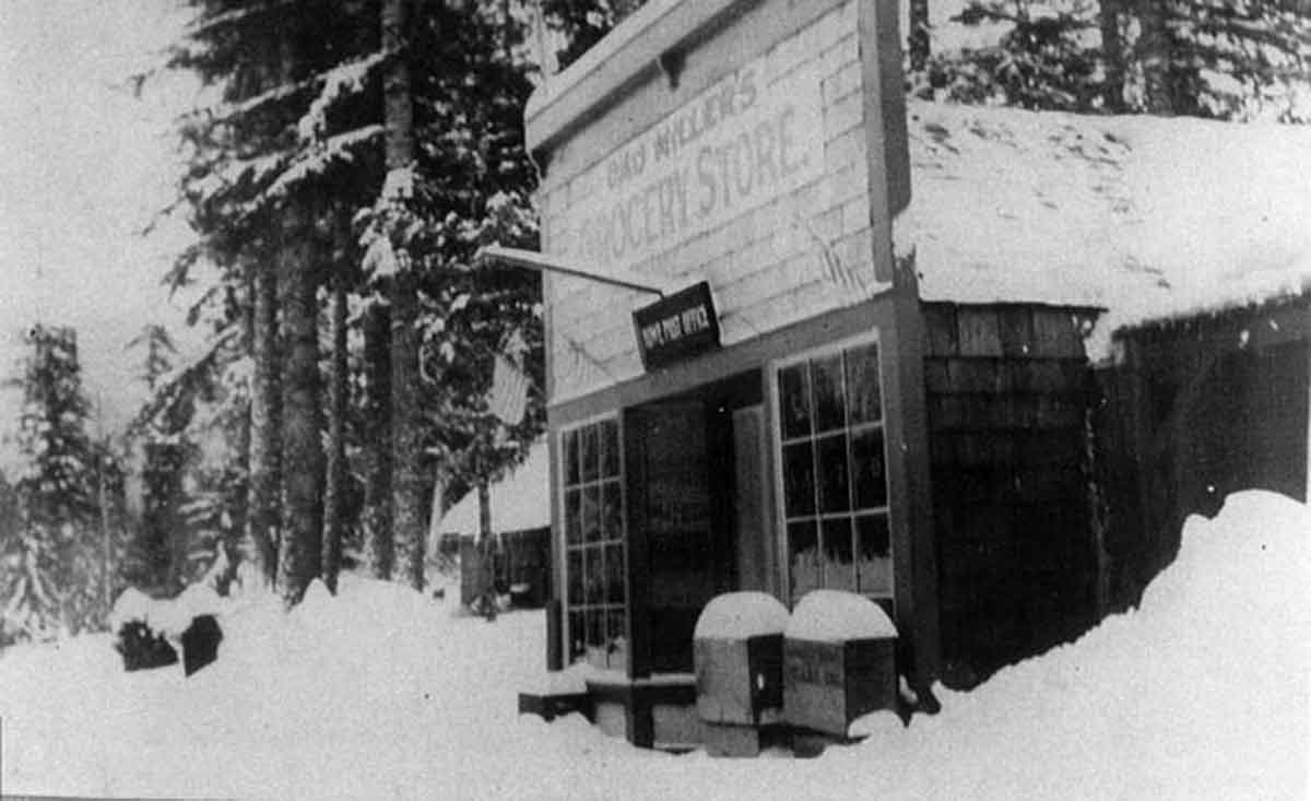
In 1909, a post office was established in the little town of Rowe. Named for Henry S. Rowe, an ex-mayor of Portland who built the old Rhododendron Inn, the post office was located in Dad Miller’s store. The Rowe post office name was changed to Zigzag in 1917.
The Zigzag post office existed as its own entity until 1964 when it became a rural delivery station for the Rhododendron post office. Although the mail was sorted at Rhododendron, the mail was postmarked “Zigzag Rur St”. The Zigzag post office closed for good in 1974.
The Rhododendron post office was established in 1920 and is still operating today.
The Faubion post office, which was located in the old Cedarwood Store on what is now Faubion Loop operated from 1924 to 1932 and was operated by William Faubion, Jennie Welch’s father.
Please take some time to send a postcard to friends or relatives. Our postmasters on The Mountain are all friendly down to earth folks that would love to have you drop in. They will also remind you that they need your business to continue their existence.
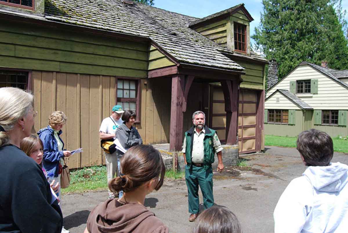
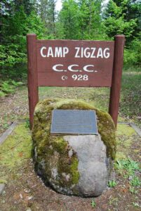
I had the pleasure of attending the 75th Anniversary Celebration of the New Deal / Civilian Conservation Corps. The event was sponsored by the US Forest Service, Friends of Timberline, Mount Hood Cultural Center &Museum and RLK and Company (Timberline Lodge). The event started at the historic Zigzag Ranger Station.
The event included talks by Rick McClure, Forest Archaeologist – Cristy Covington, USFS – Sarah Munro, historian and Jeff Jaqua, Zigzag Archaeologist that included a great PowerPoint Presentation and vintage film of the CCC days at Mount Hood. An excellent guided tour by Jeff Jaqua of the Forest Service was also well received.
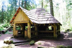
Part of the day included a the monument for the Zigzag CCC boys that included great conversation with Joe Bailey, an original Zigzag CCC’er, and then a stop at the Tollgate Campground in Rhododendron to view the CCC era log shelter. At that stop were representatives from the Fire Lookout club as well as Dave Rogers, a talented log builder that has worked on important Cascadian style historical restorations including the log shelter that was a part of the tour.
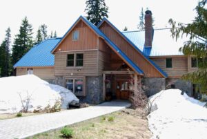
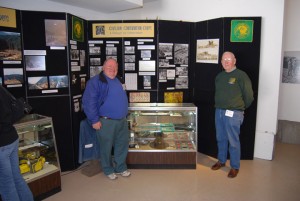
After that stop I headed to Government Camp to visit Lloyd Musser and the crew at the Mount Hood Cultural Center and Museum. They have a terrific CCC display down stairs. In the same area is a great display of a typical Mount Hood area forest fire lookout. Please stop in if you’re ever in Government Camp.
Then it was up the hill to Timberline Lodge. A slide show and another movie about the 3C’s was shown and two CCC alumni gave a short talk describing their days back then. and then it was cake and punch. There were also tours of The Lodge.
A fun part of the celebration was a passport that they gave out which could be stamped with a special stamp at four of the stops along the way, the Ranger Station, the log shelter at Tollgate, the Mount Hood Cultural Center and Museum and Timberline Lodge. Printed on the back of the passport was a great short history of the New Deal, WPA and their involvement in the Mount Hood National Forest, written by Sarah Munro.
“The New Deal was launched in March 1933, shortly after President Delano Roosevelt took office. Among the first projects enacted was the Civilian Conservation Corps Reforestation Relief Act that authorized the CCC’s. Within weeks, unemployed men between 18 and 25 were shipped to camps where, under the direction of army officers, they undertook soil conservation, reforestation, road construction and national park and flood control projects. In the Mount Hood National Forest, men in the 3C’s were under the direction of the Forest Service. They built the road to Timberline (a leg from the existing road to the construction site), built the terraces at the Lodge, laid out the Timberline Trail that circumnavigated Mount Hood and excavated for the water lines to the Lodge.
The Works Progress Administration was launched under the emergency Relief Appropriation Act adopted in April 1935. It was under the WPA the Timberline Lodge was constructed. The hundreds of workers who labored over the summer of 1936 to frame in the structure were WPA workers under the direction of private contractors hired by the WPA to build the lodge. The stonemasons who built the stone facing were also WPA workers. The Lodge was decorated and furnished under the Federal Arts Project, one program of the WPA.”
Written by Sarah Munro, 2008
The weather was great to boot. If you were there, you know it was well attended and all who organized it needs a big pat on the back! 🙂
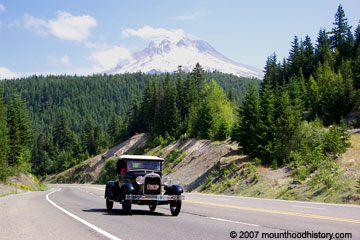
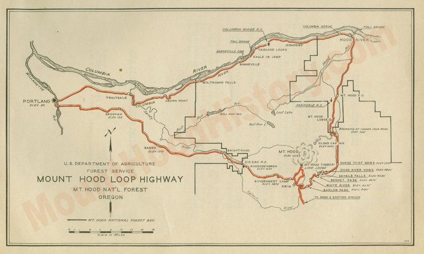
I’ve lived on the old Columbia River Highway in Bridal Veil, and currently live along the course of the Barlow Trail in Brightwood. My love of the Columbia River Gorge and Mount Hood, and my interest in their history has driven my research into the story of both routes and the development of the Mount Hood Loop Highway. Mount Hood is the only glacial peak with a road that completely circles it allowing access to the peak from every direction. It’s a fun day when I can relax and go for a drive the Mount Hood Loop Highway.
Before the immigrants from the East came to settle here the native people had well beaten trails that led from the Columbia River, located to the north, and from the Willamette Valley to the west. The trails led to the hills on the southwest side of the mountain where they would come to hunt, fish, gather berries and harvest medicinal plants.
In the early days of the Oregon Trail the “Great River of The West, the Columbia River, was used by the immigrants on their surge west. Many families rafted what was left of their earthly belongings, and in many cases what was left of their families, down the perilous river route through cascading rapids and laborious portages to the Willamette Valley in search of the “Land of Milk and Honey”. Because of this migration, the initial establishment of the overland roads by and large carried traffic from east to west following game and native trails, the primary route being over the southern shoulder of Mount Hood.
Sam Barlow and Joel Palmer arrived in charge of separate wagon trains at The Dalles in September of 1845 and found a shortage of everything, and a long wait for the dicey trip down the river. They both felt that the prospect of staying in The Dalles until a guide could be secured was more than their patience or their budget could endure. Considering the fare charged by the River Guides and the expensive prices for supplies at The Dalles, and the fact that the trip was not just a leisurely float downstream, a land route around Mount Hood sounded like a good idea. Hearing of Sam Barlow’s plan to cross the southern shoulder of Mount Hood, Joel Palmer decided to follow him with his own wagon train, overtaking them soon after.
Moving south along the Deschutes and up the White River they burned and slashed their way to the south shoulder of Mount Hood before succumbing to the arduous labor and the oncoming winter weather which required them to stash their wagons and head in the most expedient way to Fosters Farm and on to Oregon City, with the weaker ones of the party riding their tired stock. December of that same year found Samuel Barlow petitioning the territorial government for a permit to operate a toll road over the path that he and his companions traveled the previous October.
In time several routes were pushed through the Columbia River gorge to the valley, including supply/trade and cattle trails as well as a Military road. By the 1880’s railroads were running through, and of course in 1913 the first paved road was built through in the form of the Scenic Columbia River Highway, of which much has been written.
Meantime on the South side of Mt. Hood Sam Barlow’s road was changing too. Nearly put out of business by the gorge routes, the old Barlow road went through many private hands and states of repair and disrepair before it was handed over to the state to be developed into a highway, much along the same route that we drive today along Highway 26.
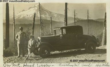
By the late 1800’s the immigrants had established their civilization and now many of the next generation wanted to play in the outdoors that their parents fought to survive in fifty years before. Mount Hood is in Portland’s back yard and it beckoned from its position on the horizon visible from most any part of the city, calling them to the mountains. Outdoor sports were very popular then, much like they are today, and many would take the road to the mountain for a guided trip to the summit, or as time went by to the ski slopes in the winter. Summer found them taking wonderful alpine hikes, festooned with breathtaking vistas, fields of wildflowers, creeks and lakes. Fishing and hunting trips were also taken to teaming rivers and the forests abundant with wild game.
Mountain lodges and road houses were established to cater to the tourists, including Welch’s Ranch and Tawny’s Mountain Home as transportation methods and road conditions improved. Horse drawn stages and then auto stages started regular runs from Portland to Mount Hood and back. Many would stop and stay at Welches and others would make the trip to Government Camp where the guides would take them to the top of the mountain.
In 1911 E. Henry Wemme, an automobile enthusiast and Portland businessman, purchased the old road from the Mount Hood & Barlow Road Company with the intentions of improving the route to the mountain and points east for the automobile that was to become the new wave of modern transportation. Two years later he offered the road to the government, who turned down his offer. He died the following year and willed the road to his attorney, who in 1917 presented it to the state who removed the tolls on the road and took over maintenance. By that time there had already been talk of plans for a road that would allow travel completely around Mount Hood.
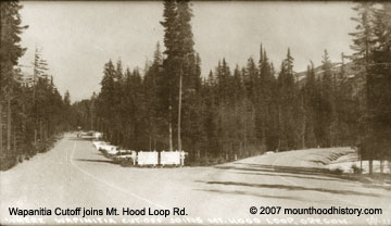
In 1914 Thomas H. Sherrard, supervisor for the Mount Hood National Forest along with William L. Finley, a naturalist, Rufus Holman, the Multnomah County Commissioner, Leslie Butler and Charles Bell from Hood River and Jacob Kanzler of Portland took a horseback trip around the east side of the mountain much along the route of the present highway 35, which created more interest and faith in the feasibility of a route that would follow the upper Hood River Valley around the east side to the Wapanitia cutoff and the south side road.
In 1919 a cooperative agreement was signed between the state and the government to build the road. It was started late in the year of 1919, and was completed in late 1924. The first traffic to follow the new road came in the summer of 1925 after the winter snows cleared. The road was only used seasonally until improvements were made and snow removal started in 1967.
And so the Mount Hood Loop Highway was complete. Fred McNeil wrote that at its dedication the Mount Hood Loop road was called “The necklace about the old volcano with Portland as its pendant”. The Loop hasn’t lost much of its allure since then and is travelled often today by folks out for a “Sunday Drive”. It is easily travelled in a day, including stops for pictures of mountain vistas, waterfalls and lunch. If anything has been lost, it’s the lack of awareness of what is being passed unnoticed by those that are “making tracks” and not “smelling the rhodies” while encapsulated in their climate controlled, surround sound equipped cocoons that travel at speeds not thought of by the pioneers that traveled before them.
Do yourself a favor the next time that you are looking for adventure and take the Mount Hood Loop Highway and please, stop and read an historical marker, or visit a museum. There are many shops and restaurants along the way that are just waiting to be discovered as well. If you’ll leave your cocoon and take a side trip or two and stop and smell the rhodies, maybe you’ll figure out why I love my neighborhood so much. Oh, and wave as you pass Brightwood, it’s right off the highway on a great stretch of the old road.
Click here to see vintage pics from the old Mount Hood Loop Highway from Wemme to Hood River.
The Mount Hood Highway No. 26 (see Oregon highways and routes) is the Oregon Department of Transportation’s designation for a 96.74-mile-long (155.69 km)
Sep 21, 2011 … From Hood River, the byway leads south on OR-35 through the broad Hood
River Valley along part of the Hood River County Fruit Loop. Fertile …
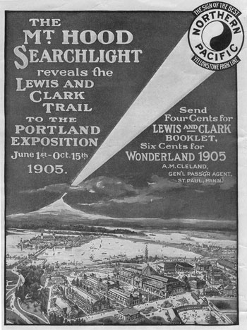
It was 1905, one hundred years after the Corp of Discovery was sent west from the United States into the wilderness to report the makeup of their newly acquired territory, and Portland Oregon was throwing a party to celebrate the occasion. In four months, 1.6 million people toured what was the equivalent to a World’s Fair with exhibits from nineteen states and twenty one different countries. Extravagant, if not substantially built buildings were constructed in the Spanish Renaissance style. It was quite an event with many different publicity stunts to draw attention to cooperators and to the event itself. One of which was an attempt at illuminating the summit of Mount Hood in a way that could be seen from Portland and the Lewis and Clark Expo.
Illuminating Mount Hood was nothing less than an obsession to folks in the late 19th century, as there were many attempts, and a couple successes.
Perry Vickers, Mount Hood’s first full time resident, started a tradition of building a bon fire on Mt. Hood in 1870 that lasted for many years. It was most likely not so much for the enjoyment of the people in Portland, but for the enjoyment of the locals who either participated in the building of the fires, or for those in Government Camp or campers at Summit Meadows, where Perry Vickars had facilities for travelers and campers. After a few bon fires, he was the first to initiate a blaze in an attempt be made visible from Portland. He used magnesium for the flame and was seen from Summit Meadow, but not in Portland. This was in 1873.
Several other unsuccessful attempts were made before two Portland men named George Breck and Charles H. Grove, on their second attempt on July 4th, 1887, were able to illuminate the mountain clearly, and bright enough to be seen in Portland. Their attempts were what gave Illumination Rock its name. Other notable names from the party were acclaimed conservationist William G. Steele, N.W. Durham. Govt. Camp’s first citizen and famous mountain guide Olliver C. Yokum, Dr. J.M. Keene and Dr. Charles F. Adams.
In 1901 plans were being made to illuminate the mountain as a part of the 1905 Lewis & Clark Centennial Exposition. Portland businessman and event co-organizer W.M. Killingsworth wanted an electrical light display featuring a huge statue of Lewis on one side of the mountain, and another of Clark on the opposite side. The logistics of such an event were wholly impractical for obvious reasons. Disregarding the construction and placing of the statues that would indeed need to be massive to be seen from such a distance, taking electricity to the mountain was also impractical, even if generated from the closest stream that could be used to power a generator, it was a fanciful but impossible feat.
On July 4th. 1905 “Plan B” for the illumination of Mount Hood for the exposition was put into place. A party consisting of George Weister, E.H. Moorhouse, Horace Mecklem, Mark Weygant and guide Peter Feldhausen proceeded up Cooper Spur for the summit, arriving at around 6pm. Upon reaching the summit, they held on in the frigid cold until the planned time of 9pm when they ignited the red powder that was to provide the flame. When the flame was ignited a wind blew through, taking some the fire down the mountain, thus subduing the flame making in near impossible to see in Portland, but it was reported at being visible in the Hood River Valley to the north. The party left the mountain top right away.
Many more illuminations were done in the subsequent years, with the most spectacular fire being the one that was done for the Mazama Climbing Club’s 75th anniversary in 1969.
The previous story doesn’t touch on the heliography that was done from the summit of Mount Hood, and will most likely be a subject of another story in the future.
Climbing Mt. Hood “Back in the day” – Today I thought that I would post a great story about a typical climb from the 1930’s. I’ve been lucky to have been able to meet many historic figures, or their relatives since I started to pursue my interest in learning the history of Mt. Hood.
This story was forwarded to me through a conversation that I had with Anne Trussell (Harlow) from Sacramento, Ca. Anne is James Harlow’s daughter.
I hope that you enjoy this story.
Gary =0)
James Harlow’s journal entry and photos.
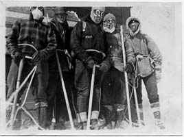
Saturday and Sunday, September 19-20, 1931
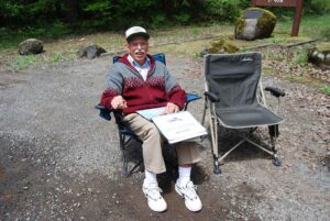
James Harlow, Curtis Ijames, Cecil Morris, Everett Darr, Dr. Bowles and Ole Lien
Ole came for awhile at noon, and we made definite plans for the climb up Mt. Hood over this weekend. Then I packed up and went over to Ole’s where we were to meet the fellows from Camas with whom we were going up. They were due at 7:30 but didn’t show up by 9:00 so we made arrangements to go up with Everett Darr and two of his friends. They came by after us by 10:30 and we started by 11:00 PM. Ole and I rode in the rumble seat. Everett’s two friends were Cecil Morris and a fellow named Bowles, a doctor. The car, a Chevrolet Coupe, belonged to Cecil Morris. We were at Government Camp by 12:45 AM Sunday. We didn’t stop at the hotel as Raffertys had gone to bed.
It was very foggy from Laurel Hill to Timberline but was mostly clear at Timberline with a 38-degree temperature. The mountain showed up white with a fresh coat of snow. We started on the climb about 3:00 AM with a fellow from Portland, Curtis Ijames by name, making a party of six.
We ran into snow a half mile above Timberline, and put on crampons half way to Triangle Moraine. The snow was well frozen and we hardly sunk in. There was a very heavy west wind and clouds were rapidly blowing across the mountian. The summit was obscured by the first streak of dawn. On Triangle Moraine there was probably an average of fourteen inches of snow piled into drifts, sometimes four or five feet deep. When the sun came up, we saw some beautiful cloud effects, the most wonderful colors I have ever seen.
When we got to Packs Rocks, we were in the fog and the wind tried its best to blow us off into White River Glacier. Upon reaching the first hot rocks, the wind was so hard we could barely move. At times, we just lay down in the snow and anchored ourselves with our ice axes. It wasn’t bad going up on the Crater Rocks drift until we got on the top of it. Then the wind was so bad it took us ten minutes to go 100 feet. The snow was soft, making the going hard. It was foggy most of the time and ice froze on our clothes. It took us quite a while to go the last 1000 feet because of soft snow.
It cleared up before we got to the top of the Summit Ridge. We looked down on a sea of clouds below 8,000 or 9,000 feet on the south and west and scattered clouds on the north and east. Fleecy strings of fog were blowing across the summit with tremendous velocity. And the gusty wind was so strong as to be dangerous. The rocks were ice-covered and the going was very treacherous. The last 200 feet over to the cabin was terrible.
We finally got to the cabin and went in, as the door was unlocked. It was very cold and the fire we lit in the kerosene stove did little to warm things up. We had arrived at the cabin about 11:30, and stayed about an hour. The shack swayed, creaked, and groaned crazily in that wind. The noise was terrific. Leaving about 12:30, we got down the chute okay but got lost in the fog below Triangle Moraine. The snow had softened and made the going very tiresome in the three and four foot drifts.
We finally got on the right path and got down to Timberline by 4:00 PM. Everett, trying to crank Cecil’s car, which started hard, punctured the radiator. We got it started down the road and he could coast nearly all the way to Rhododendron. Ole and I rode into Portland with Curtis Ijames in his Model T Ford delivery. We stopped at Government Camp and got a bite to eat at Rafferty’s so home by 7:30 PM, thus ending a great trip.
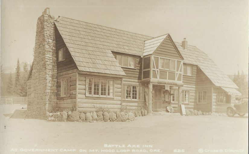
The Battle Axe Inn, in Government Camp was for many years the hub for much of the activity on Mt. Hood’s South side. Many mountain rescues were headquartered from the old inn, as well as community gatherings and parties. Many a cold and tired skier found warmth and rest in front of its grand rock fireplace. Continue reading Battle Axe Inn, Government Camp, Oregon
 William Faubion moved his family to the area in 1907 from the Lents District of Portland. He and his wife Anna settled along the old Barlow Road, which was soon to become the Mount Hood Loop Highway. Just past Zigzag and at the base of Hunchback Mountain they built a home, which they later converted into a roadhouse, similar to our modern day bed and breakfasts. They named it “La Casa Monte”, Spanish for “The Mountain House”.
 In time, the addition of a store with a post office made Faubion a spot on the map. The post office was established in 1924, and was discontinued in 1932. The store and post office was operated by one of William and Anna’s daughters and son in law, Aneita (Faubion) and Thomas Brown. Many of the early motor car tourists travelling along the old Mount Hood road made La Casa Monte their first stop on their way to adventure on Mount Hood.
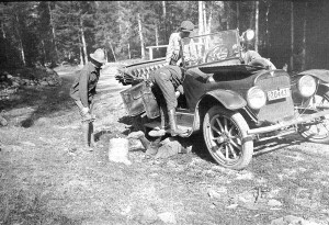 The story of the Village of Wemme must start with the establishment of the Barlow Road and its development into a toll road and a two way track from its original westerly Oregon Trail route. In the later part of the 19th century, the Barlow Road, established in 1845 by Oregon Trail immigrant Samuel Barlow, was the route to Mount Hood’s south side and its recreational possibilities for the early Portland area adventurers. The road was a private toll road and, throughout its years, was held by several different companies. It went into many different levels of repair and disrepair over the years.
 Back in its heyday, Wemme was separated from the other local communities by the wooded, winding, rutted unpaved road. Pavement, modern automobiles and rapid travel had yet to come into existence, which made each village its own separate community. It was only after the widening of the road into a modern highway and the loss of the slow paced country road that the local communities started losing their separate identities.


 Before the immigrants from the East came to settle here the native people had well beaten trails that led from the Columbia River, located to the north, and from the Willamette Valley to the west. The trails led to the hills on the southwest side of the mountain where they would come to hunt, fish, gather berries and harvest medicinal plants.
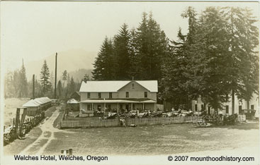


