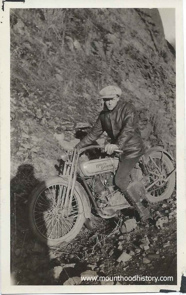
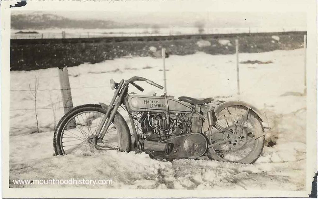
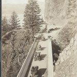
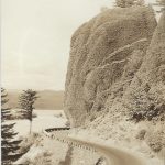
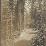
Here’s a series of photos from 1927, ten years after the opening of the Historic Highway, showing a young man and his Harley Davidson motorcycle. It must have been in the Winter as there seems to be snow and rock fall in the photos.
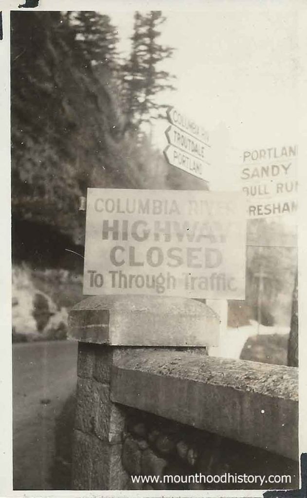
One of the photos clearly shows road signs with familiar destinations – Portland, Sandy, Bull Run, Gresham, Troutdale and the Columbia River Highway. The best part of the photo is the additional temporary sign that reads “Columbia River Highway Closed To Through Traffic” placed in on top of one of the road’s stone and concrete guard rails. The second one shows some stone rubble along a roadway which looks much like a winter day at unstable spots along the old road today.
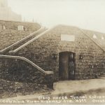
The Summit of Mt. Hood circa 1915 – This is a “Magic Lantern” slide from my collection. It shows a climber standing on the top of Mount Hood with the old Summit House fire lookout station built by the legendary mountain man Lige Coalman.
All of the lumber was carried up the mountain by hand, with Lige doing most of the carrying. Lige found it difficult to find men who would work as hard as him. Most of those whom he hired lasted only a day or two before quitting. Once the building was built Lige routinely carried barrels of heating oil and other supplies to the lookout.
This structure was built in the Summer of 1915. By 1941 it had deteriorated to bad that it was pushed over the edge.
Standing on the summit of Mt. Hood, the highest point in Oregon at 11,250 feet, is
a lifelong dream for many aspiring mountaineers. The Mazamas have been …
A Day on Historic Columbia River Highway when it was new.
It was 1915 and a lot was going on just east of Troutdale Oregon in the beautiful Columbia River Gorge. Planning was taking place for the construction of the now Historic Columbia River Highway.
The Columbia River Gorge back then had only limited ways of accessing it. Traditionally excursions from Portland on steam powered sternwheeler paddle boats were the way that most transportation took place. In time the railroads were built, primarily for trade but in time passenger trains started taking people there on day trips. Tourist excursions to the waterfalls on the south side of the river were common. Locations such as Multnomah Falls were the main attractions.
Of course many people rode horses or travelled in horse drawn wagons back then but with the advent of automobiles the old primitive roads were improved and new roads were made but they were still dirt wagon roads. Not long after the idea to create one of the first paved scenic automobile roads in America was imagined by several prominent Portland businessmen. Thus was created the Scenic Columbia River Highway.
Although a cultural treasure today, not all who lived in the area back then supported this idea. Many people still used horses and automobiles were owned by the wealthy. Many people back then never thought that they would ever own a car let alone use one to tour the Columbia River Gorge. Public support for financing the highway was tenuous at best.
As we all know, the highway was built and within a couple of decades was being used heavily for transporting cars from central Oregon to the Willamette Valley. Heavy trucks had been developed to carry commodities and products and most everyone had a car in their garage. It didn’t take long to see how those who imagined the highway were visionaries. The highway was quickly becoming overused and plans for a riverside highway, which would become Highway 84, was in the works.
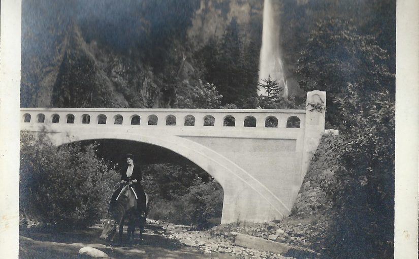
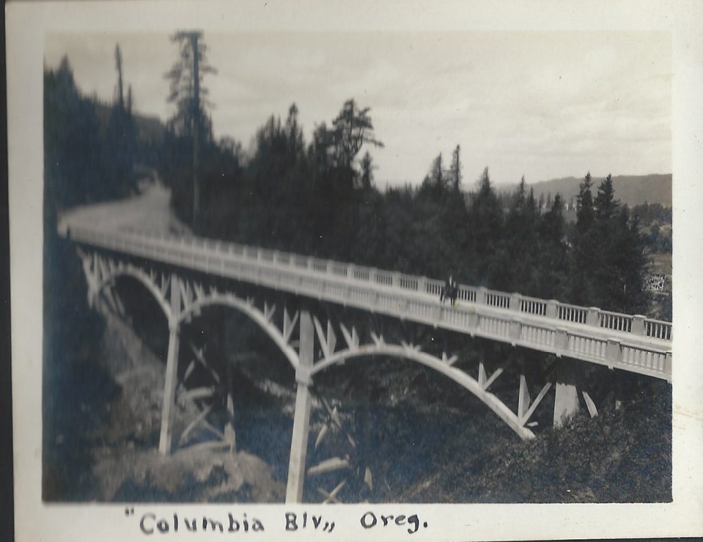
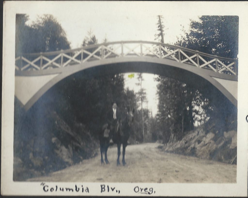
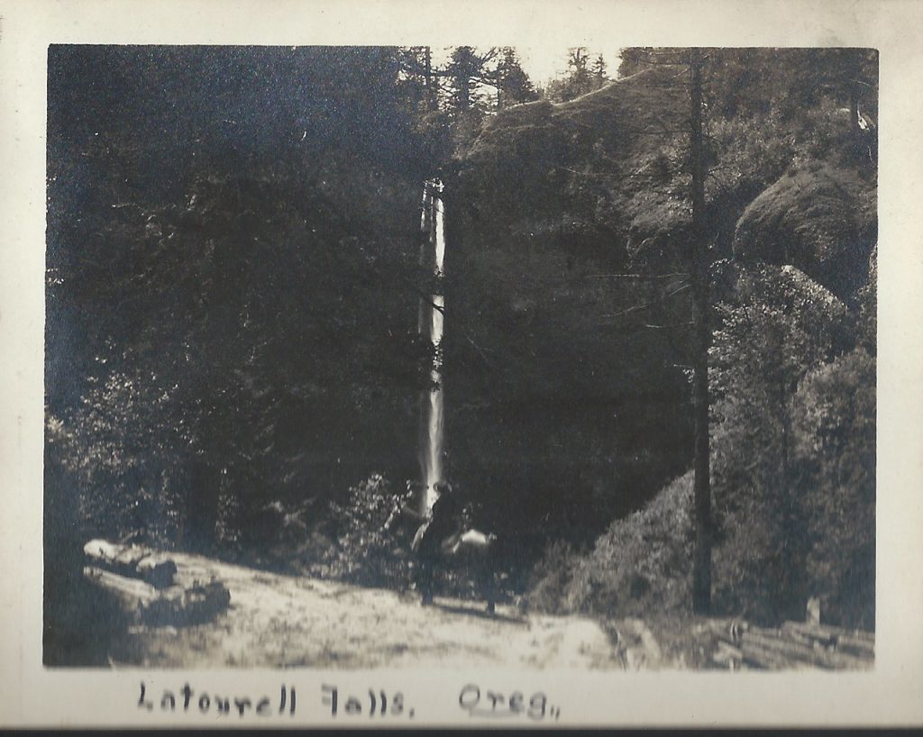
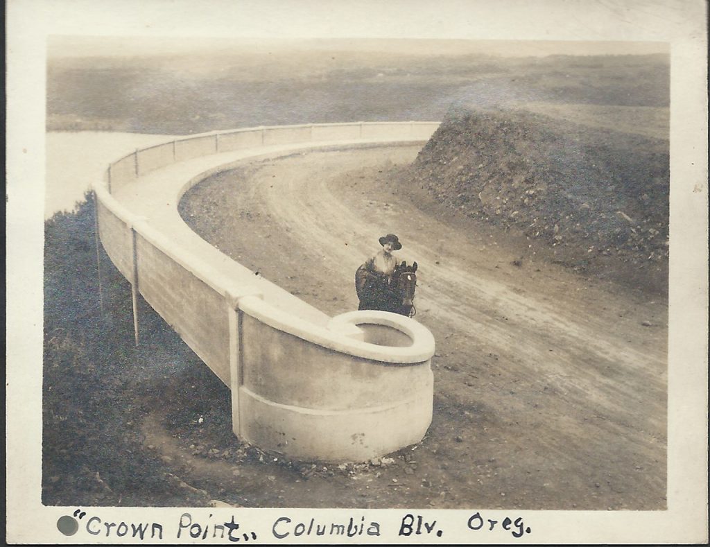
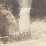
And so back in 1915 the Historic Columbia River Highway was in construction. It would be dedicated a couple years later in 1917, but that didn’t keep people from going out to explore the modern engineering marvel. Of course traffic was minimal back then. Today we can only imagine a peaceful horseback ride along it’s path to familiar waterfalls along the way, but that’s just what this couple did.
Harry and Alvida Calvert decided to take a trip out to survey the progress on the new highway via horseback. Harry Calvert was a photographer from Oregon City, Oregon.
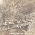
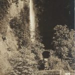
These photos are some of his personal photos. Snapshots into his and his wife Alvida’s life. In these photos you can see familiar places along the Historic Columbia River Highway such as Crown Point, Latourell including the falls and the old arched footbridge that was removed due to obstruction of trucks that needed to pass as well as the recently constructed highway bridge. Other locations include Bishops Cap and the Sheppards Dell Bridge, as well as Multnomah Falls. Alvida and Harry take turns posing in the photos with their horse Pat, including one where one of them made their way to the Simon Benson bridge between the upper and lower tier of Multnomah Falls.
Needless to say a horse ride on the old Historic Columbia River Highway is totally impractical today, but there once was a time. I’m certainly glad that Harry and Alvida took the time to document their day in the Scenic Columbia River Gorge.
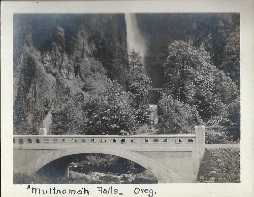
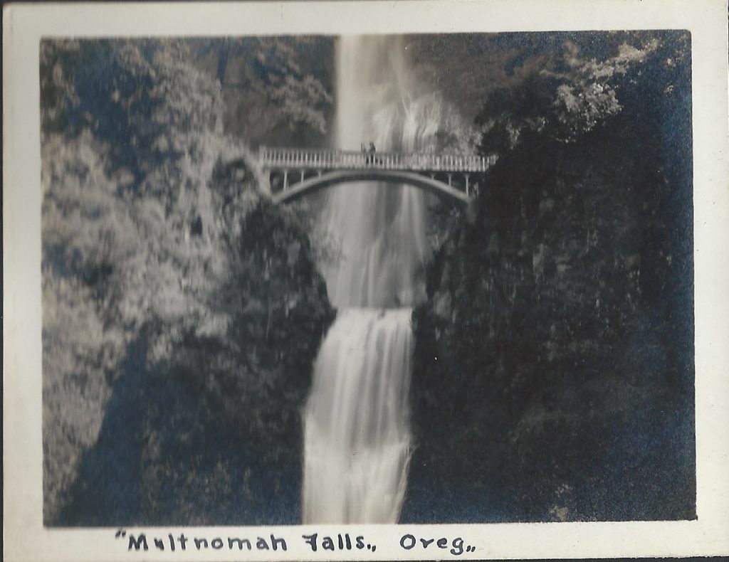
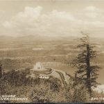
Horse Ride in The Columbia River Gorge – Multnomah Falls
Horse Ride in The Columbia River Gorge – Multnomah Falls
Horse Ride in The Columbia River Gorge – Multnomah Falls
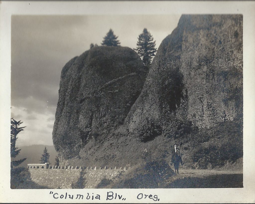
Horse Ride in The Columbia River Gorge – Bishop’s Cap at Shepperds Dell
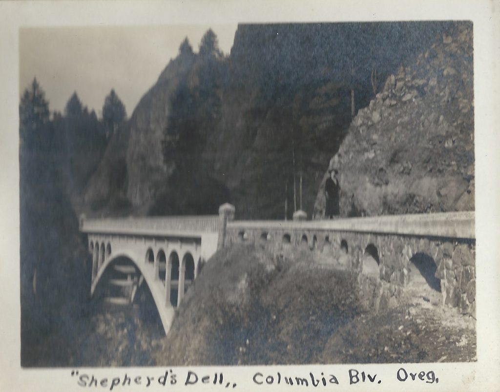
Horse Ride in The Columbia River Gorge – Shepperds Dell Bridge
Horse Ride in The Columbia River Gorge – Latourell Falls Bridge
Horse Ride in The Columbia River Gorge – Latourell Walking Bridge
Horse Ride in The Columbia River Gorge – Latourell Falls
Horse Ride in The Columbia River Gorge – Crown Point
Sep 21, 2011 … About 14000 years ago, cataclysmic floods scoured out the Columbia River
Gorge. Early visionaries engineered an inspired drive along its …
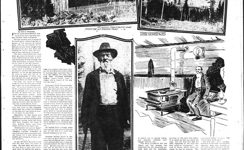
Steven Mitchell was legend on Mount Hood in his times, as well as his son Arlie, who was the last tollgate keeper at the Rhododendron Tollgate of the old Barlow Trail Road. Lige Coalman, who was raised by Steven, was also a legendary mountain man on Mount Hood in his own right.
Steven Mitchell – Portland Oregonian Sept 12 1920
“Steve Mitchell – Husband of the Hills
Man of the mountains
Whose Life Near Mount Hood Is a Story Book of Many Treasures
By Earl C. Brownlee
For 60 years Steve Mitchell, husband of the hills, has been fleeing, terrified, from civilization.
Yet the dreaded ogre as pacing at his heels again, debauching the icy waters of his streams of melted snow, defacing the majesty of his brilliant autumn hills, slaughtering the game that gave him his meat and heaping its insults upon injuries suffered at its hands.
The dusty road before his cabin door, an artery that helped to carve from the wilderness of woods, is leading multitudes of folk through the most wonderfully romantic section of the land of the last frontier.
And from end to end of the timber bordered highway of delightful vistas there is nothing or no one so romantic as Steve himself; Steve Mitchell, as old as the mountains he loves so well-the last of a sterling generation of brave men who revered the quiet grandeur of the hills above all other things.
Far from the paths of man’s progress Steve Mitchell many years ago sought the realm of heart’s desire. To achieve his goal this man of the mountains first cut his way as a workman over what became, by dint of labors like his, Portland’s Hawthorne avenue. With the street completed, civilization advanced and Steve Mitchell fled to far places again, cutting roadways as he went, into dark forests the circled Mount Hood.
There he found his glorious freedom and there he has remained, while time has etched its wrinkles on his face and has woven a mantle of white for his brow.
Meanwhile, he has reared and sacrificed to man’s estate four splendid sons and two accomplished daughters, among whom are those who have forsaken the ways of their grizzled father and have found success in the hated city.
“Confounded thunder buses” roll by his forest-bound home in ceaseless numbers nowadays as Steve Mitchell peers peacefully into the future for a spot where the profits and pleasures of men cannot be encroached.
In the ‘60s Steve Mitchell looked into the west from his home in Iowa. He kept faith with the vision and from a point near Cleveland, Ohio, he started the pilgrimage.
“And I’ve been tinkering aling ever since,” he says, as he declares he has other distances to gain.
Briefly, his tinkering was centered in mines of gold in California, but in 1866 he came to Oregon. He helped build streets through the timber and then built roads to and through Sandy to the mountains.
About the man and his life many tales are told, but none more truthfully nor well then Steve can tell them. There’s the story of his gold claim to entrance the mountain novice.
It is said that far back on the Salmon River, concealed for nearly half a century against the prying eyes of friends and enemy, Mitchell has a gold mine.. There, the story has it, he chips great nuggets from a rocky wall whenever he’s in need of funds and brings them to the counting house. The claim is a priceless treasure, we are told, that would yield the cost of every comfort if its owner chose.
“Bah!” Steve Mitchell will exclaim if you inquire into the story. “There are more lies in these hills than there wever were cougars.
“Liars, thunder buses and a new kind of man-animal with a whooping sort of holler are the torments of civilization. There’s too much civilization in the world. “If you write articles tell about these man-animals who have come into the hills to pollute God’s creeks by washing their unworthy feet in them and tearing the quiet night with their whooping hollering. They’re ornery-worse than a cougar, and a couple of ‘em aint very far away.”
Folks don’t know the mountains, Steve Mitchell says, and can’t love their dim trails and rocky peaks as he does. Wedded to their wonders, Mitchell has learned their lore as the schoolboy learns from books; in them he has built his home and in them he will find his grave.
In the interim, though, there has been a lifetime of marvelous days, attended with thrills at times, yet always mandatory in their hold upon the heart of this fine fellow.
Steve was bent over a kitchen stove, when by inquisitiveness born of long acquaintance, he was interrupted, and his story elicited by many questions. Upon the stove a frying pan, containing a stewing portion of carrots, simmered as Steve jammed more firewood into the blaze that was heating his dinner.
He hauled forth a shaggy, yet sadly worn pipe for himself and from his seat on the end of a wood box, fanned romance by his talk.
Nineteen fording places in the river back of Steve Mitchell’s cabin mark the old Barlow trail, pathway of the pioneers who first crossed the Cascades around the base of Mount Hood. Mitchell can point out each ford and can tell of the days when he trod the still fresh trail of those empire builders who preceded him.
He will show from his front door the vast, timbered hill where, within his mountain lifetime, has grown a forest. When Mitchell selected his mountainous home there was no sign of woods save the blackened bulk of great trees destroyed by an ancient fire.
He has seen those hills yield heavy timber, where, within the scope of his own memory, there was but a charred reminder of a once deep forest. Over their denuded slopes he has watched by the hour while his dogs ran deer that he might have food, he lolled in their shade times unnumbered as he hauled from their roaring streams great trout to appease the mountaineer’s keen appetite. He has tracked the bear to favorite berry fields and his gun has brought the mountain lion hurtling from his tree.
He has held communion with the lords of nature’s great open spaces, and he has studies their secrets until they are his lexicon-his primer and his Bible.
From it all he has learned both hospitality and hate. He hates civilization; yet he is hospitable to a degree unlimited.
As he spread his Sunday dinner a demand to partake with him declined, he proferred (sic) a piece of his “bachelor pie” that would bring envy to the most dainty housewife. Its flaky crust enough to belittle a salaried chef, the pie he had manufactured, with filling of raisins, was a delicious morsel the he insisted must be followed by a generous slab of light loaf cake he had just drawn from the oven.
“And now,” he jocularly said, “you can stay overnight if it rains real hard.”
“Folks from the towns are taking all the fish from the creeks are we’d have a mess for breakfast too. No, ‘planted’ fish do not restock the streams. Does a hen lay all her eggs in one day, once she gets started? Neither do fish, if they’re left to their natural means, and scientific methods can’t change nature’s way.
“The same civilization that has ‘fished out’ the streams has frightened the few remaining animals back into the mountains, where these confounded thunder buses can’t chug and sputter and roar their dusty way through night and day.
“Between thunder buses and these man-animals down the road one can’t even sleep anymore.
“Civilization is coming too close and I’m about to move back with the deer and the bear and the fish. There are no neighbors there to let their people starve on their doorstep. There is no whopping holler at midnight, but the call of the mountain winds and the cougar’s cry.”
Steve Mitchell’s comfortable little cabin sits beside the road 10 miles west of Government camp, and for many miles around there is hardly a foot of ground that this main of the mountains has not trod and whose charms he has not sought.
He is known to the folk who live in the hills, but to those who come from “civilized” places his is but one of the modest homes that may be found in the wilderness.
His, though, is a home in every sense, for he lives in it in summer and winter, through snow and sunshine. Only upon “occasions” does he venture from his mountain haven and such occasions are all to frequent if they occur more than once in a decade. The sturdy sons who remain in the family drop in now and then to visit with their father or to spend an idle day under his roof. But his wife who saw his early happiness in the hills has been called to “civilization.” She lives at Sandy, where, Steve declares, he has no business. Two splendid daughters hold worthy positions in centers of “civilization”.
Three sons remain of the four reared in the Mitchell family. Lige Coalman, famous Mount Hood guide and forest ranger, whose knowledge of the timbered wilds founded on training at Steve Mitchell’s hands, was reared as a son by this mountaineer and his wife. But Coalman, too, has quit the mountains for the profits of a farm.
When the world war opened the four stalwart Mitchell boys, each loyally attentive to their father and each a convert to the nature-loving, out-of-doors creed of their forebear, were prepared with strong bodies, capable hands and a will for the fray. Mountaineers, each of them, the four enlisted for service. Two were members of the marine corp, one chose navy and the fourth wore an army uniform. The first three were overseas fighting men. Arlie, a strapping young chap wonderfully versed in mountain lore, made 11 round trips over the Atlantic as a member of the nation’s naval forces and did eight months of shore duty overseas, where he visited almost every important city on the continent and in the British Isles.
“I hadn’t been out of the mountains much before,” he says, “and I never want to be again.
The sons who were marines, members of the mow historic fifth regiment, were also initiated to the ultra-modern delights of the world’s capitals, but they gleefully returned to the mountains of their childhood and resumed to their work in the forests.
One of these, a boy respected by every mountaineer who met him, fought through all the hot campaigns in which the American marines mouled war history in France, before he returned to the wooded, romantic land of his choice.
Again in the mountains, held fast by their appeal, this youth, just a year ago, gave his life to the protection of his playground when fire swept through the forest almost within sight of his father’s cabin.
With the same strength and courage that he fought his battle overseas, Steve’s son fought the blaze that would denude his homeland. Nor did he care a whit for the danger that surrounded him when a great fir, rocked upon its fire gnawed base, crashed down upon him.
That was an “occasion,” a day of sorrow for Steve Mitchell. He was drawn to the city-hated Portland-to hear the funeral dirge. And he vows he will never return.
The lonesome trails of the mysterious mountains have felt the footfall of Steve Mitchell. He will not profane the joys the hills have given him by the belated association with the world beyond his forest bound home. “
Mount Hood, called Wy’east by the Multnomah tribe, is a potentially active
stratovolcano in the Cascade Volcanic Arc. It was formed by a subduction zone
on the …
Mrs Pierce of Welches Killed a Bear With a Hoe – I have spent a lot of time talking with old timers and family members of those who have lived up here in the Mountain Community for quite a few years now. In one or two conversations I’ve heard tell of a woman who gained local notoriety for killing a bear that invaded her space with a garden hoe. That’s right a woman killed a bear with a hoe.
This afternoon while perusing newspaper archives I happened across this newspaper clipping. Well what do you know? It’s a true story.
The Oregon Daily Journal (Portland Oregon) 20 March 1915
“Gresham Outlook: When Mrs. Pierce of Welches killed a bear with a hoe last Saturday she set an example for all the people of the mountain country. The usual plan of warfare on bears is a good dog and a trusty rifle, but it has been proved that they are no longer needed. The sport should become popular now, because everyone can afford a hoe, and bears are plentiful.”
Welches Oregon Bear Hoe Portland Oregon Daily Journal 20 March 1915
Jul 21, 2016 … You’re more likely to die from a tick bite or a bee sting than to you are to be killed
by a grizzly bear in Yellowstone park, but here are a few tips …
This is Chief Tommy Thompson. I don’t hear his name mentioned much these days. When my father was a boy growing up in The Dalles he was legend. He would come to the schools and give talks to the children about the local native history and heritage. He was a man who was respected by all races.
<<<>>>
“Chief Tommy Thompson was a most exceptional human being, a cross between Jim Thorpe and the Pope. Tall, handsome, and athletic, a famed swimmer and boatman in his youth, he was married to as many as seven women at one time but never to a white woman; it would have been unthinkable. Chief Tommy Thompson was a holy man. His ancient religion was that of the Waashat, the drums.
He had begun serving as salmon chief at Celilo Village in 1875, when he was but twenty, after the death of the previous chief, his uncle Stocketly, who had been killed by friendly fire while serving as a scout for the U.S. Army. Tommy was salmon chief of Celilo Falls for the next eighty-five years, making him, without much question, the longest-serving public official in American history. Chief Tommy Thompson was also the most revered man on the river, the last true chief.
Chief Tommy was 102 years old when Celilo Falls were drowned. The death of Celilo Falls in 1957 foreshadowed the death of Chief Thompson two years later, at age 104. The River People believe he died of a broken heart. (from George Rohrbacher “Talk of the Past”)”
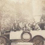
“Dear Flo – Just a postal of us on a Trip Up The Columbia River Highway, Portland, Ore. Love to all.”
Addressed to: Miss Flo. McGuiness. 38 Gardner Avenue, Jersey City, New Jersey.
This is a unique set of postal cards that were made by the family using the photos that they made that day. It was quite common back in the early part of the 20th Century to have your photos printed on postcard stock. You could then send the cards off to friends and relatives across the country. In the group photo a camera is clearly seen in the left hand of the gentleman on the right. Most likely an early Kodak.
Although we don’t know how the folks in the photos area, I’m sure that their “Trip up The Columbia Highway” was very similar to a day on the Historic Columbia River Highway in today’s Columbia River Gorge.
27 Jul 2016 … A parade of antique cars traveled from Troutdale to the Gorge Discovery Center,
to experience the Historic Columbia River Highway in the …
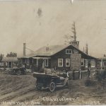
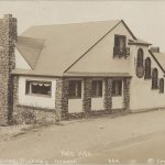
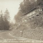
Roadhouses on The Mt Hood Loop – The Wistaria Farm Inn
The Wistaria Farm Inn, near Cherryville Oregon east of Sandy on the old Mount Hood Loop Highway (Highway 26 today), was only one of the many roadhouses located on the Mount Hood Loop Highway popular during the motor age. Continue reading The Wistaria Farm Inn
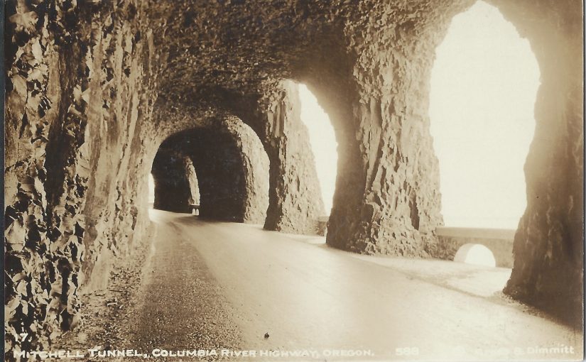
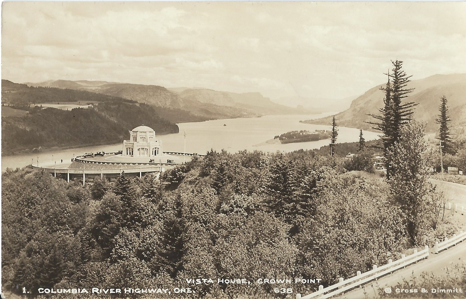
Cross and Dimmit Postcards of The Columbia River Gorge and Historic Columbia River Highway.
Cross and Dimit were two of the most successful photographers in Portland back in the first part of the 20th Century.
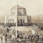
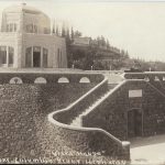
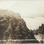
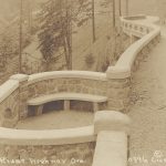
Crown Point and Vista House
Arthur B. Cross opened his photography studio in Portland Oregon in 1909. Five years later Edward L. Dimmit began working at Cross’s at his studio and two years later became partners with Cross, naming it “Cross and Dimmit”.
The Historic Columbia River Highway was dedicated in 1917 and quickly became a huge tourist draw. All along the new road built through the pristine and deeply beautiful Columbia River Gorge, roadhouses, restaurants and gift shops sprung up to supply the needs of the tourist traffic.
And around that very same time postcards became extremely popular due to the fact that one could buy a package of cards and forego lugging their own camera long, or to allow those without ne to have photos of the views, streams and waterfalls along the road. All of these factors came together to provide the new Cross and Dimmit venture with a steady stream of potential customers via the souvenirs shops as well as from the running boards of their Model T Ford. In time they had their own gift shop located at Crown Point near Vista House.
Cross and Dimmit created real photo postcards in large quantities and sold them individually as well as packs of a variety of scenes. Most everyone who toured the gorge back then bought some. Cross and Dimmit sold scenes from other areas, but the photos of the gorge are their most iconic photos. Today they’re some of the best photos of the Columbia River Gorge and the historic Columbia River Highway from that era, and because of the quantities that they made, are still easy to find.
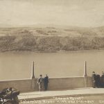
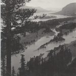
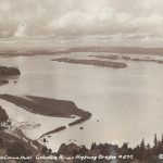
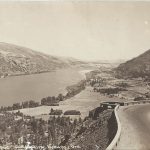
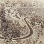
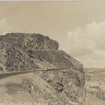
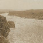
This is a series of their most common cards of the Columbia Gorge. They start from Chanticleer Point, today referred to as The Women’s Forum near the town of Corbett. They then go along the highway from Crown Point and Vista House to the Rowena Loops near The Dalles Oregon.
Arthur Cross died in 1940 and Dimmit lived until 1963.
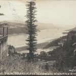
View From Chanticleer Inn
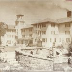
Chanticleer Inn at Chanticleer Point
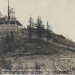
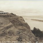
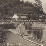
Mrs M E Henderson’s Crown Point Chalet
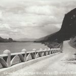
View of Crown Point
View of Crown Point
View of Crown Point
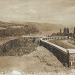
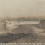
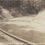
Columbia River Highway at Crown Point Prior to Warrenite
Columbia River Highway Dedication
Vista House New
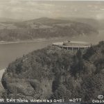
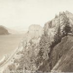
The View from Crown Point
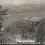
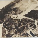
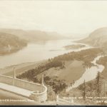
Aerial View of Crown Point and Vista House
Crown Point and Vista House
Crown Point and Vista House
Crown Point and Vista House
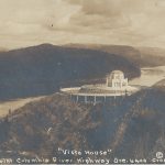
Vista House
Vista House
The View from Vista House
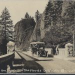
Crown Point
Cross and Dimmit Columbia River Highway Postcard Crown Point
View East from Crown Point
View East from Crown Point
View west from Crown Point
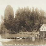
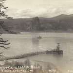
Fish Cannery at Rooster Rock
Historic Columbia River Highway Before Warrenite
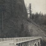
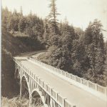
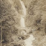
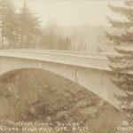
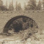
Latourell Bridge
Cross and Dimmit Columbia River Highway Scene at Latourell Postcard
Falls Villa at Latourell
Latourell Falls
Bridge at Latourell
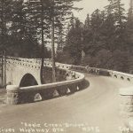
Shepperds Dell Bridge
Shepperds Dell Bridge
Shepperds Dell Bridge
Shepperds Dell Bridge
Bishops Cap near Shepperds Dell
Bishops Cap near Shepperds Dell
Bridal Veil Falls
Pillars of Hercules
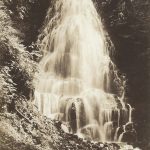
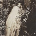
Wahkeena Falls
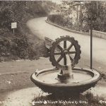
Rotary Wheel at Waukeena Falls
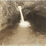
Fairy Falls
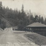
Multnomah Lodge at Mist Falls
Multnomah Falls Lodge
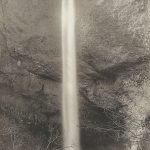
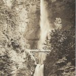
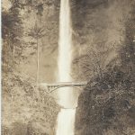
Multnomah Falls
Multnomah Falls
Multnomah Falls
Multnomah Falls
Multnomah Falls in Winter
Columbia River Highway Viaduct near Multnomah Falls
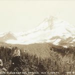
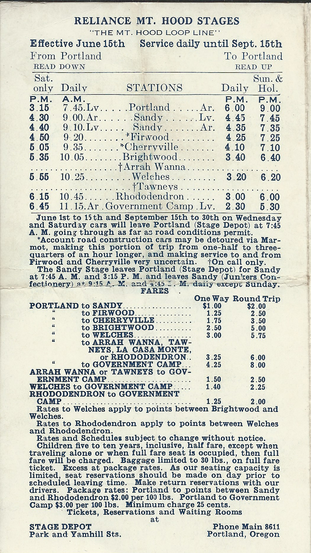
Reliance Mt Hood Stages – First Autos to Mount Hood
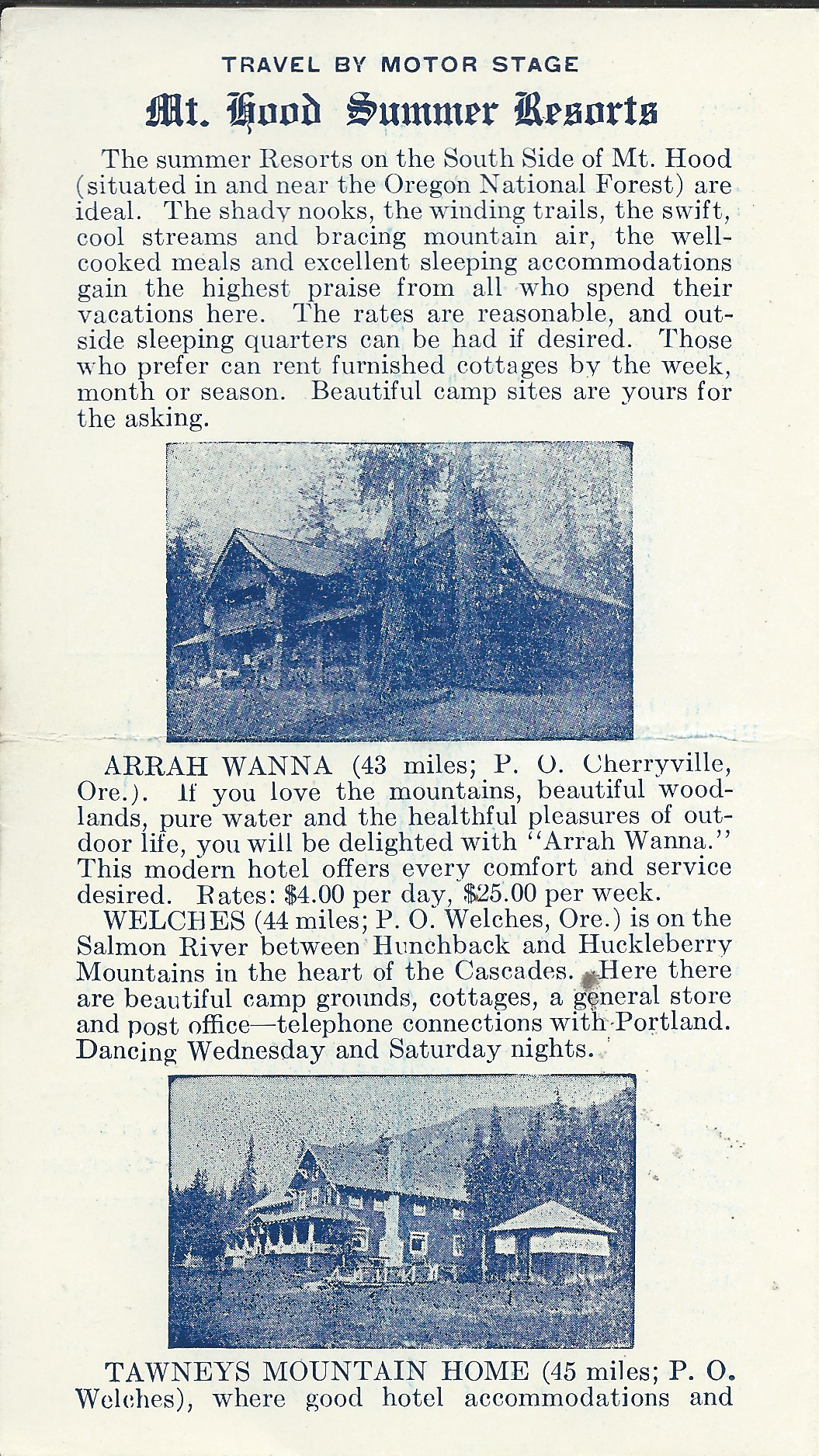
Reliance Mt Hood Stages – In the early days of the road to Mount Hood, after the immigrant era, the road allowed the burgeoning new city of Portland to access the mountain for recreation. Mountain climbing and hiking the trails in the foothills in those days was the primary activity in the area. Skiing had yet to become an activity on the mountain.
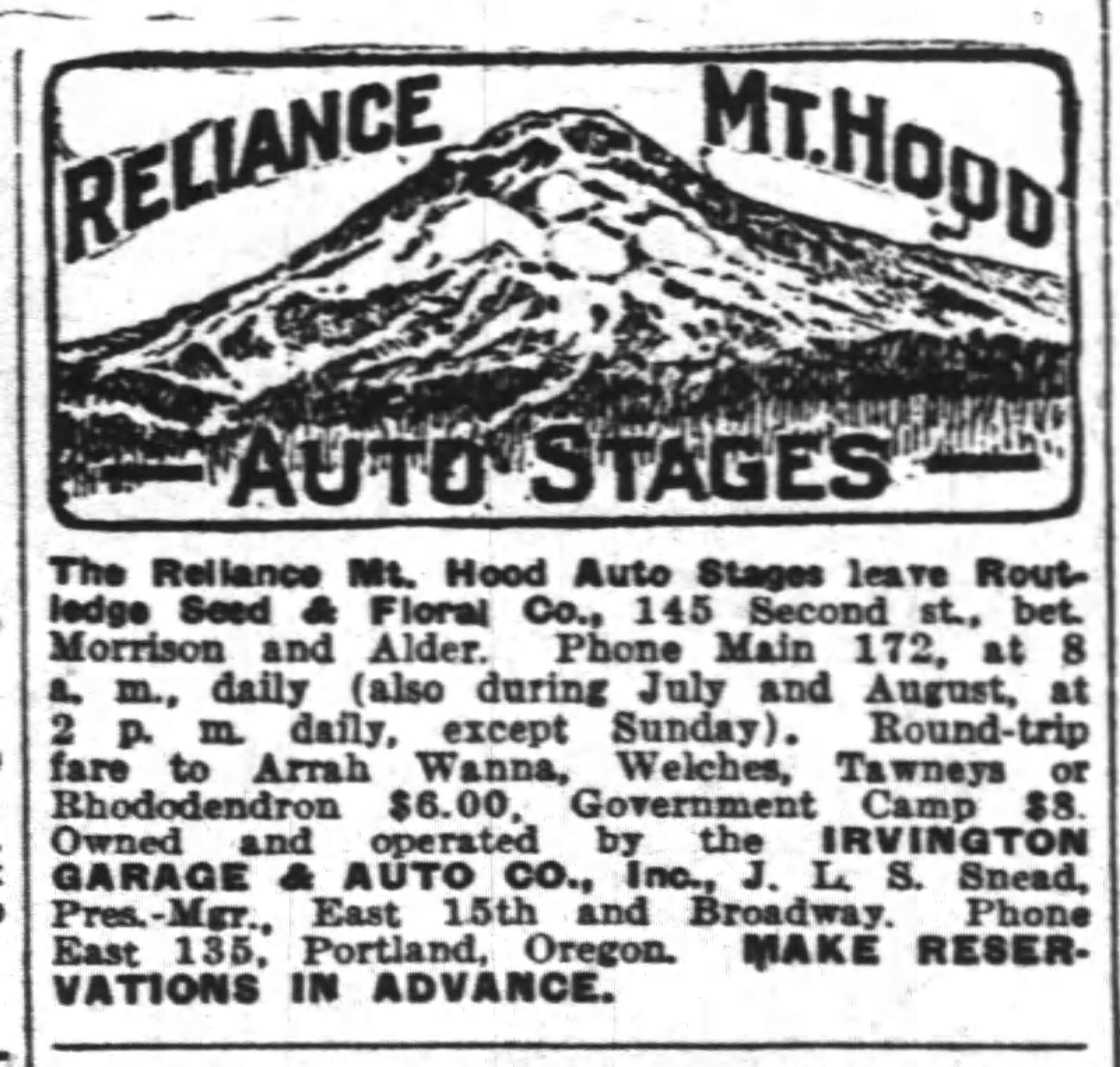
Reliance Mt Hood Stages advertising
Automobiles were starting to become a practical means of transportation, but was still primitive. Most people didn’t own a car which gave stage companies an opportunity to carry fun seekers to and from the lodges and roadhouses on Mount Hood. This also gave inn keepers an opportunity to host these people because a trip to Mount Hood wasn’t a simple day trip. Many times a trip to The Mountain was a week minimum investment in time.
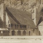
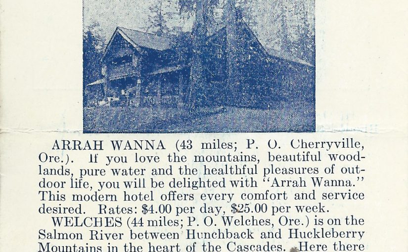
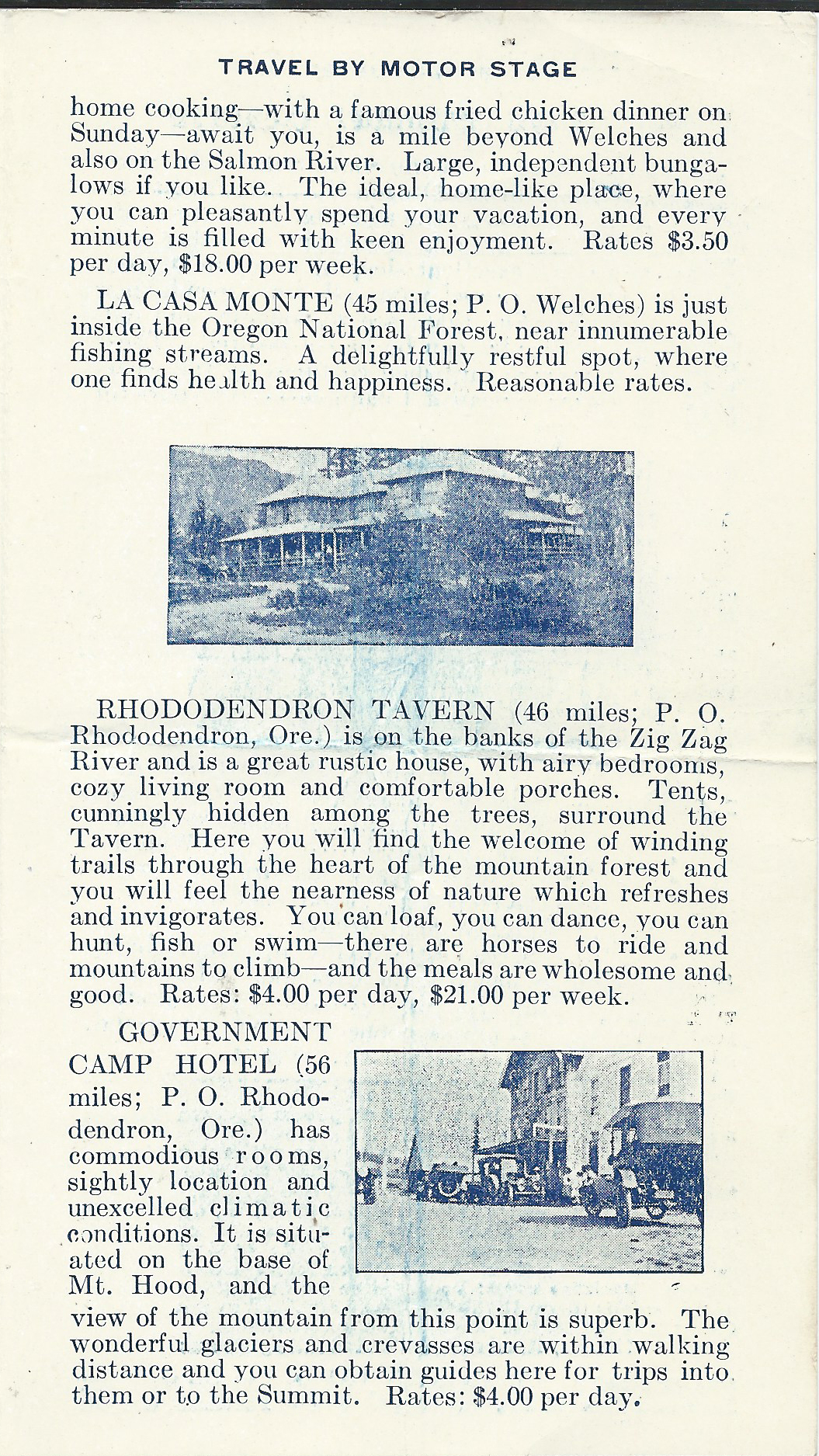
Lodges such as Arrah Wanna, Welches Ranch, Tawney’s Mountain Home, La Casa Monte, The Rhododendron Tavern and the Government Camp Hotel all sprang up due to a need to recreational lodging.
The flyer below gives a great representation of the mileage, the lodging available and cost of a trip to the mountain.
Those days were primitive and simple and difficult compared to this day and age, but the life that was lived seems much more fun and adventure filled than the way we live today.
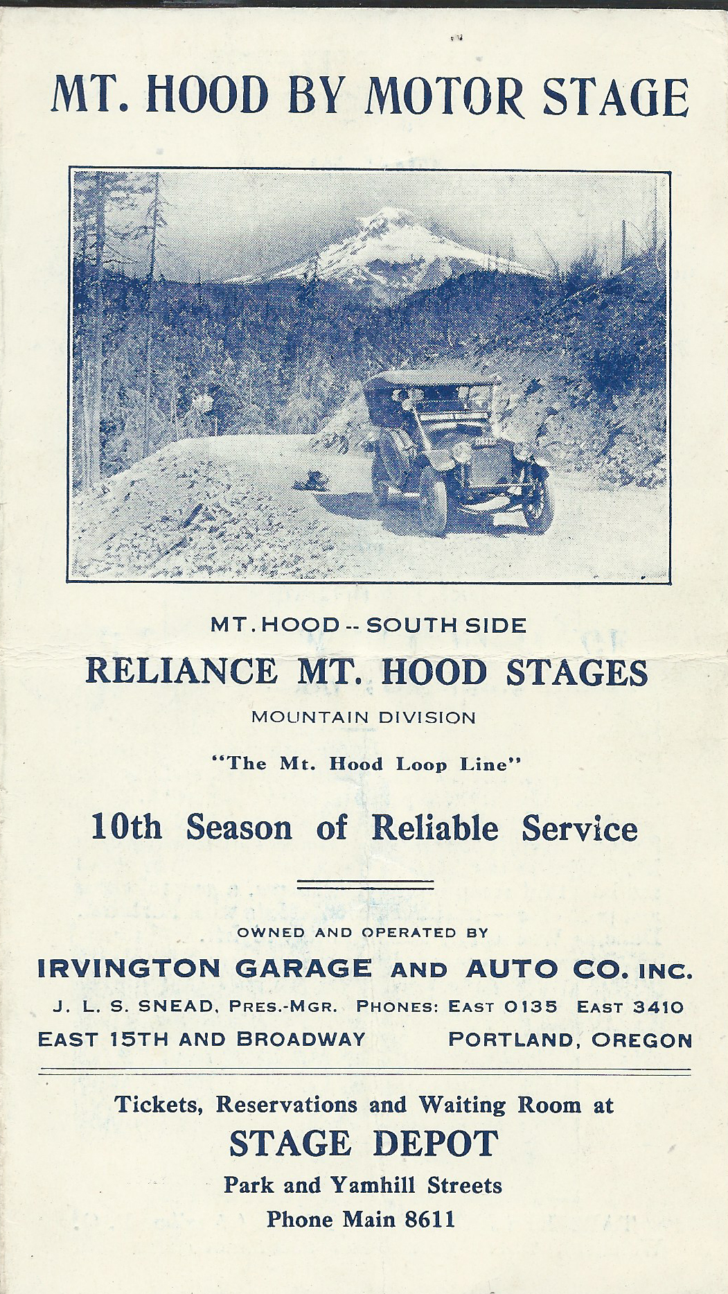
Mt Hood By Motor Stage Mt. Hood – South Side Reliance Mt Hood Stages Mountain Division “The Mt. Hood Line” 10th Season of Reliable Service
Owned and Operated by Irvington Garage and Auto Co. Inc. J. L. S. Snead, Pres,-Mgr. Phones: East 0135 East 3410 Tickets, Reservations and Waiting Room at Stage Depot Park and Yamhill Streets Phone Main 8611